Property Record
2435 Battleground Ave, Greensboro, NC 27408


Save to a Folder
{{folder.Name}}
{{folder.ListingIds.length}} Properties
{{folder.ListingIds.length}} Property
Create a New Folder
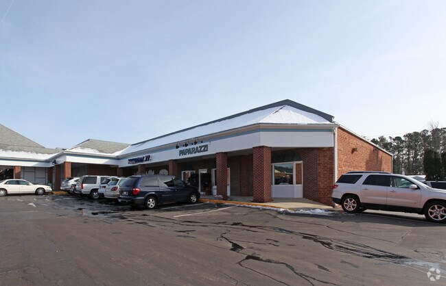
Property Detail
2435 Battleground Ave
0035239
OAKCREST SHOPPING CTR PB 158-115 PL:158-115
Storebuilding
Guilford
C-M
North Carolina
B and X Area of moderate flood hazard, usually the area between the limits of the 100-year and 500-year floods.
1
2024
2.97 AC
2025
NW Guilford County
012508
Greensboro/Winston-Salem
46,178 SF
Greensboro-High Point, NC
NEARBY LISTINGS FOR SALE OR LEASE
DEMOGRAPHICS near 2435 Battleground Ave
1 mile
3 mile
5 mile
2025 Total Population
8,186
83,981
220,885
2030 Population
8,375
86,345
228,085
Pop Growth 2025-2030
+ 2.31%
+ 2.81%
+ 3.26%
Average Age
42
40
38
2025 Total Households
3,857
35,592
90,825
HH Growth 2025-2030
+ 2.41%
+ 3.10%
+ 3.52%
Median Household Inc
$78,676
$73,873
$58,536
Avg Household Size
2.10
2.10
2.20
2025 Avg HH Vehicles
2.00
2.00
2.00
Median Home Value
$286,242
$352,895
$280,731
Median Year Built
1959
1974
1980
Nearby Places
Map Layers
Map Styles
 Street
 Aerial
Layers
 Traffic
 Biking
Places
Listings with unknown addresses are not visible on the map
- Restaurants
- Banks
- Shops
- Fitness
- Groceries
PUBLIC TRANSPORTATION
COMMUTER RAIL
Greensboro (Carolinian - Amtrak, Crescent - Amtrak, Piedmont - Amtrak)
Drive
Walk
Distance
Greensboro (Carolinian - Amtrak, Crescent - Amtrak, Piedmont - Amtrak)
8 min
3.8 mi
AIRPORT
Piedmont Triad International
Drive
Walk
Distance
Piedmont Triad International
18 min
9.7 mi
Freight Ports
Virginia Port Authority - Richmond
Drive
Walk
Distance
Virginia Port Authority - Richmond
233 min
201.1 mi
Nearby Properties
Address
Land Use
TOTAL SIZE
Lot Size
Zoning
Address
Land Use
TOTAL SIZE
Lot Size
Zoning
908,421 SF
62.30 AC
PI
Address
Land Use
TOTAL SIZE
Lot Size
Zoning
1,864,781 SF
96.17 AC
PI
Address
Land Use
TOTAL SIZE
Lot Size
Zoning
593,135 SF
26.07 AC
PI
Address
Land Use
TOTAL SIZE
Lot Size
Zoning
646,229 SF
25.47 AC
LI
Address
Land Use
TOTAL SIZE
Lot Size
Zoning
733,612 SF
19.38 AC
PI
Address
Land Use
TOTAL SIZE
Lot Size
Zoning
388,224 SF
0.98 AC
CB
Address
Land Use
TOTAL SIZE
Lot Size
Zoning
356,139 SF
0.99 AC
CB
Address
Land Use
TOTAL SIZE
Lot Size
Zoning
549,907 SF
43.02 AC
C-H
Address
Land Use
TOTAL SIZE
Lot Size
Zoning
2.09 AC
CB
Address
Land Use
TOTAL SIZE
Lot Size
Zoning
352,060 SF
3.67 AC
CB
Address
Land Use
TOTAL SIZE
Lot Size
Zoning
472,566 SF
46.77 AC
RM-12
Address
Land Use
TOTAL SIZE
Lot Size
Zoning
364,370 SF
1.85 AC
CB
Address
Land Use
TOTAL SIZE
Lot Size
Zoning
303,490 SF
1.29 AC
CB
Address
Land Use
TOTAL SIZE
Lot Size
Zoning
275,122 SF
0.76 AC
CB
Address
Land Use
TOTAL SIZE
Lot Size
Zoning
413,840 SF
3.68 AC
PI
Address
Land Use
TOTAL SIZE
Lot Size
Zoning
106,706 SF
343.57 AC
PI
Address
Land Use
TOTAL SIZE
Lot Size
Zoning
309,598 SF
28.10 AC
RM-18
Address
Land Use
TOTAL SIZE
Lot Size
Zoning
342,490 SF
17.99 AC
PI
Address
Land Use
TOTAL SIZE
Lot Size
Zoning
228,253 SF
11.21 AC
RM-18
Address
Land Use
TOTAL SIZE
Lot Size
Zoning
361,604 SF
16.55 AC
RM-18
Address
Land Use
TOTAL SIZE
Lot Size
Zoning
163,439 SF
4.01 AC
CB
Address
Land Use
TOTAL SIZE
Lot Size
Zoning
321,985 SF
4.80 AC
C-H
Address
Land Use
TOTAL SIZE
Lot Size
Zoning
358,324 SF
4.02 AC
PUD
Address
Land Use
TOTAL SIZE
Lot Size
Zoning
163,346 SF
0.92 AC
CB
Address
Land Use
TOTAL SIZE
Lot Size
Zoning
227,063 SF
6.65 AC
C-H
Address
Land Use
TOTAL SIZE
Lot Size
Zoning
223,891 SF
10.53 AC
PUD
Address
Land Use
TOTAL SIZE
Lot Size
Zoning
249,779 SF
2.83 AC
CB
Address
Land Use
TOTAL SIZE
Lot Size
Zoning
170,200 SF
1.05 AC
CB
Address
Land Use
TOTAL SIZE
Lot Size
Zoning
133,069 SF
7.90 AC
PI
Address
Land Use
TOTAL SIZE
Lot Size
Zoning
231,863 SF
7.96 AC
PUD
The World's #1 Commercial Real Estate Marketplace
Connect with us
© 2026 CoStar Group
The information above has been obtained from sources believed reliable. While we do not doubt its accuracy we have not verified it and make no guarantee, warranty or representation about it. It is your responsibility to independently confirm its accuracy and completeness. Any projections, opinions, assumptions, or estimates used are for example only and do not represent the current or future performance of the property. The value of this transaction to you depends on tax and other factors which should be evaluated by your tax, financial, and legal advisors. You and your advisors should conduct a careful, independent investigation of the property to determine to your satisfaction the suitability of the property for your needs.