Property Record
2435 E 17Th St, Tucson, AZ 85719
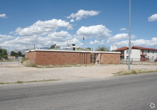


Property Detail
2435 E 17Th St
129-01-0610
W132.6 E330.4 N2 NE4 NE4 SW4 LESS N16.5 & EXC S30 FOR E 17TH ST .88 AC SEC 17-14-14
Commercialnec
Pima
C1
Arizona
B and X Area of moderate flood hazard, usually the area between the limits of the 100-year and 500-year floods.
14
0
0.89 AC
2026
Central Tucson
000700
Tucson
4,514 SF
Tucson, AZ
NEARBY LISTINGS FOR SALE OR LEASE
-
-
View all Tucson listings for sale on LoopNet.com
DEMOGRAPHICS near 2435 E 17Th St
1 mile
3 mile
5 mile
2024 Total Population
8,579
106,765
300,131
2029 Population
8,762
109,319
307,819
Pop Growth 2024-2029
+ 2.13%
+ 2.39%
+ 2.56%
Average Age
40
37
38
2024 Total Households
3,909
45,272
126,809
HH Growth 2024-2029
+ 2.25%
+ 2.67%
+ 2.68%
Median Household Inc
$70,411
$49,193
$47,251
Avg Household Size
2.10
2.10
2.20
2024 Avg HH Vehicles
2.00
1.00
1.00
Median Home Value
$292,722
$307,180
$265,173
Median Year Built
1956
1960
1972
Nearby Places
Map Layers
Map Styles
 Street
 Aerial
Transit
 Traffic
 Biking
Places
Listings with unknown addresses are not visible on the map
- Restaurants
- Banks
- Shops
- Fitness
- Groceries
PUBLIC TRANSPORTATION
COMMUTER RAIL
Drive
Walk
Distance
5 min
2.8 mi
AIRPORT
Tucson International
Drive
Walk
Distance
Tucson International
17 min
7.9 mi
Nearby Properties
Address
Land Use
TOTAL SIZE
Lot Size
Zoning
Address
Land Use
TOTAL SIZE
Lot Size
Zoning
251,851 SF
0.74 AC
Address
Land Use
TOTAL SIZE
Lot Size
Zoning
6,691,842 SF
179.97 AC
Address
Land Use
TOTAL SIZE
Lot Size
Zoning
1,316,364 SF
12.21 AC
Address
Land Use
TOTAL SIZE
Lot Size
Zoning
1,811,513 SF
30.09 AC
Address
Land Use
TOTAL SIZE
Lot Size
Zoning
840,246 SF
180.96 AC
R1
Address
Land Use
TOTAL SIZE
Lot Size
Zoning
813,186 SF
3.65 AC
OCR2
Address
Land Use
TOTAL SIZE
Lot Size
Zoning
89,497 SF
0.51 AC
Address
Land Use
TOTAL SIZE
Lot Size
Zoning
657,188 SF
24.97 AC
PAD5
Address
Land Use
TOTAL SIZE
Lot Size
Zoning
326,845 SF
0.71 AC
Address
Land Use
TOTAL SIZE
Lot Size
Zoning
837,885 SF
16.41 AC
R2
Address
Land Use
TOTAL SIZE
Lot Size
Zoning
60,426 SF
0.43 AC
OCR2
Address
Land Use
TOTAL SIZE
Lot Size
Zoning
594,802 SF
62.57 AC
Address
Land Use
TOTAL SIZE
Lot Size
Zoning
60,377 SF
6.25 AC
I1
Address
Land Use
TOTAL SIZE
Lot Size
Zoning
239,060 SF
7.85 AC
Address
Land Use
TOTAL SIZE
Lot Size
Zoning
495,871 SF
3.56 AC
Address
Land Use
TOTAL SIZE
Lot Size
Zoning
475,707 SF
107.59 AC
Address
Land Use
TOTAL SIZE
Lot Size
Zoning
226,240 SF
0.33 AC
R2
Address
Land Use
TOTAL SIZE
Lot Size
Zoning
278,566 SF
0.60 AC
C1
Address
Land Use
TOTAL SIZE
Lot Size
Zoning
21,126 SF
1.10 AC
O3
Address
Land Use
TOTAL SIZE
Lot Size
Zoning
299,658 SF
0.77 AC
Address
Land Use
TOTAL SIZE
Lot Size
Zoning
172,623 SF
0.15 AC
R1
Address
Land Use
TOTAL SIZE
Lot Size
Zoning
360,881 SF
21.39 AC
Address
Land Use
TOTAL SIZE
Lot Size
Zoning
1.45 AC
HR1
Address
Land Use
TOTAL SIZE
Lot Size
Zoning
419,317 SF
7.23 AC
Address
Land Use
TOTAL SIZE
Lot Size
Zoning
296,286 SF
0.71 AC
Address
Land Use
TOTAL SIZE
Lot Size
Zoning
141,450 SF
0.14 AC
R1
Address
Land Use
TOTAL SIZE
Lot Size
Zoning
346,246 SF
0.14 AC
R2
Address
Land Use
TOTAL SIZE
Lot Size
Zoning
213,400 SF
0.46 AC
Address
Land Use
TOTAL SIZE
Lot Size
Zoning
475,275 SF
2.56 AC
Address
Land Use
TOTAL SIZE
Lot Size
Zoning
256,275 SF
7.57 AC
R2
The World's #1 Commercial Real Estate Marketplace
Connect with us
© 2026 CoStar Group
The information above has been obtained from sources believed reliable. While we do not doubt its accuracy we have not verified it and make no guarantee, warranty or representation about it. It is your responsibility to independently confirm its accuracy and completeness. Any projections, opinions, assumptions, or estimates used are for example only and do not represent the current or future performance of the property. The value of this transaction to you depends on tax and other factors which should be evaluated by your tax, financial, and legal advisors. You and your advisors should conduct a careful, independent investigation of the property to determine to your satisfaction the suitability of the property for your needs.