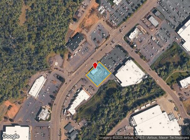
Property Record
2435 Nw Stewart Pky, Roseburg, OR 97471


NEARBY LISTINGS FOR SALE OR LEASE
Property Detail
2435 Nw Stewart Pky
R119854
Edenbower Orch Trs Vac
Commercialnec
P.P. 2017-30, PARCEL 1, ACRES 0.61
X
Douglas
41019C1726F
Oregon
2025
0.61 AC
2025
Oregon West Area
080002
Other Market Areas
2,304 SF
Roseburg, OR
DEMOGRAPHICS near 2435 Nw Stewart Pky
1 Mile
3 Mile
5 Mile
2024 Total Population
5,622
31,634
40,233
2029 Population
5,841
32,950
41,818
Pop Growth 2024-2029
+ 3.90%
+ 4.16%
+ 3.94%
Average Age
47
44
44
2024 Total Households
2,328
13,411
16,913
HH Growth 2024-2029
+ 4.04%
+ 4.24%
+ 4.01%
Median Household Inc
$57,288
$48,040
$48,647
Avg Household Size
2.20
2.20
2.30
2024 Avg HH Vehicles
2.00
2.00
2.00
Median Home Value
$297,187
$265,559
$280,205
Median Year Built
1988
1977
1978
Nearby Places
Map Layers
Map Styles
 Street
 Aerial
- Restaurants
- Banks
- Shops
- Fitness
- Groceries
SALE & LEASE HISTORY
LISTING DATE
SALE/LEASE

Sep 22, 2021
For Sale
Dec 06, 2016
For Sale
Apr 04, 2017
For Sale
Nearby Properties
Address
Land Use
TOTAL SIZE
Lot Size
Zoning
Address
Land Use
TOTAL SIZE
Lot Size
Zoning
276,720 SF
18.77 AC
PR
Address
Land Use
TOTAL SIZE
Lot Size
Zoning
149.62 AC
PR
Address
Land Use
TOTAL SIZE
Lot Size
Zoning
1,000 SF
18.99 AC
PR
Address
Land Use
TOTAL SIZE
Lot Size
Zoning
239,143 SF
6.29 AC
PR
Address
Land Use
TOTAL SIZE
Lot Size
Zoning
102.28 AC
AP
Address
Land Use
TOTAL SIZE
Lot Size
Zoning
9.96 AC
PR
Address
Land Use
TOTAL SIZE
Lot Size
Zoning
63.52 AC
PR
Address
Land Use
TOTAL SIZE
Lot Size
Zoning
138,337 SF
16.25 AC
MU
Address
Land Use
TOTAL SIZE
Lot Size
Zoning
199,245 SF
13.97 AC
C3
Address
Land Use
TOTAL SIZE
Lot Size
Zoning
86,285 SF
4.91 AC
C3
Address
Land Use
TOTAL SIZE
Lot Size
Zoning
152,625 SF
20.21 AC
C3
Address
Land Use
TOTAL SIZE
Lot Size
Zoning
90,785 SF
2.76 AC
PR
Address
Land Use
TOTAL SIZE
Lot Size
Zoning
71,302 SF
1.84 AC
PR
Address
Land Use
TOTAL SIZE
Lot Size
Zoning
230,093 SF
17.80 AC
C3
Address
Land Use
TOTAL SIZE
Lot Size
Zoning
82,532 SF
2.43 AC
C3
Address
Land Use
TOTAL SIZE
Lot Size
Zoning
115,574 SF
4.32 AC
C3
Address
Land Use
TOTAL SIZE
Lot Size
Zoning
43,384 SF
9.16 AC
PR
Address
Land Use
TOTAL SIZE
Lot Size
Zoning
124,320 SF
13.02 AC
MR40
Address
Land Use
TOTAL SIZE
Lot Size
Zoning
103,469 SF
10.45 AC
MU
Address
Land Use
TOTAL SIZE
Lot Size
Zoning
2.11 AC
MU
Address
Land Use
TOTAL SIZE
Lot Size
Zoning
115,934 SF
3.48 AC
MR29
Address
Land Use
TOTAL SIZE
Lot Size
Zoning
119,646 SF
10.03 AC
MR18
Address
Land Use
TOTAL SIZE
Lot Size
Zoning
42,708 SF
0.78 AC
PR
Address
Land Use
TOTAL SIZE
Lot Size
Zoning
68,135 SF
8.13 AC
C3
Address
Land Use
TOTAL SIZE
Lot Size
Zoning
4.76 AC
PR
Address
Land Use
TOTAL SIZE
Lot Size
Zoning
37,755 SF
2.80 AC
C3
Address
Land Use
TOTAL SIZE
Lot Size
Zoning
2.55 AC
M2
Address
Land Use
TOTAL SIZE
Lot Size
Zoning
129,644 SF
4.85 AC
MU
Address
Land Use
TOTAL SIZE
Lot Size
Zoning
41,353 SF
4.18 AC
C3
Address
Land Use
TOTAL SIZE
Lot Size
Zoning
57,685 SF
5.34 AC
C3
The World's #1 Commercial Real Estate Marketplace
Connect with us
© 2025 CoStar Group
The information above has been obtained from sources believed reliable. While we do not doubt its accuracy we have not verified it and make no guarantee, warranty or representation about it. It is your responsibility to independently confirm its accuracy and completeness. Any projections, opinions, assumptions, or estimates used are for example only and do not represent the current or future performance of the property. The value of this transaction to you depends on tax and other factors which should be evaluated by your tax, financial, and legal advisors. You and your advisors should conduct a careful, independent investigation of the property to determine to your satisfaction the suitability of the property for your needs.