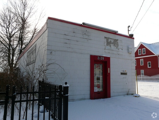
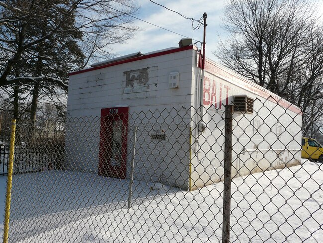
Property Record
2439 Fairfield Ave, Bridgeport, CT 06605
NEARBY LISTINGS FOR SALE OR LEASE
Property Detail
2439 Fairfield Ave
BRID-000219-000003
Fairfield
Commercialbuilding
Connecticut
X
3
09001C0436G
0.28 AC
2025
Bridgeport
2025
Westchester/So Connecticut
070200
Bridgeport-Stamford-Norwalk, CT
900 SF
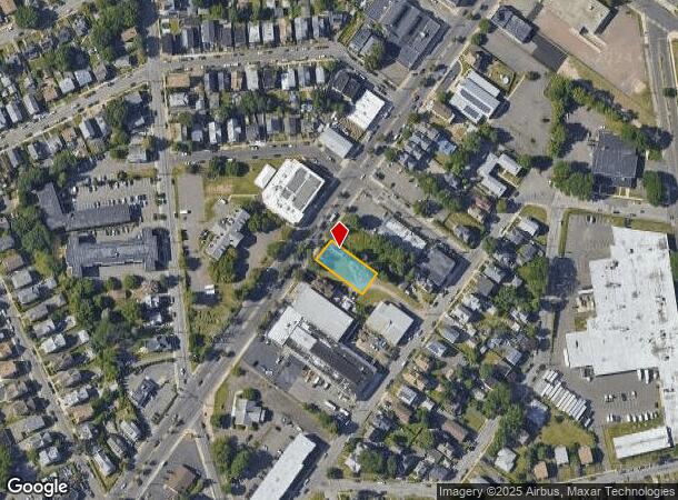
DEMOGRAPHICS near 2439 Fairfield Ave
1 Mile
3 Mile
5 Mile
2024 Total Population
19,553
122,489
236,166
2029 Population
19,732
122,410
236,627
Pop Growth 2024-2029
+ 0.92%
(0.06%)
+ 0.20%
Average Age
37
37
38
2024 Total Households
7,991
43,961
84,227
HH Growth 2024-2029
+ 0.78%
(0.11%)
+ 0.16%
Median Household Inc
$63,513
$61,991
$65,427
Avg Household Size
2.40
2.60
2.60
2024 Avg HH Vehicles
1.00
2.00
2.00
Median Home Value
$335,756
$411,934
$321,829
Median Year Built
1958
1952
1954
Nearby Places
Map Layers
Map Styles
 Street
 Aerial
- Restaurants
- Banks
- Shops
- Fitness
- Groceries
PUBLIC TRANSPORTATION
COMMUTER RAIL
Fairfield Metro (New Haven - Metro-North Railroad)
DRIVE
WALK
Distance
Fairfield Metro (New Haven - Metro-North Railroad)
3 min
1.1 mi
Bridgeport Station (New Haven Line - Shore Line East, Shore Line East - Shore Line East)
DRIVE
WALK
Distance
Bridgeport Station (New Haven Line - Shore Line East, Shore Line East - Shore Line East)
4 min
2.2 mi
AIRPORT
Tweed/New Haven
DRIVE
WALK
Distance
Tweed/New Haven
38 min
24.6 mi
Westchester County
DRIVE
WALK
Distance
Westchester County
50 min
32.2 mi
Long Island MacArthur
DRIVE
WALK
Distance
Long Island MacArthur
111 min
36.1 mi
Freight Ports
Port of New Haven
DRIVE
WALK
Distance
Port of New Haven
33 min
21.8 mi
Nearby Properties
Address
Land Use
TOTAL SIZE
Lot Size
Zoning
Address
Land Use
TOTAL SIZE
Lot Size
Zoning
Address
Land Use
TOTAL SIZE
Lot Size
Zoning
124 AC
FPD
Address
Land Use
TOTAL SIZE
Lot Size
Zoning
22.85 AC
Address
Land Use
TOTAL SIZE
Lot Size
Zoning
23.95 AC
RB
Address
Land Use
TOTAL SIZE
Lot Size
Zoning
111 AC
RA
Address
Land Use
TOTAL SIZE
Lot Size
Zoning
335,633 SF
39.70 AC
R3
Address
Land Use
TOTAL SIZE
Lot Size
Zoning
19.43 AC
A
Address
Land Use
TOTAL SIZE
Lot Size
Zoning
1,183 SF
2.33 AC
DID
Address
Land Use
TOTAL SIZE
Lot Size
Zoning
178,265 SF
6.92 AC
Address
Land Use
TOTAL SIZE
Lot Size
Zoning
83,122 SF
4.39 AC
Address
Land Use
TOTAL SIZE
Lot Size
Zoning
288,875 SF
1.57 AC
MUEM
Address
Land Use
TOTAL SIZE
Lot Size
Zoning
213,826 SF
18.30 AC
A
Address
Land Use
TOTAL SIZE
Lot Size
Zoning
146,351 SF
8.86 AC
Address
Land Use
TOTAL SIZE
Lot Size
Zoning
497,430 SF
4.16 AC
DCB
Address
Land Use
TOTAL SIZE
Lot Size
Zoning
162,376 SF
7.82 AC
Address
Land Use
TOTAL SIZE
Lot Size
Zoning
10.66 AC
ORR
Address
Land Use
TOTAL SIZE
Lot Size
Zoning
10.28 AC
DID
Address
Land Use
TOTAL SIZE
Lot Size
Zoning
260,992 SF
4.19 AC
ILI
Address
Land Use
TOTAL SIZE
Lot Size
Zoning
585,480 SF
3.66 AC
Address
Land Use
TOTAL SIZE
Lot Size
Zoning
493,114 SF
2.20 AC
DCB
Address
Land Use
TOTAL SIZE
Lot Size
Zoning
144,086 SF
3.12 AC
DRD
Address
Land Use
TOTAL SIZE
Lot Size
Zoning
22.43 AC
R3
Address
Land Use
TOTAL SIZE
Lot Size
Zoning
92,318 SF
5.33 AC
Address
Land Use
TOTAL SIZE
Lot Size
Zoning
115,006 SF
2.51 AC
DCD
Address
Land Use
TOTAL SIZE
Lot Size
Zoning
12.47 AC
AA
Address
Land Use
TOTAL SIZE
Lot Size
Zoning
216,972 SF
2.53 AC
DCB
Address
Land Use
TOTAL SIZE
Lot Size
Zoning
14.90 AC
RC
Address
Land Use
TOTAL SIZE
Lot Size
Zoning
5.31 AC
RC
Address
Land Use
TOTAL SIZE
Lot Size
Zoning
16.73 AC
DCD
Address
Land Use
TOTAL SIZE
Lot Size
Zoning
79,739 SF
1.53 AC
PDD
The World's #1 Commercial Real Estate Marketplace
Connect with us
© 2026 CoStar Group
The information above has been obtained from sources believed reliable. While we do not doubt its accuracy we have not verified it and make no guarantee, warranty or representation about it. It is your responsibility to independently confirm its accuracy and completeness. Any projections, opinions, assumptions, or estimates used are for example only and do not represent the current or future performance of the property. The value of this transaction to you depends on tax and other factors which should be evaluated by your tax, financial, and legal advisors. You and your advisors should conduct a careful, independent investigation of the property to determine to your satisfaction the suitability of the property for your needs.