Property Record
244 E Washington St, Oswego, IL 60543
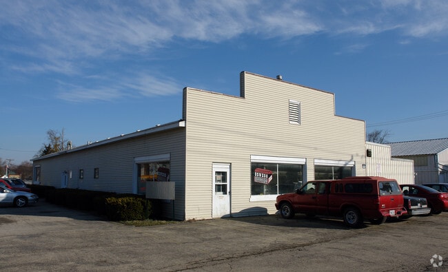


Property Detail
244 E Washington St
03-20-128-010
.75 AC TR LYG SEC 20-37-8, N RT 71, E WASHINGTON ST (EXC ROW TAKEN 12-15320) VILLAGE OF OSWEGO (EXC ROW TAKEN 20-19313)
Commercialnec
Kendall
B and X Area of moderate flood hazard, usually the area between the limits of the 100-year and 500-year floods.
Illinois
2024
0.75 AC
2024
I-88 West
890106
Chicago
3,045 SF
Chicago-Naperville-Elgin, IL-IN
NEARBY LISTINGS FOR SALE OR LEASE
DEMOGRAPHICS near 244 E Washington St
1 mile
3 mile
5 mile
2025 Total Population
8,794
47,545
110,051
2030 Population
9,461
50,956
116,602
Pop Growth 2025-2030
+ 7.58%
+ 7.17%
+ 5.95%
Average Age
39
38
37
2025 Total Households
2,925
15,810
35,999
HH Growth 2025-2030
+ 7.56%
+ 7.05%
+ 5.91%
Median Household Inc
$130,951
$113,811
$107,621
Avg Household Size
2.90
3.00
3.00
2025 Avg HH Vehicles
2.00
2.00
2.00
Median Home Value
$341,007
$315,302
$298,179
Median Year Built
1996
1995
1998
Nearby Places
Map Layers
Map Styles
 Street
 Aerial
Transit
 Traffic
 Biking
Places
Listings with unknown addresses are not visible on the map
- Restaurants
- Banks
- Shops
- Fitness
- Groceries
PUBLIC TRANSPORTATION
COMMUTER RAIL
Aurora Station (Burlington Northern-Santa Fe Railway Line - Northeast Illinois Regional Commuter Railroad (Metra))
Drive
Walk
Distance
Aurora Station (Burlington Northern-Santa Fe Railway Line - Northeast Illinois Regional Commuter Railroad (Metra))
14 min
7.3 mi
Freight Ports
Port Milwaukee
Drive
Walk
Distance
Port Milwaukee
146 min
113.5 mi
Nearby Properties
Address
Land Use
TOTAL SIZE
Lot Size
Zoning
Address
Land Use
TOTAL SIZE
Lot Size
Zoning
121,608 SF
27.48 AC
Address
Land Use
TOTAL SIZE
Lot Size
Zoning
296,502 SF
19.01 AC
Address
Land Use
TOTAL SIZE
Lot Size
Zoning
350.78 AC
Address
Land Use
TOTAL SIZE
Lot Size
Zoning
56.02 AC
Address
Land Use
TOTAL SIZE
Lot Size
Zoning
20.76 AC
Address
Land Use
TOTAL SIZE
Lot Size
Zoning
9.86 AC
Address
Land Use
TOTAL SIZE
Lot Size
Zoning
220,091 SF
22.09 AC
Address
Land Use
TOTAL SIZE
Lot Size
Zoning
156,614 SF
17.63 AC
Address
Land Use
TOTAL SIZE
Lot Size
Zoning
207,596 SF
20.63 AC
Address
Land Use
TOTAL SIZE
Lot Size
Zoning
122,387 SF
21.92 AC
Address
Land Use
TOTAL SIZE
Lot Size
Zoning
118,236 SF
20.93 AC
Address
Land Use
TOTAL SIZE
Lot Size
Zoning
140,888 SF
16.31 AC
Address
Land Use
TOTAL SIZE
Lot Size
Zoning
56.13 AC
Address
Land Use
TOTAL SIZE
Lot Size
Zoning
87,746 SF
8.01 AC
Address
Land Use
TOTAL SIZE
Lot Size
Zoning
49,292 SF
1.70 AC
Address
Land Use
TOTAL SIZE
Lot Size
Zoning
49,292 SF
1.70 AC
Address
Land Use
TOTAL SIZE
Lot Size
Zoning
49,292 SF
1.70 AC
Address
Land Use
TOTAL SIZE
Lot Size
Zoning
125,513 SF
9.94 AC
Address
Land Use
TOTAL SIZE
Lot Size
Zoning
120,750 SF
11.07 AC
Address
Land Use
TOTAL SIZE
Lot Size
Zoning
62,164 SF
6.76 AC
Address
Land Use
TOTAL SIZE
Lot Size
Zoning
39,020 SF
1.70 AC
Address
Land Use
TOTAL SIZE
Lot Size
Zoning
31.35 AC
Address
Land Use
TOTAL SIZE
Lot Size
Zoning
65,040 SF
6.04 AC
Address
Land Use
TOTAL SIZE
Lot Size
Zoning
65,982 SF
5.21 AC
Address
Land Use
TOTAL SIZE
Lot Size
Zoning
33,730 SF
6.95 AC
Address
Land Use
TOTAL SIZE
Lot Size
Zoning
120,058 SF
10.71 AC
Address
Land Use
TOTAL SIZE
Lot Size
Zoning
18,774 SF
4.95 AC
Address
Land Use
TOTAL SIZE
Lot Size
Zoning
36,711 SF
0.44 AC
Address
Land Use
TOTAL SIZE
Lot Size
Zoning
88,798 SF
7.91 AC
Address
Land Use
TOTAL SIZE
Lot Size
Zoning
16,152 SF
2.40 AC
The World's #1 Commercial Real Estate Marketplace
Connect with us
© 2026 CoStar Group
The information above has been obtained from sources believed reliable. While we do not doubt its accuracy we have not verified it and make no guarantee, warranty or representation about it. It is your responsibility to independently confirm its accuracy and completeness. Any projections, opinions, assumptions, or estimates used are for example only and do not represent the current or future performance of the property. The value of this transaction to you depends on tax and other factors which should be evaluated by your tax, financial, and legal advisors. You and your advisors should conduct a careful, independent investigation of the property to determine to your satisfaction the suitability of the property for your needs.