Property Record
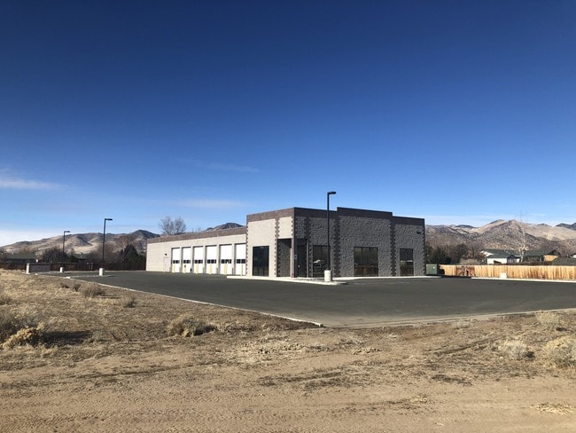
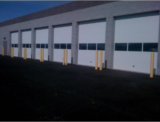
244 Riverboat Rd, Dayton, NV 89403


Property Detail
244 Riverboat Rd
016-031-14
32-17-22 FRSE4/PAR 1-C PARCEL 1-C AS SHOWN ON THE MAP OF PEEK PARCELS FILED IN THE OFFICE OF THE COUNTY RECORDER OF LYON COUNTY, NEVADA, ON DECEMBER 15, 1975, AS FILE NO. 70396. CHANGED FROM PARCEL # 016-031-04 BAM #443936 POR N2 SE4
Commercialnec
LYON
C2
Nevada
C and X Area of minimal flood hazard, usually depicted on FIRMs as above the 500-year flood level.
1.21 AC
0
Lyon County
2025
Reno/Sparks
960304
Reno, NV
7,771 SF
NEARBY LISTINGS FOR SALE OR LEASE
-
-
View all Dayton listings for lease on LoopNet.com
DEMOGRAPHICS near 244 Riverboat Rd
1 mile
3 mile
5 mile
2025 Total Population
4,273
11,217
17,771
2030 Population
4,516
11,870
18,777
Pop Growth 2025-2030
+ 5.69%
+ 5.82%
+ 5.66%
Average Age
44
44
44
2025 Total Households
1,606
4,241
6,914
HH Growth 2025-2030
+ 5.67%
+ 5.78%
+ 5.61%
Median Household Inc
$95,893
$94,908
$91,535
Avg Household Size
2.70
2.60
2.60
2025 Avg HH Vehicles
3.00
3.00
2.00
Median Home Value
$408,361
$415,763
$426,259
Median Year Built
2002
2002
2001
Nearby Places
Map Layers
Map Styles
 Street
 Aerial
Layers
 Traffic
 Biking
Places
Listings with unknown addresses are not visible on the map
- Restaurants
- Banks
- Shops
- Fitness
- Groceries
PUBLIC TRANSPORTATION
AIRPORT
Reno/Tahoe International
Drive
Walk
Distance
Reno/Tahoe International
51 min
29.4 mi
SALE & LEASE HISTORY
LISTING DATE
SALE/LEASE

Sep 25, 2016
For Lease
Feb 27, 2018
For Lease
Feb 27, 2018
For Sale
Nearby Properties
Address
Land Use
TOTAL SIZE
Lot Size
Zoning
Address
Land Use
TOTAL SIZE
Lot Size
Zoning
50,495 SF
10.76 AC
E1
Address
Land Use
TOTAL SIZE
Lot Size
Zoning
47,941 SF
10.33 AC
MULT
Address
Land Use
TOTAL SIZE
Lot Size
Zoning
24.60 AC
MULT
Address
Land Use
TOTAL SIZE
Lot Size
Zoning
9,600 SF
4.50 AC
C2
Address
Land Use
TOTAL SIZE
Lot Size
Zoning
5,760 SF
3 AC
M1
Address
Land Use
TOTAL SIZE
Lot Size
Zoning
19,934 SF
2.18 AC
C2
Address
Land Use
TOTAL SIZE
Lot Size
Zoning
35,000 SF
3 AC
M1
Address
Land Use
TOTAL SIZE
Lot Size
Zoning
17.04 AC
C2
Address
Land Use
TOTAL SIZE
Lot Size
Zoning
672 SF
5.37 AC
C2
Address
Land Use
TOTAL SIZE
Lot Size
Zoning
29,290 SF
2 AC
M1
Address
Land Use
TOTAL SIZE
Lot Size
Zoning
18,456 SF
1.35 AC
C2
Address
Land Use
TOTAL SIZE
Lot Size
Zoning
37,200 SF
5.55 AC
M1
Address
Land Use
TOTAL SIZE
Lot Size
Zoning
4,644 SF
1.18 AC
C2
Address
Land Use
TOTAL SIZE
Lot Size
Zoning
4,537 SF
35.19 AC
RR2T
Address
Land Use
TOTAL SIZE
Lot Size
Zoning
12.39 AC
C2
Address
Land Use
TOTAL SIZE
Lot Size
Zoning
1,620 SF
2.81 AC
C2
Address
Land Use
TOTAL SIZE
Lot Size
Zoning
5.67 AC
C2
Address
Land Use
TOTAL SIZE
Lot Size
Zoning
7,380 SF
1.07 AC
MULT
Address
Land Use
TOTAL SIZE
Lot Size
Zoning
8.86 AC
MULT
Address
Land Use
TOTAL SIZE
Lot Size
Zoning
78.88 AC
E1
Address
Land Use
TOTAL SIZE
Lot Size
Zoning
2,400 SF
3.01 AC
C2
Address
Land Use
TOTAL SIZE
Lot Size
Zoning
5,250 SF
2.15 AC
M1
Address
Land Use
TOTAL SIZE
Lot Size
Zoning
10,125 SF
2.03 AC
C2
Address
Land Use
TOTAL SIZE
Lot Size
Zoning
230.76 AC
MULT
Address
Land Use
TOTAL SIZE
Lot Size
Zoning
5,952 SF
3.50 AC
M1
Address
Land Use
TOTAL SIZE
Lot Size
Zoning
7,488 SF
5.07 AC
C2
Address
Land Use
TOTAL SIZE
Lot Size
Zoning
67.47 AC
E1
Address
Land Use
TOTAL SIZE
Lot Size
Zoning
2,301 SF
4.98 AC
C2
Address
Land Use
TOTAL SIZE
Lot Size
Zoning
10,800 SF
2.73 AC
C2
The World's #1 Commercial Real Estate Marketplace
Connect with us
© 2026 CoStar Group
The information above has been obtained from sources believed reliable. While we do not doubt its accuracy we have not verified it and make no guarantee, warranty or representation about it. It is your responsibility to independently confirm its accuracy and completeness. Any projections, opinions, assumptions, or estimates used are for example only and do not represent the current or future performance of the property. The value of this transaction to you depends on tax and other factors which should be evaluated by your tax, financial, and legal advisors. You and your advisors should conduct a careful, independent investigation of the property to determine to your satisfaction the suitability of the property for your needs.