Property Record
244 W Maple Rd, Troy, MI 48084


NEARBY LISTINGS FOR SALE OR LEASE
Property Detail
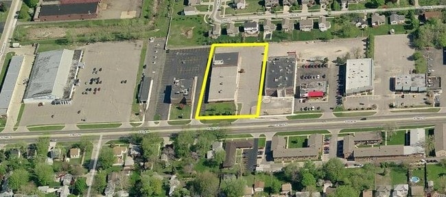
244 W Maple Rd
20-28-478-027
T2N, R11E, SEC 28 PART OF SE 1/4 BEG AT PT DIST N 89-21-56 W 996.00 FT FROM SESEC COR, TH N 89-21-56 W 158.30 FT, TH N
Industrialgeneral
Oakland
X
Michigan
26125C0542G
1.48 AC
2024
Troy South
2022
Detroit
197600
Detroit-Warren-Dearborn, MI
20,160 SF
DEMOGRAPHICS near 244 W Maple Rd
1 Mile
3 Mile
5 Mile
2024 Total Population
9,758
95,918
283,346
2029 Population
9,707
95,150
280,476
Pop Growth 2024-2029
(0.52%)
(0.80%)
(1.01%)
Average Age
40
41
41
2024 Total Households
4,532
43,578
119,222
HH Growth 2024-2029
(0.60%)
(0.85%)
(0.99%)
Median Household Inc
$79,786
$90,519
$93,382
Avg Household Size
2.10
2.20
2.30
2024 Avg HH Vehicles
2.00
2.00
2.00
Median Home Value
$227,809
$294,332
$292,063
Median Year Built
1965
1967
1966
Nearby Places
Map Layers
Map Styles
 Street
 Aerial
- Restaurants
- Banks
- Shops
- Fitness
- Groceries
PUBLIC TRANSPORTATION
COMMUTER RAIL
DRIVE
WALK
Distance
6 min
2.4 mi
DRIVE
WALK
Distance
13 min
5.3 mi
AIRPORT
Windsor International
DRIVE
WALK
Distance
Windsor International
48 min
27.6 mi
Detroit Metro Wayne County
DRIVE
WALK
Distance
Detroit Metro Wayne County
52 min
37.2 mi
SALE & LEASE HISTORY
LISTING DATE
SALE/LEASE

Oct 25, 2024
For Sale
Oct 25, 2024
For Lease
Nov 10, 2017
For Lease
Nearby Properties
Address
Land Use
TOTAL SIZE
Lot Size
Zoning
Address
Land Use
TOTAL SIZE
Lot Size
Zoning
399,735 SF
19.71 AC
B2
Address
Land Use
TOTAL SIZE
Lot Size
Zoning
272,233 SF
90.90 AC
Address
Land Use
TOTAL SIZE
Lot Size
Zoning
136,137 SF
12.28 AC
RM2
Address
Land Use
TOTAL SIZE
Lot Size
Zoning
224,766 SF
19.92 AC
B2
Address
Land Use
TOTAL SIZE
Lot Size
Zoning
300,925 SF
10.13 AC
Address
Land Use
TOTAL SIZE
Lot Size
Zoning
512,471 SF
21 AC
Address
Land Use
TOTAL SIZE
Lot Size
Zoning
512,475 SF
20.02 AC
Address
Land Use
TOTAL SIZE
Lot Size
Zoning
21.76 AC
Address
Land Use
TOTAL SIZE
Lot Size
Zoning
476,388 SF
23 AC
Address
Land Use
TOTAL SIZE
Lot Size
Zoning
15.32 AC
GEN BUS
Address
Land Use
TOTAL SIZE
Lot Size
Zoning
208,296 SF
8.16 AC
OSC
Address
Land Use
TOTAL SIZE
Lot Size
Zoning
157,500 SF
20.79 AC
OM
Address
Land Use
TOTAL SIZE
Lot Size
Zoning
272,233 SF
9.09 AC
OSC
Address
Land Use
TOTAL SIZE
Lot Size
Zoning
399,212 SF
26.18 AC
RM1
Address
Land Use
TOTAL SIZE
Lot Size
Zoning
136,672 SF
32 AC
Address
Land Use
TOTAL SIZE
Lot Size
Zoning
12.16 AC
PUD
Address
Land Use
TOTAL SIZE
Lot Size
Zoning
427,945 SF
18.26 AC
OSC
Address
Land Use
TOTAL SIZE
Lot Size
Zoning
251,735 SF
10.57 AC
RM3
Address
Land Use
TOTAL SIZE
Lot Size
Zoning
250,868 SF
6 AC
OSC
Address
Land Use
TOTAL SIZE
Lot Size
Zoning
160,796 SF
1.84 AC
Address
Land Use
TOTAL SIZE
Lot Size
Zoning
362,816 SF
29 AC
Address
Land Use
TOTAL SIZE
Lot Size
Zoning
365,104 SF
2.03 AC
Address
Land Use
TOTAL SIZE
Lot Size
Zoning
300,925 SF
10.13 AC
OSC
Address
Land Use
TOTAL SIZE
Lot Size
Zoning
300,924 SF
10.13 AC
Address
Land Use
TOTAL SIZE
Lot Size
Zoning
301,728 SF
2.83 AC
B2
Address
Land Use
TOTAL SIZE
Lot Size
Zoning
119,732 SF
3.77 AC
Address
Land Use
TOTAL SIZE
Lot Size
Zoning
94,228 SF
17.66 AC
Address
Land Use
TOTAL SIZE
Lot Size
Zoning
16,022 SF
4.07 AC
OSC
Address
Land Use
TOTAL SIZE
Lot Size
Zoning
150,240 SF
10.70 AC
OSC
Address
Land Use
TOTAL SIZE
Lot Size
Zoning
206,913 SF
16.99 AC
O1
The World's #1 Commercial Real Estate Marketplace
Connect with us
© 2025 CoStar Group
The information above has been obtained from sources believed reliable. While we do not doubt its accuracy we have not verified it and make no guarantee, warranty or representation about it. It is your responsibility to independently confirm its accuracy and completeness. Any projections, opinions, assumptions, or estimates used are for example only and do not represent the current or future performance of the property. The value of this transaction to you depends on tax and other factors which should be evaluated by your tax, financial, and legal advisors. You and your advisors should conduct a careful, independent investigation of the property to determine to your satisfaction the suitability of the property for your needs.