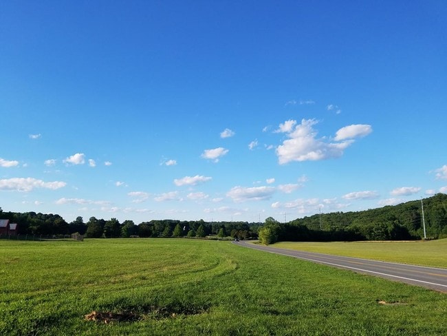
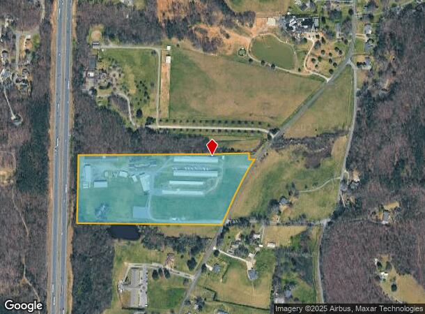
Property Record
2440 Dug Gap Rd, Dalton, GA 30720
NEARBY LISTINGS FOR SALE OR LEASE
Property Detail
2440 Dug Gap Rd
Dalton, GA
Overide Value
12-348-01-000
22.20A LL348 12
Commercialnec
Whitfield
X
Georgia
13313C0225D
348
2025
22.20 AC
2025
Georgia Northwest
001500
Other Market Areas
13,500 SF
DEMOGRAPHICS near 2440 Dug Gap Rd
1 mile
3 mile
5 mile
2024 Total Population
1,243
13,249
42,906
2029 Population
1,244
13,292
43,054
Pop Growth 2024-2029
+ 0.08%
+ 0.32%
+ 0.34%
Average Age
40
39
37
2024 Total Households
434
4,566
14,854
HH Growth 2024-2029
0.00%
+ 0.24%
+ 0.36%
Median Household Inc
$58,333
$65,232
$49,724
Avg Household Size
2.80
2.90
2.80
2024 Avg HH Vehicles
2.00
2.00
2.00
Median Home Value
$227,884
$185,720
$175,655
Median Year Built
1988
1982
1982
Nearby Places
Map Layers
Map Styles
 Street
 Aerial
Transit
 Traffic
 Biking
Places
Listings with unknown addresses are not visible on the map
- Restaurants
- Banks
- Shops
- Fitness
- Groceries
PUBLIC TRANSPORTATION
AIRPORT
Lovell Field
Drive
Walk
Distance
Lovell Field
45 min
30.8 mi
Freight Ports
Georgia Ports - Savannah
Drive
Walk
Distance
Georgia Ports - Savannah
375 min
332.6 mi
SALE & LEASE HISTORY
LISTING DATE
SALE/LEASE

Mar 14, 2019
For Sale
Jul 02, 2019
For Sale
Dec 23, 2020
For Lease
Nearby Properties
Address
Land Use
TOTAL SIZE
Lot Size
Zoning
Address
Land Use
TOTAL SIZE
Lot Size
Zoning
601,800 SF
33.86 AC
M-2
Address
Land Use
TOTAL SIZE
Lot Size
Zoning
513,638 SF
61.78 AC
M2
Address
Land Use
TOTAL SIZE
Lot Size
Zoning
69,590 SF
29.96 AC
Address
Land Use
TOTAL SIZE
Lot Size
Zoning
1,183,067 SF
48.97 AC
M2
Address
Land Use
TOTAL SIZE
Lot Size
Zoning
662,926 SF
67.28 AC
M2
Address
Land Use
TOTAL SIZE
Lot Size
Zoning
341,549 SF
25.46 AC
Address
Land Use
TOTAL SIZE
Lot Size
Zoning
827,500 SF
162.17 AC
M2
Address
Land Use
TOTAL SIZE
Lot Size
Zoning
115,979 SF
10.60 AC
C2
Address
Land Use
TOTAL SIZE
Lot Size
Zoning
250,000 SF
12.50 AC
M2
Address
Land Use
TOTAL SIZE
Lot Size
Zoning
255,350 SF
18.64 AC
Address
Land Use
TOTAL SIZE
Lot Size
Zoning
150,772 SF
12.66 AC
C2
Address
Land Use
TOTAL SIZE
Lot Size
Zoning
281,625 SF
19.58 AC
M2
Address
Land Use
TOTAL SIZE
Lot Size
Zoning
277,385 SF
10.22 AC
Address
Land Use
TOTAL SIZE
Lot Size
Zoning
31,376 SF
9.64 AC
Address
Land Use
TOTAL SIZE
Lot Size
Zoning
227,111 SF
16.09 AC
Address
Land Use
TOTAL SIZE
Lot Size
Zoning
471,045 SF
45.93 AC
M2
Address
Land Use
TOTAL SIZE
Lot Size
Zoning
58,500 SF
48.69 AC
M-2
Address
Land Use
TOTAL SIZE
Lot Size
Zoning
243,100 SF
27.04 AC
M2
Address
Land Use
TOTAL SIZE
Lot Size
Zoning
450,292 SF
23.87 AC
M2
Address
Land Use
TOTAL SIZE
Lot Size
Zoning
99,486 SF
8.66 AC
MU
Address
Land Use
TOTAL SIZE
Lot Size
Zoning
180,109 SF
10.36 AC
Address
Land Use
TOTAL SIZE
Lot Size
Zoning
365,021 SF
16.99 AC
M2
Address
Land Use
TOTAL SIZE
Lot Size
Zoning
337,431 SF
14.51 AC
M2
Address
Land Use
TOTAL SIZE
Lot Size
Zoning
330,439 SF
11.58 AC
M2
Address
Land Use
TOTAL SIZE
Lot Size
Zoning
307,646 SF
10.50 AC
M2
Address
Land Use
TOTAL SIZE
Lot Size
Zoning
143,379 SF
11.30 AC
M2
Address
Land Use
TOTAL SIZE
Lot Size
Zoning
355,274 SF
17.41 AC
Address
Land Use
TOTAL SIZE
Lot Size
Zoning
337,368 SF
13.46 AC
M2
Address
Land Use
TOTAL SIZE
Lot Size
Zoning
104.47 AC
C-2
Address
Land Use
TOTAL SIZE
Lot Size
Zoning
160,000 SF
8.34 AC
M2
The World's #1 Commercial Real Estate Marketplace
Connect with us
© 2026 CoStar Group
The information above has been obtained from sources believed reliable. While we do not doubt its accuracy we have not verified it and make no guarantee, warranty or representation about it. It is your responsibility to independently confirm its accuracy and completeness. Any projections, opinions, assumptions, or estimates used are for example only and do not represent the current or future performance of the property. The value of this transaction to you depends on tax and other factors which should be evaluated by your tax, financial, and legal advisors. You and your advisors should conduct a careful, independent investigation of the property to determine to your satisfaction the suitability of the property for your needs.