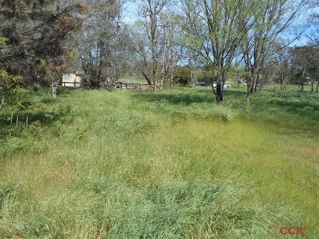
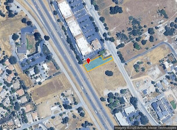
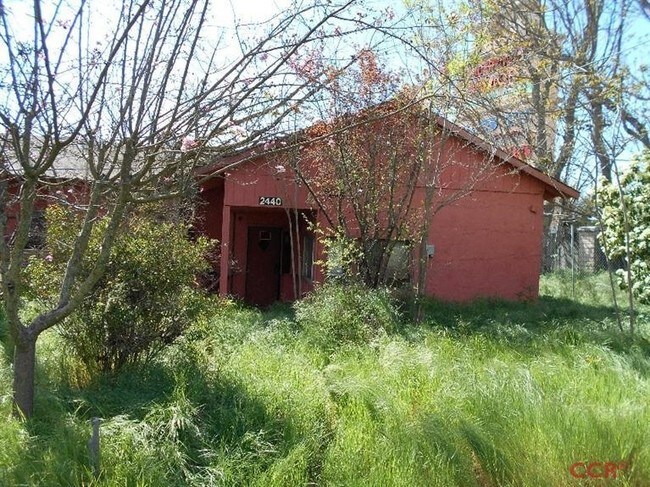
Property Record
2440 El Camino Real, Atascadero, CA 93422
NEARBY LISTINGS FOR SALE OR LEASE
Property Detail
2440 El Camino Real
San Luis Obispo-Paso Robles-Arroyo Grande, CA
Atascadero Colony
049-141-023
CY ATAS ATAS COL BL 23 PTN LT 8
Commercialacreage
San Luis Obispo
X
California
06079C0614G
8
2024
0.68 AC
2025
North 101 Corridor
012505
San Luis Obispo/Paso Robles
DEMOGRAPHICS near 2440 El Camino Real
1 Mile
3 Mile
5 Mile
2024 Total Population
2,995
19,197
35,548
2029 Population
2,955
18,909
34,930
Pop Growth 2024-2029
(1.34%)
(1.50%)
(1.74%)
Average Age
44
42
42
2024 Total Households
1,136
7,351
13,620
HH Growth 2024-2029
(1.58%)
(1.69%)
(1.94%)
Median Household Inc
$88,398
$92,397
$90,970
Avg Household Size
2.50
2.50
2.50
2024 Avg HH Vehicles
2.00
2.00
2.00
Median Home Value
$666,388
$667,340
$674,042
Median Year Built
1987
1979
1983
Nearby Places
Map Layers
Map Styles
 Street
 Aerial
- Restaurants
- Banks
- Shops
- Fitness
- Groceries
PUBLIC TRANSPORTATION
COMMUTER RAIL
Paso Robles Amtrak Station (Coast Starlight - Amtrak)
DRIVE
WALK
Distance
Paso Robles Amtrak Station (Coast Starlight - Amtrak)
11 min
8.5 mi
AIRPORT
San Luis County Regional
DRIVE
WALK
Distance
San Luis County Regional
36 min
25.8 mi
Freight Ports
The Port of Hueneme
DRIVE
WALK
Distance
The Port of Hueneme
193 min
152.9 mi
SALE & LEASE HISTORY
LISTING DATE
SALE/LEASE

Mar 27, 2017
For Sale
Feb 01, 2021
For Sale
Nearby Properties
Address
Land Use
TOTAL SIZE
Lot Size
Zoning
Address
Land Use
TOTAL SIZE
Lot Size
Zoning
88,191 SF
4.01 AC
CPK
Address
Land Use
TOTAL SIZE
Lot Size
Zoning
1.78 AC
CPK
Address
Land Use
TOTAL SIZE
Lot Size
Zoning
89,617 SF
6.97 AC
CPK
Address
Land Use
TOTAL SIZE
Lot Size
Zoning
12 AC
CPK
Address
Land Use
TOTAL SIZE
Lot Size
Zoning
49,652 SF
3.84 AC
CR
Address
Land Use
TOTAL SIZE
Lot Size
Zoning
18,800 SF
0.45 AC
DC
Address
Land Use
TOTAL SIZE
Lot Size
Zoning
39,765 SF
2.43 AC
CR
Address
Land Use
TOTAL SIZE
Lot Size
Zoning
7,114 SF
32.04 AC
AG
Address
Land Use
TOTAL SIZE
Lot Size
Zoning
14,932 SF
0.64 AC
DC
Address
Land Use
TOTAL SIZE
Lot Size
Zoning
2.94 AC
CR
Address
Land Use
TOTAL SIZE
Lot Size
Zoning
21,230 SF
2.36 AC
CR
Address
Land Use
TOTAL SIZE
Lot Size
Zoning
34,661 SF
1.57 AC
MF20
Address
Land Use
TOTAL SIZE
Lot Size
Zoning
0.91 AC
CP
Address
Land Use
TOTAL SIZE
Lot Size
Zoning
3.94 AC
CR
Address
Land Use
TOTAL SIZE
Lot Size
Zoning
Address
Land Use
TOTAL SIZE
Lot Size
Zoning
59,321 SF
3.92 AC
P
Address
Land Use
TOTAL SIZE
Lot Size
Zoning
151.15 AC
AG
Address
Land Use
TOTAL SIZE
Lot Size
Zoning
21,814 SF
33.47 AC
CR
Address
Land Use
TOTAL SIZE
Lot Size
Zoning
1.12 AC
RMF
Address
Land Use
TOTAL SIZE
Lot Size
Zoning
17,161 SF
1.38 AC
CP
Address
Land Use
TOTAL SIZE
Lot Size
Zoning
69,680 SF
5.69 AC
CR
Address
Land Use
TOTAL SIZE
Lot Size
Zoning
15,168 SF
0.64 AC
CR
Address
Land Use
TOTAL SIZE
Lot Size
Zoning
101.53 AC
AG
Address
Land Use
TOTAL SIZE
Lot Size
Zoning
5.07 AC
RS
Address
Land Use
TOTAL SIZE
Lot Size
Zoning
0.39 AC
CR
Address
Land Use
TOTAL SIZE
Lot Size
Zoning
84.21 AC
AG
Address
Land Use
TOTAL SIZE
Lot Size
Zoning
1.49 AC
CR
Address
Land Use
TOTAL SIZE
Lot Size
Zoning
14,496 SF
1 AC
CPK
Address
Land Use
TOTAL SIZE
Lot Size
Zoning
55 AC
AG
Address
Land Use
TOTAL SIZE
Lot Size
Zoning
13,131 SF
1.03 AC
CR
The World's #1 Commercial Real Estate Marketplace
Connect with us
© 2025 CoStar Group
The information above has been obtained from sources believed reliable. While we do not doubt its accuracy we have not verified it and make no guarantee, warranty or representation about it. It is your responsibility to independently confirm its accuracy and completeness. Any projections, opinions, assumptions, or estimates used are for example only and do not represent the current or future performance of the property. The value of this transaction to you depends on tax and other factors which should be evaluated by your tax, financial, and legal advisors. You and your advisors should conduct a careful, independent investigation of the property to determine to your satisfaction the suitability of the property for your needs.