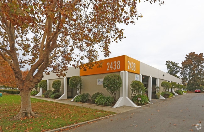
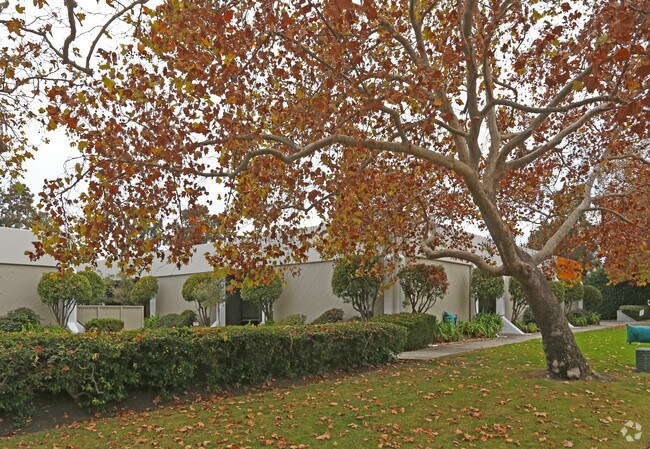
Property Record
2440 Embarcadero Way, Palo Alto, CA 94303

NEARBY LISTINGS FOR SALE OR LEASE
Property Detail
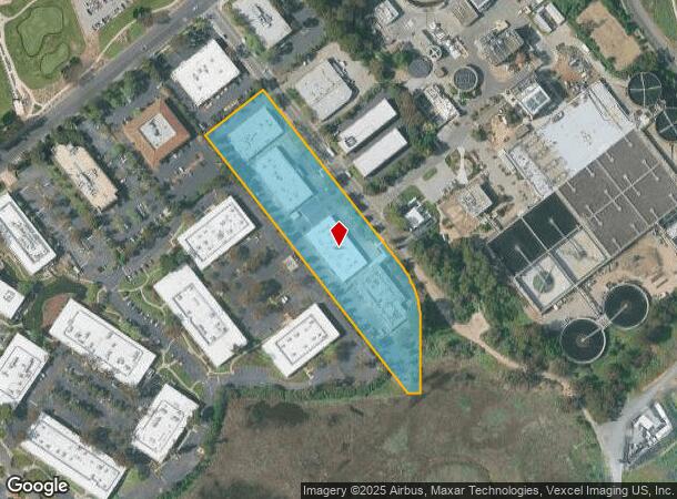
2440 Embarcadero Way
008-03-072
Seale Tr
Financialbuilding
LOT B RECORDER'S BOOK 284 PAGE 40
AE
Santa Clara
06081C0328F
California
2024
3.95 AC
2025
Palo Alto
504601
South Bay/San Jose
11,300 SF
San Jose-Sunnyvale-Santa Clara, CA
DEMOGRAPHICS near 2440 Embarcadero Way
1 Mile
3 Mile
5 Mile
2024 Total Population
6,875
101,657
234,506
2029 Population
6,539
97,675
227,233
Pop Growth 2024-2029
(4.89%)
(3.92%)
(3.10%)
Average Age
38
40
39
2024 Total Households
2,049
35,135
84,878
HH Growth 2024-2029
(5.08%)
(3.88%)
(3.03%)
Median Household Inc
$159,344
$163,837
$162,882
Avg Household Size
3.20
2.70
2.50
2024 Avg HH Vehicles
2.00
2.00
2.00
Median Home Value
$1,125,097
$1,132,425
$1,132,213
Median Year Built
1957
1961
1968
Nearby Places
Map Layers
Map Styles
 Street
 Aerial
- Restaurants
- Banks
- Shops
- Fitness
- Groceries
PUBLIC TRANSPORTATION
COMMUTER RAIL
California Avenue (Caltrain - Caltrain (Caltrain))
DRIVE
WALK
Distance
California Avenue (Caltrain - Caltrain (Caltrain))
9 min
3.3 mi
DRIVE
WALK
Distance
9 min
3.3 mi
AIRPORT
Norman Y Mineta San Jose International
DRIVE
WALK
Distance
Norman Y Mineta San Jose International
21 min
13.9 mi
San Francisco International
DRIVE
WALK
Distance
San Francisco International
29 min
20.9 mi
Metro Oakland International
DRIVE
WALK
Distance
Metro Oakland International
42 min
29.6 mi
Freight Ports
Port of Redwood City
DRIVE
WALK
Distance
Port of Redwood City
14 min
7.8 mi
Nearby Properties
Address
Land Use
TOTAL SIZE
Lot Size
Zoning
Address
Land Use
TOTAL SIZE
Lot Size
Zoning
355,490 SF
26.49 AC
P39
Address
Land Use
TOTAL SIZE
Lot Size
Zoning
440,173 SF
25.33 AC
P39
Address
Land Use
TOTAL SIZE
Lot Size
Zoning
265,341 SF
13.53 AC
RP
Address
Land Use
TOTAL SIZE
Lot Size
Zoning
233,124 SF
9.18 AC
P(7)
Address
Land Use
TOTAL SIZE
Lot Size
Zoning
4.13 AC
P39
Address
Land Use
TOTAL SIZE
Lot Size
Zoning
224,505 SF
5.15 AC
CORE
Address
Land Use
TOTAL SIZE
Lot Size
Zoning
212,924 SF
1.83 AC
Address
Land Use
TOTAL SIZE
Lot Size
Zoning
20,140.41 AC
MV
Address
Land Use
TOTAL SIZE
Lot Size
Zoning
164,853 SF
3.89 AC
Address
Land Use
TOTAL SIZE
Lot Size
Zoning
145,617 SF
8.24 AC
EA00C1
Address
Land Use
TOTAL SIZE
Lot Size
Zoning
652,964 SF
14.99 AC
GM
Address
Land Use
TOTAL SIZE
Lot Size
Zoning
190,389 SF
11.20 AC
M20000
Address
Land Use
TOTAL SIZE
Lot Size
Zoning
143,429 SF
2.12 AC
Address
Land Use
TOTAL SIZE
Lot Size
Zoning
149,700 SF
2.28 AC
Address
Land Use
TOTAL SIZE
Lot Size
Zoning
113,964 SF
6.28 AC
RP
Address
Land Use
TOTAL SIZE
Lot Size
Zoning
222,234 SF
6.39 AC
Address
Land Use
TOTAL SIZE
Lot Size
Zoning
184,142 SF
10.29 AC
RP
Address
Land Use
TOTAL SIZE
Lot Size
Zoning
190,000 SF
3.37 AC
Address
Land Use
TOTAL SIZE
Lot Size
Zoning
128,051 SF
4.26 AC
P39
Address
Land Use
TOTAL SIZE
Lot Size
Zoning
161,432 SF
13.72 AC
RP
Address
Land Use
TOTAL SIZE
Lot Size
Zoning
224,852 SF
9.86 AC
GMB
Address
Land Use
TOTAL SIZE
Lot Size
Zoning
97,203 SF
5.91 AC
RP
Address
Land Use
TOTAL SIZE
Lot Size
Zoning
373,702 SF
13.48 AC
P(39)
Address
Land Use
TOTAL SIZE
Lot Size
Zoning
259,586 SF
17.92 AC
LMD
Address
Land Use
TOTAL SIZE
Lot Size
Zoning
216,472 SF
8.73 AC
GM
Address
Land Use
TOTAL SIZE
Lot Size
Zoning
52,504 SF
1.16 AC
PC
Address
Land Use
TOTAL SIZE
Lot Size
Zoning
297,014 SF
10.12 AC
Address
Land Use
TOTAL SIZE
Lot Size
Zoning
45,000 SF
3.53 AC
EDGE
Address
Land Use
TOTAL SIZE
Lot Size
Zoning
0.41 AC
A
Address
Land Use
TOTAL SIZE
Lot Size
Zoning
0.40 AC
A
The World's #1 Commercial Real Estate Marketplace
Connect with us
© 2026 CoStar Group
The information above has been obtained from sources believed reliable. While we do not doubt its accuracy we have not verified it and make no guarantee, warranty or representation about it. It is your responsibility to independently confirm its accuracy and completeness. Any projections, opinions, assumptions, or estimates used are for example only and do not represent the current or future performance of the property. The value of this transaction to you depends on tax and other factors which should be evaluated by your tax, financial, and legal advisors. You and your advisors should conduct a careful, independent investigation of the property to determine to your satisfaction the suitability of the property for your needs.