Property Record
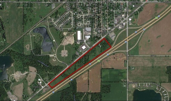
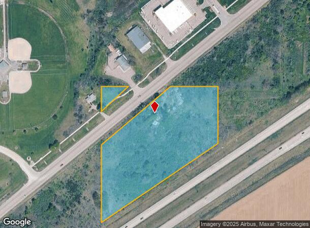
2440 Lansing Rd, Charlotte, MI 48813
NEARBY LISTINGS FOR SALE OR LEASE
Property Detail
2440 Lansing Rd
070-026-400-020-00
W 1/2 OF W 1/2 OF SE 1/4 LYING NLY OF PROPOSED HWY US-27, (NKA I69) EXCEPT HWY US-27(KNOWN AS LANSING RD). SEC.26, T3N,R4W, BENTON TWP 1987
Commercialacreage
Eaton
X
Michigan
26045C0326E
8.49 AC
2024
Outlying Eaton County
2025
West Michigan
020601
Lansing-East Lansing, MI
DEMOGRAPHICS near 2440 Lansing Rd
1 Mile
3 Mile
5 Mile
2024 Total Population
2,557
5,602
11,260
2029 Population
2,545
5,568
11,209
Pop Growth 2024-2029
(0.47%)
(0.61%)
(0.45%)
Average Age
38
40
42
2024 Total Households
988
2,180
4,400
HH Growth 2024-2029
(0.51%)
(0.64%)
(0.48%)
Median Household Inc
$58,826
$67,376
$73,463
Avg Household Size
2.60
2.50
2.50
2024 Avg HH Vehicles
2.00
2.00
2.00
Median Home Value
$148,979
$177,196
$209,721
Median Year Built
1985
1981
1982
Nearby Places
Map Layers
Map Styles
 Street
 Aerial
- Restaurants
- Banks
- Shops
- Fitness
- Groceries
PUBLIC TRANSPORTATION
AIRPORT
Capital Region International
DRIVE
WALK
Distance
Capital Region International
24 min
17.3 mi
Freight Ports
Port of Toledo
DRIVE
WALK
Distance
Port of Toledo
157 min
133.7 mi
SALE & LEASE HISTORY
LISTING DATE
SALE/LEASE

Sep 24, 2016
For Sale
Nearby Properties
Address
Land Use
TOTAL SIZE
Lot Size
Zoning
Address
Land Use
TOTAL SIZE
Lot Size
Zoning
545,421 SF
120.99 AC
I-1 INDUST
Address
Land Use
TOTAL SIZE
Lot Size
Zoning
89,356 SF
49.53 AC
Address
Land Use
TOTAL SIZE
Lot Size
Zoning
80,900 SF
8.13 AC
I-1 INDUST
Address
Land Use
TOTAL SIZE
Lot Size
Zoning
437,864 SF
Address
Land Use
TOTAL SIZE
Lot Size
Zoning
31.03 AC
R-2 MED RE
Address
Land Use
TOTAL SIZE
Lot Size
Zoning
4,160 SF
11.88 AC
LA
Address
Land Use
TOTAL SIZE
Lot Size
Zoning
30,964 SF
8.36 AC
I
Address
Land Use
TOTAL SIZE
Lot Size
Zoning
20,856 SF
2.21 AC
Address
Land Use
TOTAL SIZE
Lot Size
Zoning
30,100 SF
3.79 AC
Address
Land Use
TOTAL SIZE
Lot Size
Zoning
24,556 SF
1.52 AC
R-3 HIGH R
Address
Land Use
TOTAL SIZE
Lot Size
Zoning
2,137 SF
157.95 AC
LA
Address
Land Use
TOTAL SIZE
Lot Size
Zoning
36,962 SF
3.43 AC
I
Address
Land Use
TOTAL SIZE
Lot Size
Zoning
239.56 AC
LA
Address
Land Use
TOTAL SIZE
Lot Size
Zoning
84.81 AC
R-R RURAL
Address
Land Use
TOTAL SIZE
Lot Size
Zoning
5,420 SF
2.22 AC
R-3 HIGH R
Address
Land Use
TOTAL SIZE
Lot Size
Zoning
14,896 SF
5.93 AC
M-1
Address
Land Use
TOTAL SIZE
Lot Size
Zoning
14,608 SF
0.67 AC
R-3 HIGH R
Address
Land Use
TOTAL SIZE
Lot Size
Zoning
9,540 SF
9.22 AC
LA
Address
Land Use
TOTAL SIZE
Lot Size
Zoning
6,020 SF
40.09 AC
LA
Address
Land Use
TOTAL SIZE
Lot Size
Zoning
3,491 SF
1.50 AC
B-2 LIGHT
Address
Land Use
TOTAL SIZE
Lot Size
Zoning
364.89 AC
LA
Address
Land Use
TOTAL SIZE
Lot Size
Zoning
1,525 SF
109.17 AC
LA
Address
Land Use
TOTAL SIZE
Lot Size
Zoning
6,324 SF
8.18 AC
M-1
Address
Land Use
TOTAL SIZE
Lot Size
Zoning
7,840 SF
1.19 AC
R-3 HIGH R
Address
Land Use
TOTAL SIZE
Lot Size
Zoning
4,322 SF
39 AC
C2
Address
Land Use
TOTAL SIZE
Lot Size
Zoning
3,396 SF
0.96 AC
B-3 GENERA
Address
Land Use
TOTAL SIZE
Lot Size
Zoning
1,844 SF
80 AC
LA
Address
Land Use
TOTAL SIZE
Lot Size
Zoning
31,030 SF
5.27 AC
C2
Address
Land Use
TOTAL SIZE
Lot Size
Zoning
116.45 AC
LA
Address
Land Use
TOTAL SIZE
Lot Size
Zoning
11,088 SF
1.67 AC
B-2 LIGHT
The World's #1 Commercial Real Estate Marketplace
Connect with us
© 2026 CoStar Group
The information above has been obtained from sources believed reliable. While we do not doubt its accuracy we have not verified it and make no guarantee, warranty or representation about it. It is your responsibility to independently confirm its accuracy and completeness. Any projections, opinions, assumptions, or estimates used are for example only and do not represent the current or future performance of the property. The value of this transaction to you depends on tax and other factors which should be evaluated by your tax, financial, and legal advisors. You and your advisors should conduct a careful, independent investigation of the property to determine to your satisfaction the suitability of the property for your needs.