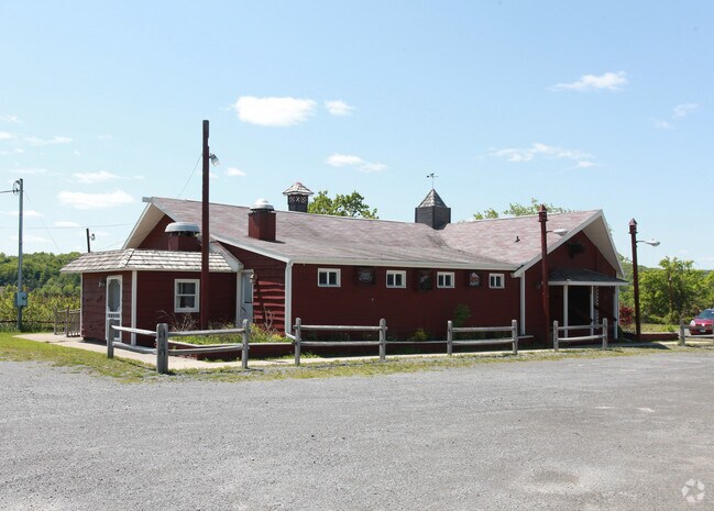
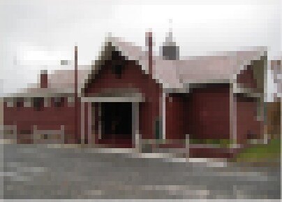
Property Record
2440 Route 5 E, Chittenango, NY 13037


Property Detail
2440 Route 5 E
254889-042-000-0001-064-000-0000
MADISON
Restaurantbuilding
New York
04 - FARM
64.000
2025
3.16 AC
2025
Madison County
030401
Syracuse
2,972 SF
Syracuse, NY
NEARBY LISTINGS FOR SALE OR LEASE
-
-
View all Chittenango listings for sale on LoopNet.com
DEMOGRAPHICS near 2440 Route 5 E
1 mile
3 mile
5 mile
2025 Total Population
259
4,684
15,281
2030 Population
255
4,580
14,998
Pop Growth 2025-2030
(1.54%)
(2.22%)
(1.85%)
Average Age
45
44
43
2025 Total Households
107
1,927
6,296
HH Growth 2025-2030
(1.87%)
(2.39%)
(1.99%)
Median Household Inc
$82,812
$78,488
$78,510
Avg Household Size
2.40
2.40
2.40
2025 Avg HH Vehicles
2.00
2.00
2.00
Median Home Value
$235,714
$191,876
$190,605
Median Year Built
1968
1966
1970
Nearby Places
Map Layers
Map Styles
 Street
 Aerial
Layers
 Traffic
 Biking
Places
Listings with unknown addresses are not visible on the map
- Restaurants
- Banks
- Shops
- Fitness
- Groceries
PUBLIC TRANSPORTATION
AIRPORT
Syracuse Hancock International
Drive
Walk
Distance
Syracuse Hancock International
43 min
24.3 mi
Nearby Properties
Address
Land Use
TOTAL SIZE
Lot Size
Zoning
Address
Land Use
TOTAL SIZE
Lot Size
Zoning
103,497 SF
23.96 AC
RES
Address
Land Use
TOTAL SIZE
Lot Size
Zoning
129,797 SF
Address
Land Use
TOTAL SIZE
Lot Size
Zoning
17,770 SF
47.91 AC
Address
Land Use
TOTAL SIZE
Lot Size
Zoning
68,425 SF
40.93 AC
Address
Land Use
TOTAL SIZE
Lot Size
Zoning
24.57 AC
Address
Land Use
TOTAL SIZE
Lot Size
Zoning
Address
Land Use
TOTAL SIZE
Lot Size
Zoning
42,307 SF
5.20 AC
02 - SINGL
Address
Land Use
TOTAL SIZE
Lot Size
Zoning
Address
Land Use
TOTAL SIZE
Lot Size
Zoning
432 SF
7.28 AC
Address
Land Use
TOTAL SIZE
Lot Size
Zoning
Address
Land Use
TOTAL SIZE
Lot Size
Zoning
10.08 AC
IND
Address
Land Use
TOTAL SIZE
Lot Size
Zoning
62,000 SF
10.12 AC
IND
Address
Land Use
TOTAL SIZE
Lot Size
Zoning
86,853 SF
22.01 AC
Address
Land Use
TOTAL SIZE
Lot Size
Zoning
6,600 SF
1.23 AC
Address
Land Use
TOTAL SIZE
Lot Size
Zoning
6,000 SF
2.68 AC
Address
Land Use
TOTAL SIZE
Lot Size
Zoning
13,259 SF
1.52 AC
05 - COMME
Address
Land Use
TOTAL SIZE
Lot Size
Zoning
Address
Land Use
TOTAL SIZE
Lot Size
Zoning
980 SF
33.08 AC
Address
Land Use
TOTAL SIZE
Lot Size
Zoning
3,600 SF
3.34 AC
05 - COMME
Address
Land Use
TOTAL SIZE
Lot Size
Zoning
7,987 SF
0.78 AC
BUS
Address
Land Use
TOTAL SIZE
Lot Size
Zoning
32,193 SF
3.21 AC
IND
Address
Land Use
TOTAL SIZE
Lot Size
Zoning
7,400 SF
0.54 AC
05 - COMME
Address
Land Use
TOTAL SIZE
Lot Size
Zoning
3,116 SF
1.94 AC
BUS
Address
Land Use
TOTAL SIZE
Lot Size
Zoning
14,000 SF
4.43 AC
IND
Address
Land Use
TOTAL SIZE
Lot Size
Zoning
6,806 SF
0.72 AC
05 - COMME
Address
Land Use
TOTAL SIZE
Lot Size
Zoning
2,600 SF
52.47 AC
Address
Land Use
TOTAL SIZE
Lot Size
Zoning
7,680 SF
4.13 AC
Address
Land Use
TOTAL SIZE
Lot Size
Zoning
4,080 SF
4.49 AC
Address
Land Use
TOTAL SIZE
Lot Size
Zoning
3,300 SF
3.13 AC
05
Address
Land Use
TOTAL SIZE
Lot Size
Zoning
6,838 SF
0.96 AC
The World's #1 Commercial Real Estate Marketplace
Connect with us
© 2026 CoStar Group
The information above has been obtained from sources believed reliable. While we do not doubt its accuracy we have not verified it and make no guarantee, warranty or representation about it. It is your responsibility to independently confirm its accuracy and completeness. Any projections, opinions, assumptions, or estimates used are for example only and do not represent the current or future performance of the property. The value of this transaction to you depends on tax and other factors which should be evaluated by your tax, financial, and legal advisors. You and your advisors should conduct a careful, independent investigation of the property to determine to your satisfaction the suitability of the property for your needs.