Property Record
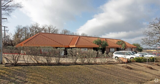
2440 W Interstate 20, Arlington, TX 76017


Property Detail
2440 W Interstate 20
Dallas-Fort Worth-Arlington, TX
AMERICANA ESTATES ADDN UNREC BLOCK 2 LOT 2R
05525098
TARRANT
Commercialnec
Texas
B and X Area of moderate flood hazard, usually the area between the limits of the 100-year and 500-year floods.
2r
2024
0.54 AC
2025
Arlington/Mansfield
111530
Dallas/Ft Worth
5,168 SF
NEARBY LISTINGS FOR SALE OR LEASE
DEMOGRAPHICS near 2440 W Interstate 20
1 mile
3 mile
5 mile
2025 Total Population
7,689
115,130
305,270
2030 Population
7,983
120,269
319,811
Pop Growth 2025-2030
+ 3.82%
+ 4.46%
+ 4.76%
Average Age
44
40
38
2025 Total Households
2,982
42,520
106,525
HH Growth 2025-2030
+ 3.96%
+ 4.62%
+ 4.95%
Median Household Inc
$98,670
$85,569
$79,850
Avg Household Size
2.60
2.70
2.80
2025 Avg HH Vehicles
2.00
2.00
2.00
Median Home Value
$362,524
$323,071
$322,863
Median Year Built
1984
1985
1985
Nearby Places
Map Layers
Map Styles
 Street
 Aerial
Transit
 Traffic
 Biking
Places
Listings with unknown addresses are not visible on the map
- Restaurants
- Banks
- Shops
- Fitness
- Groceries
PUBLIC TRANSPORTATION
AIRPORT
Dallas-Fort Worth International
Drive
Walk
Distance
Dallas-Fort Worth International
32 min
22.3 mi
Dallas Love Field
Drive
Walk
Distance
Dallas Love Field
41 min
31.0 mi
Freight Ports
Port of Shreveport
Drive
Walk
Distance
Port of Shreveport
233 min
216.7 mi
Nearby Properties
Address
Land Use
TOTAL SIZE
Lot Size
Zoning
Address
Land Use
TOTAL SIZE
Lot Size
Zoning
1,342,617 SF
40.67 AC
Address
Land Use
TOTAL SIZE
Lot Size
Zoning
569,876 SF
47.80 AC
Address
Land Use
TOTAL SIZE
Lot Size
Zoning
537,189 SF
29.08 AC
Address
Land Use
TOTAL SIZE
Lot Size
Zoning
799,893 SF
19.43 AC
Address
Land Use
TOTAL SIZE
Lot Size
Zoning
377,463 SF
19.50 AC
Address
Land Use
TOTAL SIZE
Lot Size
Zoning
569,312 SF
71.52 AC
Address
Land Use
TOTAL SIZE
Lot Size
Zoning
462,396 SF
25.76 AC
Address
Land Use
TOTAL SIZE
Lot Size
Zoning
280,000 SF
10.85 AC
Address
Land Use
TOTAL SIZE
Lot Size
Zoning
296,092 SF
7.66 AC
Address
Land Use
TOTAL SIZE
Lot Size
Zoning
252,416 SF
15.86 AC
Address
Land Use
TOTAL SIZE
Lot Size
Zoning
858,995 SF
41.93 AC
Address
Land Use
TOTAL SIZE
Lot Size
Zoning
202,262 SF
12.59 AC
Address
Land Use
TOTAL SIZE
Lot Size
Zoning
28,825 SF
81.97 AC
Address
Land Use
TOTAL SIZE
Lot Size
Zoning
268,340 SF
70 AC
Address
Land Use
TOTAL SIZE
Lot Size
Zoning
258,465 SF
8.99 AC
Address
Land Use
TOTAL SIZE
Lot Size
Zoning
167,643 SF
8.99 AC
Address
Land Use
TOTAL SIZE
Lot Size
Zoning
425,000 SF
21.26 AC
Address
Land Use
TOTAL SIZE
Lot Size
Zoning
415,800 SF
20.97 AC
Address
Land Use
TOTAL SIZE
Lot Size
Zoning
218,110 SF
8.85 AC
Address
Land Use
TOTAL SIZE
Lot Size
Zoning
425,000 SF
21.82 AC
Address
Land Use
TOTAL SIZE
Lot Size
Zoning
226,623 SF
22.90 AC
Address
Land Use
TOTAL SIZE
Lot Size
Zoning
281,009 SF
16.39 AC
Address
Land Use
TOTAL SIZE
Lot Size
Zoning
278,273 SF
9.09 AC
Address
Land Use
TOTAL SIZE
Lot Size
Zoning
222,500 SF
13.86 AC
Address
Land Use
TOTAL SIZE
Lot Size
Zoning
202,827 SF
11.96 AC
Address
Land Use
TOTAL SIZE
Lot Size
Zoning
213,824 SF
11.66 AC
Address
Land Use
TOTAL SIZE
Lot Size
Zoning
182,763 SF
10.54 AC
Address
Land Use
TOTAL SIZE
Lot Size
Zoning
208,010 SF
10 AC
Address
Land Use
TOTAL SIZE
Lot Size
Zoning
165,842 SF
9.48 AC
Address
Land Use
TOTAL SIZE
Lot Size
Zoning
245,354 SF
30.82 AC
The World's #1 Commercial Real Estate Marketplace
Connect with us
© 2026 CoStar Group
The information above has been obtained from sources believed reliable. While we do not doubt its accuracy we have not verified it and make no guarantee, warranty or representation about it. It is your responsibility to independently confirm its accuracy and completeness. Any projections, opinions, assumptions, or estimates used are for example only and do not represent the current or future performance of the property. The value of this transaction to you depends on tax and other factors which should be evaluated by your tax, financial, and legal advisors. You and your advisors should conduct a careful, independent investigation of the property to determine to your satisfaction the suitability of the property for your needs.