Property Record
24400 Sw 209Th Pl, Homestead, FL 33031


NEARBY LISTINGS FOR SALE OR LEASE
Property Detail
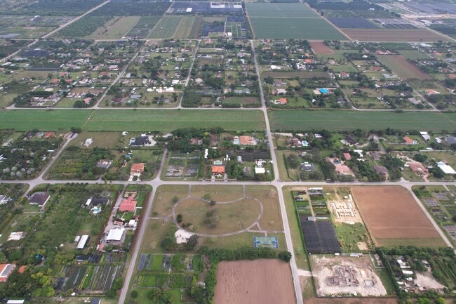
24400 Sw 209Th Pl
Miami-Miami Beach-Kendall, FL
Outback Ranches
30-6821-001-0190
OUTBACK RANCHES PB 166-8 T-20808 LOT 7 BLK 2 LOT SIZE 63435 SQ FT M/L FAU 30 6821 000 0320 0550 0560 & 0600 0660 0670 0720 4050 4090 & 4280 4350 4580 4590 & 4760
Vacantlandnec
Miami/Dade
AH
Florida
12086C0570L
7
2024
1.46 AC
2025
South Dade
010303
South Florida
DEMOGRAPHICS near 24400 Sw 209Th Pl
1 Mile
3 Mile
5 Mile
2024 Total Population
1,041
3,782
19,804
2029 Population
987
3,538
19,124
Pop Growth 2024-2029
(5.19%)
(6.45%)
(3.43%)
Average Age
43
43
40
2024 Total Households
304
1,160
5,828
HH Growth 2024-2029
(5.59%)
(6.98%)
(3.96%)
Median Household Inc
$85,654
$87,970
$76,133
Avg Household Size
3.10
3.00
3.20
2024 Avg HH Vehicles
4.00
3.00
2.00
Median Home Value
$394,537
$422,846
$411,251
Median Year Built
1986
1986
1984
Nearby Places
Map Layers
Map Styles
 Street
 Aerial
- Restaurants
- Banks
- Shops
- Fitness
- Groceries
PUBLIC TRANSPORTATION
AIRPORT
Miami International
DRIVE
WALK
Distance
Miami International
53 min
31.3 mi
Freight Ports
Port of Miami
DRIVE
WALK
Distance
Port of Miami
63 min
38.3 mi
SALE & LEASE HISTORY
LISTING DATE
SALE/LEASE

Jul 31, 2023
For Sale
Jul 25, 2023
For Sale
Dec 14, 2022
For Sale
Aug 26, 2019
For Sale
Nearby Properties
Address
Land Use
TOTAL SIZE
Lot Size
Zoning
Address
Land Use
TOTAL SIZE
Lot Size
Zoning
328,934 SF
20 AC
8900
Address
Land Use
TOTAL SIZE
Lot Size
Zoning
35,830 SF
719.34 AC
8900
Address
Land Use
TOTAL SIZE
Lot Size
Zoning
37,581 SF
5.07 AC
9000
Address
Land Use
TOTAL SIZE
Lot Size
Zoning
60,778 SF
10 AC
8900
Address
Land Use
TOTAL SIZE
Lot Size
Zoning
10 AC
3700
Address
Land Use
TOTAL SIZE
Lot Size
Zoning
33,230 SF
118.41 AC
9000
Address
Land Use
TOTAL SIZE
Lot Size
Zoning
103,381 SF
6.50 AC
7100
Address
Land Use
TOTAL SIZE
Lot Size
Zoning
16,545 SF
15 AC
9000
Address
Land Use
TOTAL SIZE
Lot Size
Zoning
13,611 SF
10 AC
9000
Address
Land Use
TOTAL SIZE
Lot Size
Zoning
54,074 SF
4.21 AC
7100
Address
Land Use
TOTAL SIZE
Lot Size
Zoning
55,681 SF
16.89 AC
8900
Address
Land Use
TOTAL SIZE
Lot Size
Zoning
4,929 SF
5.40 AC
9000
Address
Land Use
TOTAL SIZE
Lot Size
Zoning
33,860 SF
3.04 AC
7100
Address
Land Use
TOTAL SIZE
Lot Size
Zoning
3,722 SF
5 AC
8900
Address
Land Use
TOTAL SIZE
Lot Size
Zoning
10,579 SF
10 AC
9000
Address
Land Use
TOTAL SIZE
Lot Size
Zoning
6,804 SF
5 AC
9000
Address
Land Use
TOTAL SIZE
Lot Size
Zoning
13.73 AC
9000
Address
Land Use
TOTAL SIZE
Lot Size
Zoning
8,454 SF
4.20 AC
9000
Address
Land Use
TOTAL SIZE
Lot Size
Zoning
14,072 SF
9.70 AC
9000
Address
Land Use
TOTAL SIZE
Lot Size
Zoning
6,980 SF
2.99 AC
9000
Address
Land Use
TOTAL SIZE
Lot Size
Zoning
10,518 SF
10.39 AC
9000
Address
Land Use
TOTAL SIZE
Lot Size
Zoning
9,527 SF
5.03 AC
9000
Address
Land Use
TOTAL SIZE
Lot Size
Zoning
12,113 SF
9.98 AC
8900
Address
Land Use
TOTAL SIZE
Lot Size
Zoning
3,643 SF
2.42 AC
8900
Address
Land Use
TOTAL SIZE
Lot Size
Zoning
5,536 SF
1.33 AC
8900
Address
Land Use
TOTAL SIZE
Lot Size
Zoning
7,428 SF
7.06 AC
8900
Address
Land Use
TOTAL SIZE
Lot Size
Zoning
8,744 SF
4.06 AC
8900
The World's #1 Commercial Real Estate Marketplace
Connect with us
© 2026 CoStar Group
The information above has been obtained from sources believed reliable. While we do not doubt its accuracy we have not verified it and make no guarantee, warranty or representation about it. It is your responsibility to independently confirm its accuracy and completeness. Any projections, opinions, assumptions, or estimates used are for example only and do not represent the current or future performance of the property. The value of this transaction to you depends on tax and other factors which should be evaluated by your tax, financial, and legal advisors. You and your advisors should conduct a careful, independent investigation of the property to determine to your satisfaction the suitability of the property for your needs.