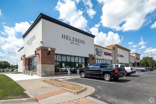
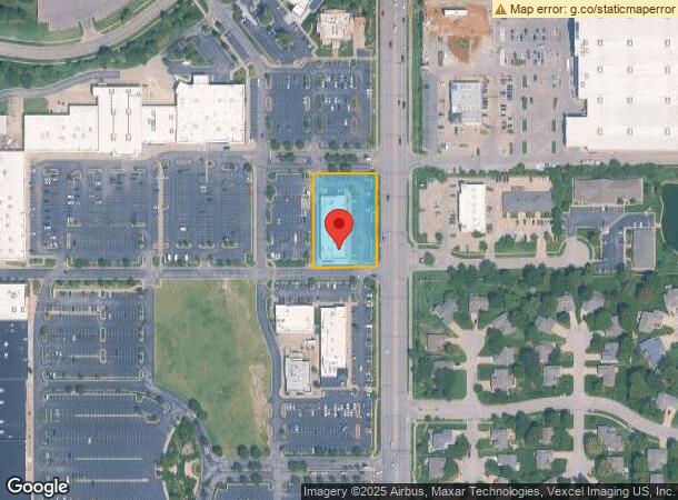
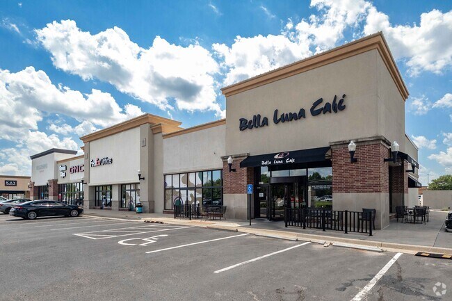
Property Record
2441 N Maize Rd, Wichita, KS 67205
Current Lease Availabilities
NEARBY LISTINGS FOR SALE OR LEASE
Property Detail
2441 N Maize Rd
Wichita, KS
Newmarket Square Phase Iii Add
133-06-0-41-02-003.00
LOT 3 BLOCK 1 NEWMARKET SQUARE PHASE III ADD
Storebuilding
Sedgwick
X
Kansas
20173C0327G
3
2024
1.06 AC
2025
Goddard/West
009515
Wichita
12,180 SF
DEMOGRAPHICS near 2441 N Maize Rd
1 Mile
3 Mile
5 Mile
2024 Total Population
9,298
55,182
100,724
2029 Population
9,299
55,651
102,048
Pop Growth 2024-2029
+ 0.01%
+ 0.85%
+ 1.31%
Average Age
39
40
40
2024 Total Households
3,346
20,910
39,580
HH Growth 2024-2029
(0.06%)
+ 0.81%
+ 1.33%
Median Household Inc
$94,220
$85,510
$74,501
Avg Household Size
2.70
2.60
2.50
2024 Avg HH Vehicles
2.00
2.00
2.00
Median Home Value
$229,288
$221,085
$203,169
Median Year Built
1995
1992
1988
Nearby Places
- Restaurants
- Banks
- Shops
- Fitness
- Groceries
PUBLIC TRANSPORTATION
AIRPORT
Wichita Dwight D Eisenhower Ntl
DRIVE
WALK
Distance
Wichita Dwight D Eisenhower Ntl
15 min
7.8 mi
Freight Ports
Tulsa Port Of Catoosa
DRIVE
WALK
Distance
Tulsa Port Of Catoosa
216 min
200.8 mi
Nearby Properties
Address
Land Use
TOTAL SIZE
Lot Size
Zoning
Address
Land Use
TOTAL SIZE
Lot Size
Zoning
662,237 SF
179.74 AC
SF-5
Address
Land Use
TOTAL SIZE
Lot Size
Zoning
143,939 SF
10.88 AC
PUD
Address
Land Use
TOTAL SIZE
Lot Size
Zoning
303,559 SF
123.23 AC
SF-5
Address
Land Use
TOTAL SIZE
Lot Size
Zoning
160,112 SF
58.49 AC
AA
Address
Land Use
TOTAL SIZE
Lot Size
Zoning
108,480 SF
14.90 AC
GO
Address
Land Use
TOTAL SIZE
Lot Size
Zoning
175,639 SF
22.91 AC
SF-5
Address
Land Use
TOTAL SIZE
Lot Size
Zoning
82,854 SF
49.09 AC
LC,SF-5
Address
Land Use
TOTAL SIZE
Lot Size
Zoning
113,253 SF
21.17 AC
SF-5
Address
Land Use
TOTAL SIZE
Lot Size
Zoning
102,794 SF
14.78 AC
SF-5
Address
Land Use
TOTAL SIZE
Lot Size
Zoning
99,933 SF
9.98 AC
SF-5
Address
Land Use
TOTAL SIZE
Lot Size
Zoning
74,378 SF
14.63 AC
GO
Address
Land Use
TOTAL SIZE
Lot Size
Zoning
136,717 SF
11.18 AC
SF-5
Address
Land Use
TOTAL SIZE
Lot Size
Zoning
38,927 SF
5 AC
LC
Address
Land Use
TOTAL SIZE
Lot Size
Zoning
77,159 SF
5.97 AC
SF-5
Address
Land Use
TOTAL SIZE
Lot Size
Zoning
84,317 SF
7.18 AC
SF-5
Address
Land Use
TOTAL SIZE
Lot Size
Zoning
79,775 SF
7.94 AC
SF-5
Address
Land Use
TOTAL SIZE
Lot Size
Zoning
29,952 SF
3.98 AC
GO
Address
Land Use
TOTAL SIZE
Lot Size
Zoning
173,604 SF
21.29 AC
LC
Address
Land Use
TOTAL SIZE
Lot Size
Zoning
65,504 SF
6.81 AC
SF-5
Address
Land Use
TOTAL SIZE
Lot Size
Zoning
51,845 SF
5.51 AC
SF-5
Address
Land Use
TOTAL SIZE
Lot Size
Zoning
68,496 SF
18.11 AC
LC
Address
Land Use
TOTAL SIZE
Lot Size
Zoning
47,158 SF
211.18 AC
SF-20,LC
Address
Land Use
TOTAL SIZE
Lot Size
Zoning
34,963 SF
6.13 AC
Address
Land Use
TOTAL SIZE
Lot Size
Zoning
60,085 SF
7.37 AC
SF-5
Address
Land Use
TOTAL SIZE
Lot Size
Zoning
65,110 SF
3.94 AC
B
Address
Land Use
TOTAL SIZE
Lot Size
Zoning
33,953 SF
10.05 AC
SF-5
Address
Land Use
TOTAL SIZE
Lot Size
Zoning
37,055 SF
19.24 AC
SF-20
Address
Land Use
TOTAL SIZE
Lot Size
Zoning
24,134 SF
8.78 AC
B1
Address
Land Use
TOTAL SIZE
Lot Size
Zoning
56,821 SF
2.68 AC
SF-5
Address
Land Use
TOTAL SIZE
Lot Size
Zoning
46,007 SF
13.19 AC
MF-29
The World's #1 Commercial Real Estate Marketplace
Connect with us
© 2025 CoStar Group
The information above has been obtained from sources believed reliable. While we do not doubt its accuracy we have not verified it and make no guarantee, warranty or representation about it. It is your responsibility to independently confirm its accuracy and completeness. Any projections, opinions, assumptions, or estimates used are for example only and do not represent the current or future performance of the property. The value of this transaction to you depends on tax and other factors which should be evaluated by your tax, financial, and legal advisors. You and your advisors should conduct a careful, independent investigation of the property to determine to your satisfaction the suitability of the property for your needs.