Property Record
2441 Ne 49Th Ter, Ocala, FL 34470


NEARBY LISTINGS FOR SALE OR LEASE
Property Detail
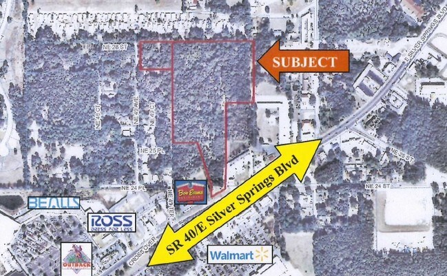
2441 Ne 49Th Ter
Ocala, FL
The Hammock
24161-000-00
SEC 01 TWP 15 RGE 22 COM AT SE COR OF HAMMOCK PLAT REC IN PLAT BOOK F PAGE 66 SAID PT ALSO BEING SW COR OF NE 1/4 OF SW 1/4 OF SEC 1 N 00-20-59 W 11.85 FT TO POB TH N 00-03-38 E 1061.16 FT TH S 89-50-52 W 289.26 FT TO PT ON E ROW OF NE 49TH AVE TH N
Publicstorage
Marion
A
Florida
12083C0529E
24
2024
19.18 AC
2024
Greater Ocala
001403
Ocala
86,393 SF
DEMOGRAPHICS near 2441 Ne 49Th Ter
1 Mile
3 Mile
5 Mile
2024 Total Population
4,470
29,272
72,158
2029 Population
5,154
32,924
81,112
Pop Growth 2024-2029
+ 15.30%
+ 12.48%
+ 12.41%
Average Age
40
42
41
2024 Total Households
2,048
12,638
29,579
HH Growth 2024-2029
+ 15.48%
+ 12.50%
+ 12.41%
Median Household Inc
$45,027
$55,500
$58,768
Avg Household Size
2.20
2.30
2.40
2024 Avg HH Vehicles
1.00
2.00
2.00
Median Home Value
$134,204
$163,090
$186,700
Median Year Built
1988
1982
1983
Nearby Places
Map Layers
Map Styles
 Street
 Aerial
- Restaurants
- Banks
- Shops
- Fitness
- Groceries
SALE & LEASE HISTORY
LISTING DATE
SALE/LEASE

Sep 24, 2016
For Sale
Nearby Properties
Address
Land Use
TOTAL SIZE
Lot Size
Zoning
Address
Land Use
TOTAL SIZE
Lot Size
Zoning
205,664 SF
22.56 AC
B5
Address
Land Use
TOTAL SIZE
Lot Size
Zoning
116,035 SF
38.20 AC
GU
Address
Land Use
TOTAL SIZE
Lot Size
Zoning
111,395 SF
13 AC
B2
Address
Land Use
TOTAL SIZE
Lot Size
Zoning
30,334 SF
29.72 AC
GU
Address
Land Use
TOTAL SIZE
Lot Size
Zoning
78,280 SF
12.54 AC
R3
Address
Land Use
TOTAL SIZE
Lot Size
Zoning
196,416 SF
29.65 AC
SC
Address
Land Use
TOTAL SIZE
Lot Size
Zoning
2,541.29 AC
A1
Address
Land Use
TOTAL SIZE
Lot Size
Zoning
134,827 SF
14.83 AC
SC
Address
Land Use
TOTAL SIZE
Lot Size
Zoning
192,553 SF
21.18 AC
SC
Address
Land Use
TOTAL SIZE
Lot Size
Zoning
134,890 SF
18.90 AC
B4
Address
Land Use
TOTAL SIZE
Lot Size
Zoning
10,552 SF
51.60 AC
PRV
Address
Land Use
TOTAL SIZE
Lot Size
Zoning
35,356 SF
6.14 AC
R3
Address
Land Use
TOTAL SIZE
Lot Size
Zoning
81,689 SF
11.05 AC
B2
Address
Land Use
TOTAL SIZE
Lot Size
Zoning
61,045 SF
22.64 AC
A1
Address
Land Use
TOTAL SIZE
Lot Size
Zoning
47,567 SF
12 AC
INST
Address
Land Use
TOTAL SIZE
Lot Size
Zoning
39,552 SF
5.97 AC
R3
Address
Land Use
TOTAL SIZE
Lot Size
Zoning
14,344 SF
3.12 AC
B2
Address
Land Use
TOTAL SIZE
Lot Size
Zoning
81,174 SF
18.50 AC
B2
Address
Land Use
TOTAL SIZE
Lot Size
Zoning
21,173 SF
216.46 AC
B2
Address
Land Use
TOTAL SIZE
Lot Size
Zoning
27,949 SF
6.03 AC
R3
Address
Land Use
TOTAL SIZE
Lot Size
Zoning
36,064 SF
5.31 AC
R3
Address
Land Use
TOTAL SIZE
Lot Size
Zoning
32,675 SF
478 AC
A1
Address
Land Use
TOTAL SIZE
Lot Size
Zoning
91,003 SF
6.31 AC
B1
Address
Land Use
TOTAL SIZE
Lot Size
Zoning
78,751 SF
20 AC
GU
Address
Land Use
TOTAL SIZE
Lot Size
Zoning
60,099 SF
52.96 AC
B2
Address
Land Use
TOTAL SIZE
Lot Size
Zoning
5,322 SF
403 AC
R1
Address
Land Use
TOTAL SIZE
Lot Size
Zoning
98,080 SF
6.69 AC
M1
Address
Land Use
TOTAL SIZE
Lot Size
Zoning
18,564 SF
3.25 AC
INST
Address
Land Use
TOTAL SIZE
Lot Size
Zoning
76,132 SF
9.40 AC
R3
Address
Land Use
TOTAL SIZE
Lot Size
Zoning
60,576 SF
20.47 AC
INST
The World's #1 Commercial Real Estate Marketplace
Connect with us
© 2025 CoStar Group
The information above has been obtained from sources believed reliable. While we do not doubt its accuracy we have not verified it and make no guarantee, warranty or representation about it. It is your responsibility to independently confirm its accuracy and completeness. Any projections, opinions, assumptions, or estimates used are for example only and do not represent the current or future performance of the property. The value of this transaction to you depends on tax and other factors which should be evaluated by your tax, financial, and legal advisors. You and your advisors should conduct a careful, independent investigation of the property to determine to your satisfaction the suitability of the property for your needs.