Property Record
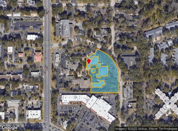
2441 Nw 43Rd St, Gainesville, FL 32606
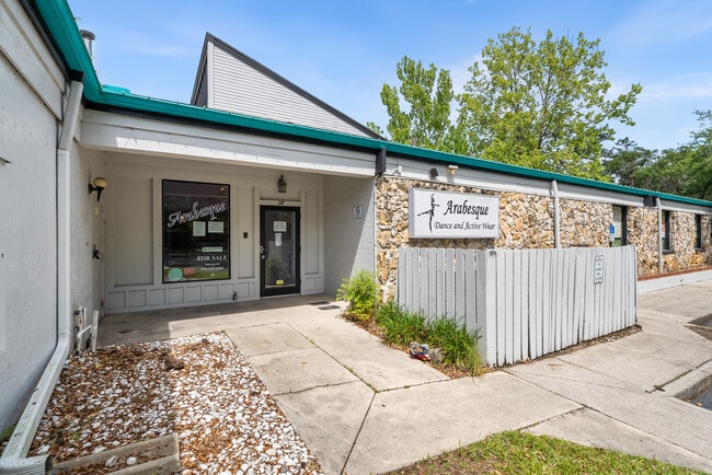
This Property Is For Sale
NEARBY LISTINGS FOR SALE OR LEASE
Property Detail
2441 Nw 43Rd St
Gainesville, FL
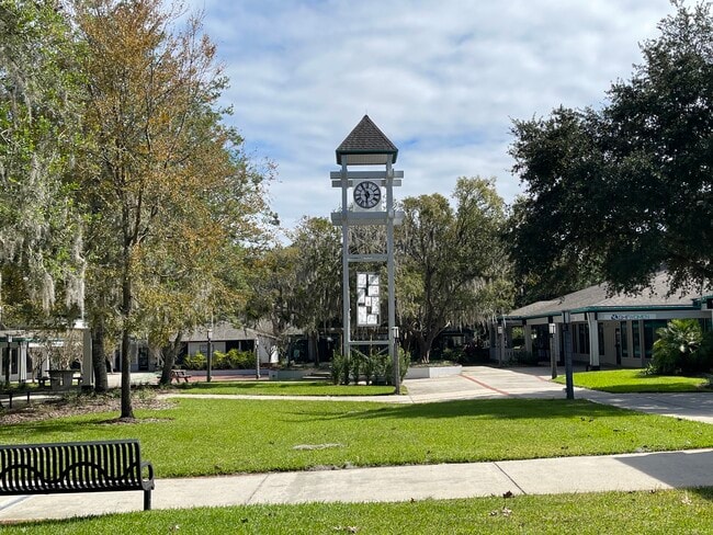
Thornebrook
06107-301-001
THORNEBROOK VILLAGE PH 2 OR 1570/1558 UNIT 1A & UNDIV INT IN COMMON ELEMENTS OR 4194/0161
Departmentstore
Alachua
X
Florida
12001C0292D
1a
2025
0.02 AC
2025
Northwest Gainesville
001100
Other Market Areas
831 SF
DEMOGRAPHICS near 2441 Nw 43Rd St
1 Mile
3 Mile
5 Mile
2024 Total Population
8,214
77,778
175,611
2029 Population
8,676
81,476
184,077
Pop Growth 2024-2029
+ 5.62%
+ 4.75%
+ 4.82%
Average Age
46
37
35
2024 Total Households
3,584
33,176
72,189
HH Growth 2024-2029
+ 5.78%
+ 4.87%
+ 5.01%
Median Household Inc
$88,064
$59,941
$48,135
Avg Household Size
2.20
2.20
2.20
2024 Avg HH Vehicles
2.00
2.00
2.00
Median Home Value
$272,544
$243,936
$245,212
Median Year Built
1977
1983
1985
Nearby Places
- Restaurants
- Banks
- Shops
- Fitness
- Groceries
PUBLIC TRANSPORTATION
AIRPORT
Gainesville Regional
DRIVE
WALK
Distance
Gainesville Regional
19 min
8.6 mi
Freight Ports
Jacksonville Port
DRIVE
WALK
Distance
Jacksonville Port
104 min
78.4 mi
Nearby Properties
Address
Land Use
TOTAL SIZE
Lot Size
Zoning
Address
Land Use
TOTAL SIZE
Lot Size
Zoning
790,340 SF
526 AC
ED
Address
Land Use
TOTAL SIZE
Lot Size
Zoning
108,640 SF
20 AC
ED
Address
Land Use
TOTAL SIZE
Lot Size
Zoning
17.87 AC
ED
Address
Land Use
TOTAL SIZE
Lot Size
Zoning
317,057 SF
128.93 AC
RP
Address
Land Use
TOTAL SIZE
Lot Size
Zoning
1,005,666 SF
11.60 AC
MD
Address
Land Use
TOTAL SIZE
Lot Size
Zoning
582,311 SF
20 AC
ED
Address
Land Use
TOTAL SIZE
Lot Size
Zoning
348,458 SF
81.44 AC
ED
Address
Land Use
TOTAL SIZE
Lot Size
Zoning
571,635 SF
55.49 AC
RMF6
Address
Land Use
TOTAL SIZE
Lot Size
Zoning
141,984 SF
20 AC
HM
Address
Land Use
TOTAL SIZE
Lot Size
Zoning
790,684 SF
57.09 AC
U8
Address
Land Use
TOTAL SIZE
Lot Size
Zoning
392,717 SF
47.62 AC
R-2
Address
Land Use
TOTAL SIZE
Lot Size
Zoning
295,990 SF
20 AC
ED
Address
Land Use
TOTAL SIZE
Lot Size
Zoning
153,592 SF
24.98 AC
R-2
Address
Land Use
TOTAL SIZE
Lot Size
Zoning
626,679 SF
41.04 AC
A
Address
Land Use
TOTAL SIZE
Lot Size
Zoning
299,984 SF
10.33 AC
MU2
Address
Land Use
TOTAL SIZE
Lot Size
Zoning
1,331,605 SF
32.61 AC
ED
Address
Land Use
TOTAL SIZE
Lot Size
Zoning
395,561 SF
19.11 AC
PD
Address
Land Use
TOTAL SIZE
Lot Size
Zoning
366,764 SF
26.03 AC
RMF6
Address
Land Use
TOTAL SIZE
Lot Size
Zoning
349,789 SF
28.08 AC
PD
Address
Land Use
TOTAL SIZE
Lot Size
Zoning
794,044 SF
80.54 AC
PD
Address
Land Use
TOTAL SIZE
Lot Size
Zoning
385,880 SF
21.51 AC
PD
Address
Land Use
TOTAL SIZE
Lot Size
Zoning
484,466 SF
7.44 AC
U9
Address
Land Use
TOTAL SIZE
Lot Size
Zoning
344,284 SF
31.74 AC
PD
Address
Land Use
TOTAL SIZE
Lot Size
Zoning
22,710 SF
30 AC
ED
Address
Land Use
TOTAL SIZE
Lot Size
Zoning
326,376 SF
39.94 AC
R-2
Address
Land Use
TOTAL SIZE
Lot Size
Zoning
214,608 SF
21.23 AC
MU2
Address
Land Use
TOTAL SIZE
Lot Size
Zoning
272,730 SF
20.13 AC
PD
Address
Land Use
TOTAL SIZE
Lot Size
Zoning
205,916 SF
9.89 AC
U9
Address
Land Use
TOTAL SIZE
Lot Size
Zoning
183,300 SF
11.73 AC
ED
Address
Land Use
TOTAL SIZE
Lot Size
Zoning
272,406 SF
25.39 AC
PD
The World's #1 Commercial Real Estate Marketplace
Connect with us
© 2025 CoStar Group
The information above has been obtained from sources believed reliable. While we do not doubt its accuracy we have not verified it and make no guarantee, warranty or representation about it. It is your responsibility to independently confirm its accuracy and completeness. Any projections, opinions, assumptions, or estimates used are for example only and do not represent the current or future performance of the property. The value of this transaction to you depends on tax and other factors which should be evaluated by your tax, financial, and legal advisors. You and your advisors should conduct a careful, independent investigation of the property to determine to your satisfaction the suitability of the property for your needs.