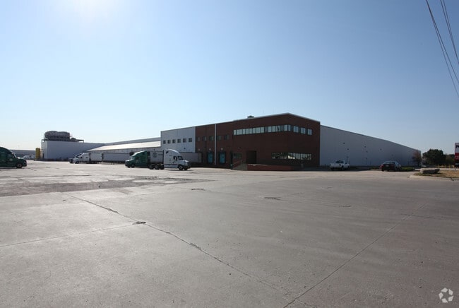
Property Record
2441 S 98Th St, Kansas City, KS 66111


NEARBY LISTINGS FOR SALE OR LEASE
Property Detail
2441 S 98Th St
939827
9398, S25, T11, R23, ACRES 56.7, BEG 20FT E OF SW COR SE1/4; E 460FT, N 452.47FT, NELY CUR LT-333.76FT, N81E-514.33FT, S 1992.9FT, SWLY CUR LT-164.64FT, W 1263.96FT, N 1581.42FT TO POB CONTG 56.7AC M/L
Shipyard
Wyandotte
X
Kansas
20209C0145E
333
2025
56.76 AC
2025
Bonner Springs
044702
Kansas City
658,206 SF
Kansas City, MO-KS
DEMOGRAPHICS near 2441 S 98Th St
1 Mile
3 Mile
5 Mile
2024 Total Population
2,357
19,340
68,868
2029 Population
2,249
19,576
69,765
Pop Growth 2024-2029
(4.58%)
+ 1.22%
+ 1.30%
Average Age
38
37
39
2024 Total Households
833
6,300
25,437
HH Growth 2024-2029
(4.92%)
+ 1.02%
+ 1.26%
Median Household Inc
$71,999
$121,361
$92,432
Avg Household Size
2.60
3.00
2.60
2024 Avg HH Vehicles
2.00
2.00
2.00
Median Home Value
$132,156
$309,565
$281,718
Median Year Built
1979
1995
1986
Nearby Places
Map Layers
Map Styles
 Street
 Aerial
- Restaurants
- Banks
- Shops
- Fitness
- Groceries
PUBLIC TRANSPORTATION
AIRPORT
Kansas City International
DRIVE
WALK
Distance
Kansas City International
34 min
28.0 mi
Freight Ports
Tulsa Port Of Catoosa
DRIVE
WALK
Distance
Tulsa Port Of Catoosa
265 min
235.6 mi
Nearby Properties
Address
Land Use
TOTAL SIZE
Lot Size
Zoning
Address
Land Use
TOTAL SIZE
Lot Size
Zoning
83,537 SF
27.65 AC
AG
Address
Land Use
TOTAL SIZE
Lot Size
Zoning
108,062 SF
14.76 AC
AG
Address
Land Use
TOTAL SIZE
Lot Size
Zoning
274,379 SF
17.32 AC
Address
Land Use
TOTAL SIZE
Lot Size
Zoning
66,916 SF
14.72 AC
AG
Address
Land Use
TOTAL SIZE
Lot Size
Zoning
69,923 SF
11.99 AC
AG
Address
Land Use
TOTAL SIZE
Lot Size
Zoning
170,000 SF
12.71 AC
PI
Address
Land Use
TOTAL SIZE
Lot Size
Zoning
170,000 SF
12.71 AC
PI
Address
Land Use
TOTAL SIZE
Lot Size
Zoning
170,000 SF
14.87 AC
PI
Address
Land Use
TOTAL SIZE
Lot Size
Zoning
170,000 SF
12.72 AC
PI
Address
Land Use
TOTAL SIZE
Lot Size
Zoning
34,641 SF
14.33 AC
AG
Address
Land Use
TOTAL SIZE
Lot Size
Zoning
285,041 SF
109.90 AC
EI1
Address
Land Use
TOTAL SIZE
Lot Size
Zoning
28,210 SF
317.17 AC
Address
Land Use
TOTAL SIZE
Lot Size
Zoning
376,094 SF
22.93 AC
Address
Land Use
TOTAL SIZE
Lot Size
Zoning
22,616 SF
31.78 AC
AG
Address
Land Use
TOTAL SIZE
Lot Size
Zoning
59,640 SF
12.92 AC
PI
Address
Land Use
TOTAL SIZE
Lot Size
Zoning
280,000 SF
24.54 AC
Address
Land Use
TOTAL SIZE
Lot Size
Zoning
5,940 SF
77.81 AC
PI
Address
Land Use
TOTAL SIZE
Lot Size
Zoning
12,097 SF
56.85 AC
PI
Address
Land Use
TOTAL SIZE
Lot Size
Zoning
81,594 SF
14.08 AC
Address
Land Use
TOTAL SIZE
Lot Size
Zoning
6,380 SF
296.16 AC
BA1
Address
Land Use
TOTAL SIZE
Lot Size
Zoning
167,713 SF
78.95 AC
KR1
Address
Land Use
TOTAL SIZE
Lot Size
Zoning
15,264 SF
73.01 AC
KR1
Address
Land Use
TOTAL SIZE
Lot Size
Zoning
402,811 SF
33.85 AC
Address
Land Use
TOTAL SIZE
Lot Size
Zoning
8.35 AC
PI
Address
Land Use
TOTAL SIZE
Lot Size
Zoning
329,330 SF
18.25 AC
Address
Land Use
TOTAL SIZE
Lot Size
Zoning
9,157 SF
1.46 AC
PUDMR
Address
Land Use
TOTAL SIZE
Lot Size
Zoning
175,714 SF
22.94 AC
Address
Land Use
TOTAL SIZE
Lot Size
Zoning
180,000 SF
12.47 AC
Address
Land Use
TOTAL SIZE
Lot Size
Zoning
181,708 SF
20.29 AC
KR1
The World's #1 Commercial Real Estate Marketplace
Connect with us
© 2026 CoStar Group
The information above has been obtained from sources believed reliable. While we do not doubt its accuracy we have not verified it and make no guarantee, warranty or representation about it. It is your responsibility to independently confirm its accuracy and completeness. Any projections, opinions, assumptions, or estimates used are for example only and do not represent the current or future performance of the property. The value of this transaction to you depends on tax and other factors which should be evaluated by your tax, financial, and legal advisors. You and your advisors should conduct a careful, independent investigation of the property to determine to your satisfaction the suitability of the property for your needs.