Property Record
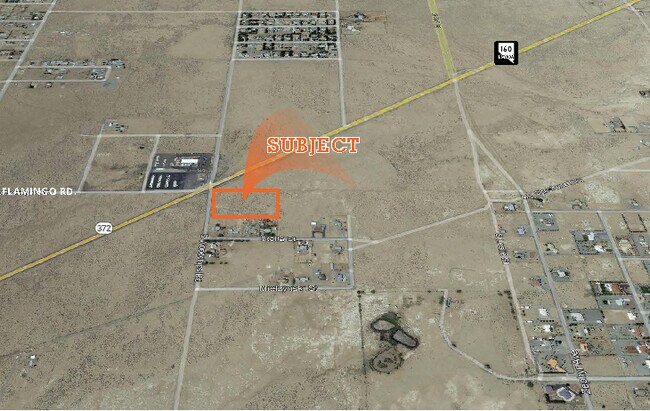
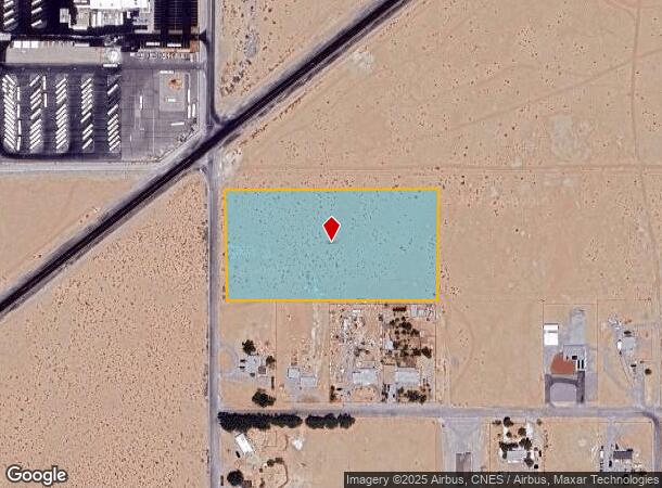
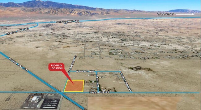
2441 W Flamingo Rd, Pahrump, NV 89048
NEARBY LISTINGS FOR SALE OR LEASE
Property Detail
2441 W Flamingo Rd
Pahrump, NV
Pm-56687
36-591-01
T20S R53E S30-F#56687 PARCEL 1 4.628 ACRES
Residentialacreage
Nye
AO
Nevada
32023C8825F
4.63 AC
2024
Carson City/Nevada Area
2025
Other Market Areas
960408
DEMOGRAPHICS near 2441 W Flamingo Rd
1 Mile
3 Mile
5 Mile
2024 Total Population
813
13,410
24,658
2029 Population
943
15,602
28,690
Pop Growth 2024-2029
+ 15.99%
+ 16.35%
+ 16.35%
Average Age
50
49
49
2024 Total Households
344
5,735
10,628
HH Growth 2024-2029
+ 15.99%
+ 16.44%
+ 16.45%
Median Household Inc
$59,399
$52,517
$52,378
Avg Household Size
2.40
2.30
2.30
2024 Avg HH Vehicles
2.00
2.00
2.00
Median Home Value
$293,749
$243,658
$246,110
Median Year Built
1995
1996
1996
Nearby Places
Map Layers
Map Styles
 Street
 Aerial
- Restaurants
- Banks
- Shops
- Fitness
- Groceries
SALE & LEASE HISTORY
LISTING DATE
SALE/LEASE

Nov 03, 2021
For Sale
Aug 04, 2022
For Sale
Nearby Properties
Address
Land Use
TOTAL SIZE
Lot Size
Zoning
Address
Land Use
TOTAL SIZE
Lot Size
Zoning
133,185 SF
41.60 AC
CF
Address
Land Use
TOTAL SIZE
Lot Size
Zoning
51,128 SF
24.15 AC
M
Address
Land Use
TOTAL SIZE
Lot Size
Zoning
10 SF
2.14 AC
OS
Address
Land Use
TOTAL SIZE
Lot Size
Zoning
13,885 SF
2.01 AC
M
Address
Land Use
TOTAL SIZE
Lot Size
Zoning
12,160 SF
1.26 AC
M
Address
Land Use
TOTAL SIZE
Lot Size
Zoning
12,000 SF
5 AC
CM
Address
Land Use
TOTAL SIZE
Lot Size
Zoning
9,564 SF
8.51 AC
CF
Address
Land Use
TOTAL SIZE
Lot Size
Zoning
10,899 SF
5 AC
NC
Address
Land Use
TOTAL SIZE
Lot Size
Zoning
6,000 SF
28 AC
SPLIT
Address
Land Use
TOTAL SIZE
Lot Size
Zoning
28,500 SF
5 AC
CM
Address
Land Use
TOTAL SIZE
Lot Size
Zoning
9,720 SF
1.57 AC
CM
Address
Land Use
TOTAL SIZE
Lot Size
Zoning
8,330 SF
2.06 AC
NC
Address
Land Use
TOTAL SIZE
Lot Size
Zoning
75.78 AC
GC
Address
Land Use
TOTAL SIZE
Lot Size
Zoning
67.55 AC
GC
Address
Land Use
TOTAL SIZE
Lot Size
Zoning
5,100 SF
2.19 AC
GC
Address
Land Use
TOTAL SIZE
Lot Size
Zoning
31,800 SF
5 AC
GC
Address
Land Use
TOTAL SIZE
Lot Size
Zoning
4,236 SF
3.19 AC
GC
Address
Land Use
TOTAL SIZE
Lot Size
Zoning
4,560 SF
9.42 AC
RH-4.5
Address
Land Use
TOTAL SIZE
Lot Size
Zoning
5,000 SF
3.69 AC
HI
Address
Land Use
TOTAL SIZE
Lot Size
Zoning
9,700 SF
4.86 AC
CM
Address
Land Use
TOTAL SIZE
Lot Size
Zoning
4,960 SF
5 AC
CM
Address
Land Use
TOTAL SIZE
Lot Size
Zoning
160 AC
R
Address
Land Use
TOTAL SIZE
Lot Size
Zoning
2,994 SF
5 AC
GC
Address
Land Use
TOTAL SIZE
Lot Size
Zoning
Address
Land Use
TOTAL SIZE
Lot Size
Zoning
4,700 SF
1.58 AC
GC
Address
Land Use
TOTAL SIZE
Lot Size
Zoning
6,001 SF
5 AC
CM
Address
Land Use
TOTAL SIZE
Lot Size
Zoning
6,000 SF
1.80 AC
RE-1
Address
Land Use
TOTAL SIZE
Lot Size
Zoning
40 AC
NC
Address
Land Use
TOTAL SIZE
Lot Size
Zoning
42.51 AC
GC
Address
Land Use
TOTAL SIZE
Lot Size
Zoning
4,948 SF
5 AC
NC
The World's #1 Commercial Real Estate Marketplace
Connect with us
© 2025 CoStar Group
The information above has been obtained from sources believed reliable. While we do not doubt its accuracy we have not verified it and make no guarantee, warranty or representation about it. It is your responsibility to independently confirm its accuracy and completeness. Any projections, opinions, assumptions, or estimates used are for example only and do not represent the current or future performance of the property. The value of this transaction to you depends on tax and other factors which should be evaluated by your tax, financial, and legal advisors. You and your advisors should conduct a careful, independent investigation of the property to determine to your satisfaction the suitability of the property for your needs.