Property Record
24425 Magic Mountain Pky, Valencia, CA 91355


NEARBY LISTINGS FOR SALE OR LEASE
Property Detail
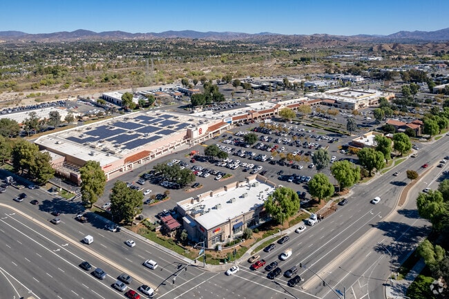
24425 Magic Mountain Pky
Los Angeles-Long Beach-Glendale, CA
43712
2811-025-088
TR=43712 FOR DESC SEE ASSESSORS MAPS POR LOT 10
Regionalshoppingcenterormallwithanchorstore
Los Angeles
X
California
06037C0816G
10
2024
8.03 AC
2025
Santa Clarita Valley
920115
Los Angeles
320,405 SF
DEMOGRAPHICS near 24425 Magic Mountain Pky
1 Mile
3 Mile
5 Mile
2024 Total Population
10,147
92,305
178,401
2029 Population
9,764
89,173
171,840
Pop Growth 2024-2029
(3.77%)
(3.39%)
(3.68%)
Average Age
40
40
40
2024 Total Households
4,248
32,584
59,702
HH Growth 2024-2029
(4.07%)
(3.67%)
(3.93%)
Median Household Inc
$108,393
$119,252
$120,126
Avg Household Size
2.40
2.80
2.90
2024 Avg HH Vehicles
2.00
2.00
2.00
Median Home Value
$753,511
$746,936
$735,295
Median Year Built
1995
1991
1989
Nearby Places
Map Layers
Map Styles
 Street
 Aerial
- Restaurants
- Banks
- Shops
- Fitness
- Groceries
PUBLIC TRANSPORTATION
COMMUTER RAIL
Santa Clarita (Antelope Valley Line - Southern California Regional Rail Authority (Metrolink))
DRIVE
WALK
Distance
Santa Clarita (Antelope Valley Line - Southern California Regional Rail Authority (Metrolink))
6 min
3.2 mi
Newhall (Antelope Valley Line - Southern California Regional Rail Authority (Metrolink))
DRIVE
WALK
Distance
Newhall (Antelope Valley Line - Southern California Regional Rail Authority (Metrolink))
9 min
4.5 mi
AIRPORT
Bob Hope
DRIVE
WALK
Distance
Bob Hope
30 min
22.4 mi
Freight Ports
The Port of Hueneme
DRIVE
WALK
Distance
The Port of Hueneme
73 min
51.2 mi
Nearby Properties
Address
Land Use
TOTAL SIZE
Lot Size
Zoning
Address
Land Use
TOTAL SIZE
Lot Size
Zoning
491,654 SF
17.56 AC
SCPI
Address
Land Use
TOTAL SIZE
Lot Size
Zoning
479,178 SF
14.17 AC
SCCR
Address
Land Use
TOTAL SIZE
Lot Size
Zoning
173,298 SF
12.42 AC
LCA25*
Address
Land Use
TOTAL SIZE
Lot Size
Zoning
180,629 SF
40.68 AC
SCBP
Address
Land Use
TOTAL SIZE
Lot Size
Zoning
200,717 SF
7.62 AC
SCCR
Address
Land Use
TOTAL SIZE
Lot Size
Zoning
197,558 SF
3.08 AC
SCBP
Address
Land Use
TOTAL SIZE
Lot Size
Zoning
495,604 SF
38.40 AC
SCI
Address
Land Use
TOTAL SIZE
Lot Size
Zoning
357,128 SF
17.04 AC
SCUR5
Address
Land Use
TOTAL SIZE
Lot Size
Zoning
291,344 SF
15.32 AC
LCA2
Address
Land Use
TOTAL SIZE
Lot Size
Zoning
1,014,267 SF
59.95 AC
SCPI
Address
Land Use
TOTAL SIZE
Lot Size
Zoning
225,723 SF
11.37 AC
Address
Land Use
TOTAL SIZE
Lot Size
Zoning
245,053 SF
19.81 AC
LCA25*
Address
Land Use
TOTAL SIZE
Lot Size
Zoning
114,136 SF
209.56 AC
LCCR*
Address
Land Use
TOTAL SIZE
Lot Size
Zoning
264,769 SF
8.97 AC
LCA25*
Address
Land Use
TOTAL SIZE
Lot Size
Zoning
258,260 SF
12.67 AC
SCSP
Address
Land Use
TOTAL SIZE
Lot Size
Zoning
194,907 SF
7.83 AC
SCSP
Address
Land Use
TOTAL SIZE
Lot Size
Zoning
139,196 SF
8.79 AC
SCUR5
Address
Land Use
TOTAL SIZE
Lot Size
Zoning
97,733 SF
13.14 AC
SCCC
Address
Land Use
TOTAL SIZE
Lot Size
Zoning
266,614 SF
7.47 AC
SCSP
Address
Land Use
TOTAL SIZE
Lot Size
Zoning
203,590 SF
10.09 AC
SCBP
Address
Land Use
TOTAL SIZE
Lot Size
Zoning
325,406 SF
4.11 AC
SCBP
Address
Land Use
TOTAL SIZE
Lot Size
Zoning
161,103 SF
4.68 AC
SCUR4
Address
Land Use
TOTAL SIZE
Lot Size
Zoning
180,450 SF
5.08 AC
SCCR
Address
Land Use
TOTAL SIZE
Lot Size
Zoning
402,480 SF
13.58 AC
SCCN
Address
Land Use
TOTAL SIZE
Lot Size
Zoning
315,346 SF
15.99 AC
SCBP
Address
Land Use
TOTAL SIZE
Lot Size
Zoning
356,265 SF
4.87 AC
SCBP
Address
Land Use
TOTAL SIZE
Lot Size
Zoning
103,828 SF
6.23 AC
SCUR4
Address
Land Use
TOTAL SIZE
Lot Size
Zoning
118,380 SF
4.52 AC
LCA2
Address
Land Use
TOTAL SIZE
Lot Size
Zoning
83,698 SF
8.94 AC
SCPI
Address
Land Use
TOTAL SIZE
Lot Size
Zoning
121,020 SF
5.94 AC
SCBP
The World's #1 Commercial Real Estate Marketplace
Connect with us
© 2025 CoStar Group
The information above has been obtained from sources believed reliable. While we do not doubt its accuracy we have not verified it and make no guarantee, warranty or representation about it. It is your responsibility to independently confirm its accuracy and completeness. Any projections, opinions, assumptions, or estimates used are for example only and do not represent the current or future performance of the property. The value of this transaction to you depends on tax and other factors which should be evaluated by your tax, financial, and legal advisors. You and your advisors should conduct a careful, independent investigation of the property to determine to your satisfaction the suitability of the property for your needs.