Property Record
2445 Iron Point Rd, Folsom, CA 95630

NEARBY LISTINGS FOR SALE OR LEASE
Property Detail
2445 Iron Point Rd
Sacramento-Roseville-Folsom, CA
Parcel Map
072-1190-109
PARCEL MAP, LOT 1
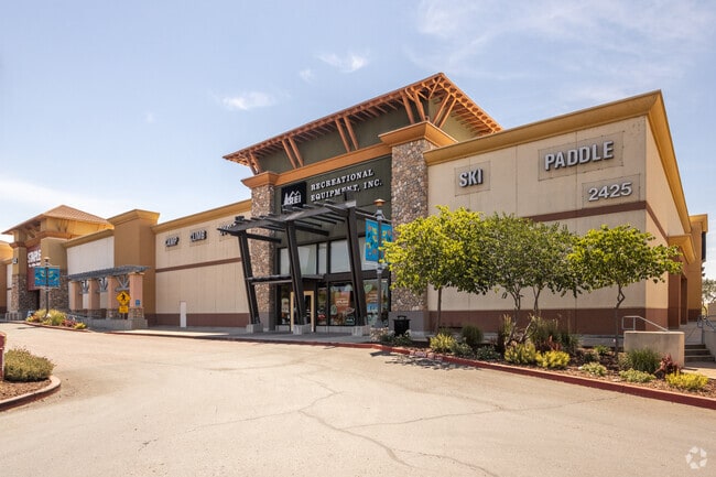
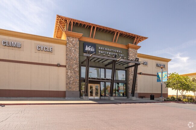
Regionalshoppingcenterormallwithanchorstore
Sacramento
X
California
06067C0138J
1
2024
3.14 AC
2025
Folsom
008507
Sacramento
30,054 SF
DEMOGRAPHICS near 2445 Iron Point Rd
1 Mile
3 Mile
5 Mile
2024 Total Population
6,019
59,903
120,733
2029 Population
6,234
61,237
122,992
Pop Growth 2024-2029
+ 3.57%
+ 2.23%
+ 1.87%
Average Age
38
40
41
2024 Total Households
2,171
21,774
42,730
HH Growth 2024-2029
+ 3.18%
+ 2.25%
+ 1.94%
Median Household Inc
$149,909
$138,274
$135,066
Avg Household Size
2.80
2.70
2.70
2024 Avg HH Vehicles
2.00
2.00
2.00
Median Home Value
$761,927
$735,740
$732,993
Median Year Built
2003
2000
1998
Nearby Places
Map Layers
Map Styles
 Street
 Aerial
- Restaurants
- Banks
- Shops
- Fitness
- Groceries
PUBLIC TRANSPORTATION
AIRPORT
Sacramento International
DRIVE
WALK
Distance
Sacramento International
46 min
35.9 mi
Freight Ports
Port of Stockton
DRIVE
WALK
Distance
Port of Stockton
82 min
69.6 mi
Nearby Properties
Address
Land Use
TOTAL SIZE
Lot Size
Zoning
Address
Land Use
TOTAL SIZE
Lot Size
Zoning
1,686,420 SF
161.78 AC
M-1 (PD)
Address
Land Use
TOTAL SIZE
Lot Size
Zoning
278,000 SF
28.48 AC
SP-LI/BP (
Address
Land Use
TOTAL SIZE
Lot Size
Zoning
424,801 SF
32.65 AC
R-M (PD)
Address
Land Use
TOTAL SIZE
Lot Size
Zoning
352,146 SF
11.54 AC
SP-R-4 (SP
Address
Land Use
TOTAL SIZE
Lot Size
Zoning
311,043 SF
10.10 AC
R-4 (PD)
Address
Land Use
TOTAL SIZE
Lot Size
Zoning
23.23 AC
SP-R-M (SP
Address
Land Use
TOTAL SIZE
Lot Size
Zoning
37.18 AC
SP-R-4 (SP
Address
Land Use
TOTAL SIZE
Lot Size
Zoning
8.54 AC
SP-MHD (PD
Address
Land Use
TOTAL SIZE
Lot Size
Zoning
302,124 SF
13.30 AC
R-M (PD)
Address
Land Use
TOTAL SIZE
Lot Size
Zoning
129,465 SF
8.30 AC
C-1 (PD)
Address
Land Use
TOTAL SIZE
Lot Size
Zoning
243,460 SF
20.46 AC
C-3 (PD)
Address
Land Use
TOTAL SIZE
Lot Size
Zoning
6.29 AC
SP-C-2 (SP
Address
Land Use
TOTAL SIZE
Lot Size
Zoning
221,948 SF
15.94 AC
R-M (PD)
Address
Land Use
TOTAL SIZE
Lot Size
Zoning
6.02 AC
C-3 (PD)
Address
Land Use
TOTAL SIZE
Lot Size
Zoning
121,378 SF
11.29 AC
M-L (PD)
Address
Land Use
TOTAL SIZE
Lot Size
Zoning
264,478 SF
13.46 AC
R-M (PD)
Address
Land Use
TOTAL SIZE
Lot Size
Zoning
415,320 SF
32.51 AC
R-M (PD) O
Address
Land Use
TOTAL SIZE
Lot Size
Zoning
140,000 SF
4.12 AC
BP (PD)
Address
Land Use
TOTAL SIZE
Lot Size
Zoning
203,397 SF
11.58 AC
SP-R-4 (SP
Address
Land Use
TOTAL SIZE
Lot Size
Zoning
114,835 SF
19.73 AC
SP-C-2 (SP
Address
Land Use
TOTAL SIZE
Lot Size
Zoning
296,680 SF
15.65 AC
R-M (PD)
Address
Land Use
TOTAL SIZE
Lot Size
Zoning
40,447 SF
8.89 AC
M-1
Address
Land Use
TOTAL SIZE
Lot Size
Zoning
5.73 AC
R-4 (PD)
Address
Land Use
TOTAL SIZE
Lot Size
Zoning
45,846 SF
12.62 AC
C-3 (PD)
Address
Land Use
TOTAL SIZE
Lot Size
Zoning
293,505 SF
27.52 AC
R-M (PD)
Address
Land Use
TOTAL SIZE
Lot Size
Zoning
6.07 AC
SP-OS2 (SP
Address
Land Use
TOTAL SIZE
Lot Size
Zoning
154,998 SF
9.14 AC
M-L (PD)
Address
Land Use
TOTAL SIZE
Lot Size
Zoning
100,053 SF
7.80 AC
M-L (PD)
Address
Land Use
TOTAL SIZE
Lot Size
Zoning
111,103 SF
11.33 AC
C-3 (PD)
Address
Land Use
TOTAL SIZE
Lot Size
Zoning
The World's #1 Commercial Real Estate Marketplace
Connect with us
© 2026 CoStar Group
The information above has been obtained from sources believed reliable. While we do not doubt its accuracy we have not verified it and make no guarantee, warranty or representation about it. It is your responsibility to independently confirm its accuracy and completeness. Any projections, opinions, assumptions, or estimates used are for example only and do not represent the current or future performance of the property. The value of this transaction to you depends on tax and other factors which should be evaluated by your tax, financial, and legal advisors. You and your advisors should conduct a careful, independent investigation of the property to determine to your satisfaction the suitability of the property for your needs.