Property Record
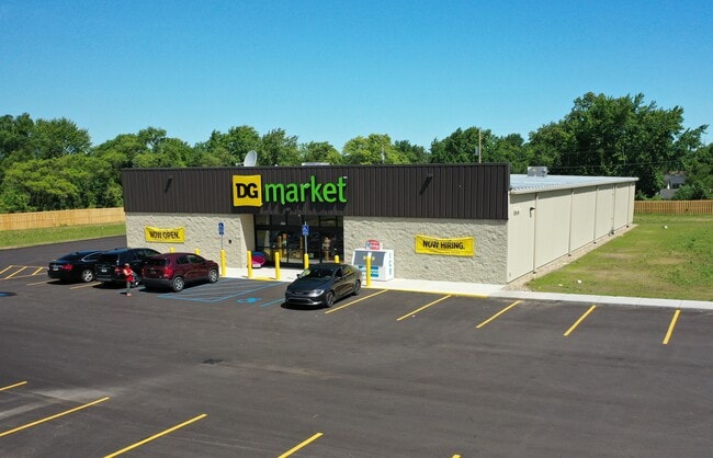
2449 Territorial Rd, Benton Harbor, MI 49022
NEARBY LISTINGS FOR SALE OR LEASE
-
-
View all Benton Harbor listings for sale on LoopNet.com
Property Detail
2449 Territorial Rd
Other Market Areas
Park Manor Sub
Niles-Benton Harbor, MI
SPLIT ON 05/01/2024 FROM 03-5930-0045-02-6; THAT PT OF LOT 45 PARK MANOR SUB DESC AS COM AT THE SW COR OF SD LOT TH ALONG THE S LN OF SD LOT N85DEG24?E 558.26? TO POB TH N 365.95? TO THE N LN OF SD LOT TH ALONG SD N LN S89DEG54?56?E 314.9? TO THE E L
03-5930-0045-04-0
Berrien
Commercialnec
Michigan
0
45
2025
2.55 AC
002300
Michigan Southwest Area
DEMOGRAPHICS near 2449 Territorial Rd
1 Mile
3 Mile
5 Mile
2024 Total Population
2,218
20,050
37,109
2029 Population
2,190
20,104
36,711
Pop Growth 2024-2029
(1.26%)
+ 0.27%
(1.07%)
Average Age
35
36
40
2024 Total Households
820
7,593
15,409
HH Growth 2024-2029
(1.71%)
(0.26%)
(1.62%)
Median Household Inc
$30,240
$27,826
$40,486
Avg Household Size
2.50
2.50
2.30
2024 Avg HH Vehicles
1.00
1.00
2.00
Median Home Value
$81,680
$96,440
$168,855
Median Year Built
1964
1963
1960
Nearby Places
Map Layers
Map Styles
 Street
 Aerial
- Restaurants
- Banks
- Shops
- Fitness
- Groceries
PUBLIC TRANSPORTATION
COMMUTER RAIL
St. Joseph-Benton Harbor Amtrak Station (Pere Marquette - Amtrak)
DRIVE
WALK
Distance
St. Joseph-Benton Harbor Amtrak Station (Pere Marquette - Amtrak)
10 min
5.0 mi
AIRPORT
South Bend International
DRIVE
WALK
Distance
South Bend International
49 min
34.9 mi
Freight Ports
Port Milwaukee
DRIVE
WALK
Distance
Port Milwaukee
224 min
186.6 mi
SALE & LEASE HISTORY
LISTING DATE
SALE/LEASE

Jun 21, 2024
For Sale
Aug 19, 2024
For Sale
Nearby Properties
Address
Land Use
TOTAL SIZE
Lot Size
Zoning
Address
Land Use
TOTAL SIZE
Lot Size
Zoning
365,903 SF
95.25 AC
Address
Land Use
TOTAL SIZE
Lot Size
Zoning
296,788 SF
34 AC
D1 COMM
Address
Land Use
TOTAL SIZE
Lot Size
Zoning
86,000 SF
22.38 AC
D1 COMM
Address
Land Use
TOTAL SIZE
Lot Size
Zoning
108,300 SF
12.36 AC
DISTRICT F
Address
Land Use
TOTAL SIZE
Lot Size
Zoning
204,000 SF
34.08 AC
F HEAVY
Address
Land Use
TOTAL SIZE
Lot Size
Zoning
88,572 SF
15.70 AC
D1 COMM
Address
Land Use
TOTAL SIZE
Lot Size
Zoning
70,617 SF
12 AC
E RESTRICT
Address
Land Use
TOTAL SIZE
Lot Size
Zoning
151,462 SF
9.96 AC
DISTRICT F
Address
Land Use
TOTAL SIZE
Lot Size
Zoning
71,755 SF
11.06 AC
Address
Land Use
TOTAL SIZE
Lot Size
Zoning
142,200 SF
18 AC
DISTRICT G
Address
Land Use
TOTAL SIZE
Lot Size
Zoning
48,756 SF
3.33 AC
DISTRICT A
Address
Land Use
TOTAL SIZE
Lot Size
Zoning
21,600 SF
Address
Land Use
TOTAL SIZE
Lot Size
Zoning
70,321 SF
14.71 AC
C MULTI
Address
Land Use
TOTAL SIZE
Lot Size
Zoning
1,590 SF
33.32 AC
C MULTI
Address
Land Use
TOTAL SIZE
Lot Size
Zoning
36,137 SF
21.40 AC
SPEC US
Address
Land Use
TOTAL SIZE
Lot Size
Zoning
101,006 SF
2.42 AC
D1 COMM
Address
Land Use
TOTAL SIZE
Lot Size
Zoning
126,880 SF
10 AC
D1 COMM
Address
Land Use
TOTAL SIZE
Lot Size
Zoning
32,488 SF
4.50 AC
SPEC US
Address
Land Use
TOTAL SIZE
Lot Size
Zoning
112,288 SF
12.31 AC
DISTRICT G
Address
Land Use
TOTAL SIZE
Lot Size
Zoning
9,276 SF
1.48 AC
D1 COMM
Address
Land Use
TOTAL SIZE
Lot Size
Zoning
13,500 SF
3.54 AC
E RESTRICT
Address
Land Use
TOTAL SIZE
Lot Size
Zoning
58,903 SF
DISTRICT A
Address
Land Use
TOTAL SIZE
Lot Size
Zoning
23,030 SF
0.13 AC
DISTRICT E
Address
Land Use
TOTAL SIZE
Lot Size
Zoning
62,528 SF
0.23 AC
DISTRICT A
Address
Land Use
TOTAL SIZE
Lot Size
Zoning
70,600 SF
8 AC
D1 COMM
Address
Land Use
TOTAL SIZE
Lot Size
Zoning
38,648 SF
0.15 AC
DISTRICT E
Address
Land Use
TOTAL SIZE
Lot Size
Zoning
48,267 SF
10.49 AC
DISTRICT G
Address
Land Use
TOTAL SIZE
Lot Size
Zoning
70,000 SF
10 AC
DISTRICT G
Address
Land Use
TOTAL SIZE
Lot Size
Zoning
27,171 SF
6.50 AC
Address
Land Use
TOTAL SIZE
Lot Size
Zoning
The World's #1 Commercial Real Estate Marketplace
Connect with us
© 2026 CoStar Group
The information above has been obtained from sources believed reliable. While we do not doubt its accuracy we have not verified it and make no guarantee, warranty or representation about it. It is your responsibility to independently confirm its accuracy and completeness. Any projections, opinions, assumptions, or estimates used are for example only and do not represent the current or future performance of the property. The value of this transaction to you depends on tax and other factors which should be evaluated by your tax, financial, and legal advisors. You and your advisors should conduct a careful, independent investigation of the property to determine to your satisfaction the suitability of the property for your needs.