Property Record
264 Powers Ferry Rd Se, Marietta, GA 30067
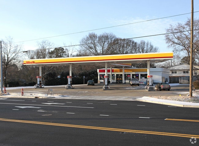


Property Detail
264 Powers Ferry Rd Se
16-1278-0-037-0
Cobb
Supermarket
Georgia
CRC
1278
B and X Area of moderate flood hazard, usually the area between the limits of the 100-year and 500-year floods.
0.66 AC
2025
Town Center/Marietta
2025
Atlanta
030405
Atlanta-Sandy Springs-Roswell, GA
2,040 SF
NEARBY LISTINGS FOR SALE OR LEASE
DEMOGRAPHICS near 264 Powers Ferry Rd Se
1 mile
3 mile
5 mile
2024 Total Population
14,023
79,250
230,829
2029 Population
14,583
81,671
237,759
Pop Growth 2024-2029
+ 3.99%
+ 3.05%
+ 3.00%
Average Age
36
37
38
2024 Total Households
5,729
32,198
95,598
HH Growth 2024-2029
+ 3.96%
+ 3.02%
+ 3.02%
Median Household Inc
$59,411
$77,606
$87,513
Avg Household Size
2.30
2.30
2.30
2024 Avg HH Vehicles
2.00
2.00
2.00
Median Home Value
$307,836
$457,893
$462,742
Median Year Built
1977
1980
1983
Nearby Places
Map Layers
Map Styles
 Street
 Aerial
Transit
 Traffic
 Biking
Places
Listings with unknown addresses are not visible on the map
- Restaurants
- Banks
- Shops
- Fitness
- Groceries
PUBLIC TRANSPORTATION
AIRPORT
Hartsfield - Jackson Atlanta International
Drive
Walk
Distance
Hartsfield - Jackson Atlanta International
36 min
25.8 mi
Nearby Properties
Address
Land Use
TOTAL SIZE
Lot Size
Zoning
Address
Land Use
TOTAL SIZE
Lot Size
Zoning
612,660 SF
46.67 AC
RM-16
Address
Land Use
TOTAL SIZE
Lot Size
Zoning
643,086 SF
40.63 AC
RM-12
Address
Land Use
TOTAL SIZE
Lot Size
Zoning
437,793 SF
41.12 AC
RM-16
Address
Land Use
TOTAL SIZE
Lot Size
Zoning
5.50 AC
RRC
Address
Land Use
TOTAL SIZE
Lot Size
Zoning
452,366 SF
27.27 AC
PRD MF
Address
Land Use
TOTAL SIZE
Lot Size
Zoning
494,076 SF
33.30 AC
PRD MF
Address
Land Use
TOTAL SIZE
Lot Size
Zoning
582,685 SF
37.58 AC
PVC
Address
Land Use
TOTAL SIZE
Lot Size
Zoning
300,105 SF
43.12 AC
RM-8
Address
Land Use
TOTAL SIZE
Lot Size
Zoning
343,570 SF
22.65 AC
PRD MF
Address
Land Use
TOTAL SIZE
Lot Size
Zoning
344,024 SF
35.69 AC
RM-12
Address
Land Use
TOTAL SIZE
Lot Size
Zoning
8,000 SF
9.57 AC
PRD MF
Address
Land Use
TOTAL SIZE
Lot Size
Zoning
464,381 SF
34.82 AC
RM-12
Address
Land Use
TOTAL SIZE
Lot Size
Zoning
376,618 SF
22.82 AC
RM-12
Address
Land Use
TOTAL SIZE
Lot Size
Zoning
393,980 SF
20.16 AC
PRD MF
Address
Land Use
TOTAL SIZE
Lot Size
Zoning
284,832 SF
19.56 AC
PRD MF
Address
Land Use
TOTAL SIZE
Lot Size
Zoning
243,574 SF
40.05 AC
RM-8
Address
Land Use
TOTAL SIZE
Lot Size
Zoning
545,301 SF
38.70 AC
RM-12
Address
Land Use
TOTAL SIZE
Lot Size
Zoning
698,904 SF
36.69 AC
HI
Address
Land Use
TOTAL SIZE
Lot Size
Zoning
290,588 SF
21.54 AC
RM-16
Address
Land Use
TOTAL SIZE
Lot Size
Zoning
285,846 SF
19.21 AC
PRD MF
Address
Land Use
TOTAL SIZE
Lot Size
Zoning
8,980 SF
51.17 AC
Address
Land Use
TOTAL SIZE
Lot Size
Zoning
243,288 SF
18.80 AC
RM-12
Address
Land Use
TOTAL SIZE
Lot Size
Zoning
347,671 SF
23.59 AC
RM-12
Address
Land Use
TOTAL SIZE
Lot Size
Zoning
228,652 SF
24.19 AC
RM-12
Address
Land Use
TOTAL SIZE
Lot Size
Zoning
509,792 SF
4.45 AC
OHR
Address
Land Use
TOTAL SIZE
Lot Size
Zoning
258,668 SF
21.54 AC
RM-16
Address
Land Use
TOTAL SIZE
Lot Size
Zoning
226,769 SF
13.40 AC
RM-16
Address
Land Use
TOTAL SIZE
Lot Size
Zoning
296,720 SF
17.31 AC
RM-12
Address
Land Use
TOTAL SIZE
Lot Size
Zoning
190,168 SF
14.60 AC
PRD MF
Address
Land Use
TOTAL SIZE
Lot Size
Zoning
226,810 SF
9.95 AC
PRD MF
The World's #1 Commercial Real Estate Marketplace
Connect with us
© 2026 CoStar Group
The information above has been obtained from sources believed reliable. While we do not doubt its accuracy we have not verified it and make no guarantee, warranty or representation about it. It is your responsibility to independently confirm its accuracy and completeness. Any projections, opinions, assumptions, or estimates used are for example only and do not represent the current or future performance of the property. The value of this transaction to you depends on tax and other factors which should be evaluated by your tax, financial, and legal advisors. You and your advisors should conduct a careful, independent investigation of the property to determine to your satisfaction the suitability of the property for your needs.