Property Record
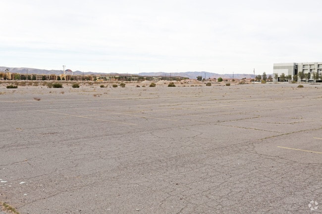
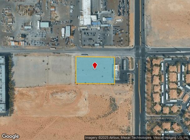
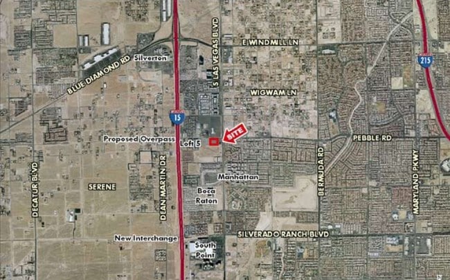
2229 E Pebble Rd, Las Vegas, NV 89123

NEARBY LISTINGS FOR SALE OR LEASE
Property Detail
2229 E Pebble Rd
Las Vegas-Henderson-Paradise, NV
Parcel Map File 88 Page 42
177-20-501-024
PARCEL MAP FILE 88 PAGE 42 LOT 1
Autorepair
Clark
X
Nevada
32003C2568F
1
2024
2.45 AC
2025
South Las Vegas
002829
Las Vegas
DEMOGRAPHICS near 2229 E Pebble Rd
1 Mile
3 Mile
5 Mile
2024 Total Population
17,256
121,395
304,613
2029 Population
18,629
130,829
329,386
Pop Growth 2024-2029
+ 7.96%
+ 7.77%
+ 8.13%
Average Age
42
39
39
2024 Total Households
8,363
46,503
114,429
HH Growth 2024-2029
+ 7.86%
+ 7.67%
+ 7.99%
Median Household Inc
$64,611
$79,118
$81,857
Avg Household Size
2.10
2.60
2.60
2024 Avg HH Vehicles
2.00
2.00
2.00
Median Home Value
$359,901
$390,469
$413,774
Median Year Built
1998
2001
2002
Nearby Places
- Restaurants
- Banks
- Shops
- Fitness
- Groceries
PUBLIC TRANSPORTATION
AIRPORT
Harry Reid International
DRIVE
WALK
Distance
Harry Reid International
10 min
5.7 mi
Boulder City Municipal
DRIVE
WALK
Distance
Boulder City Municipal
31 min
21.6 mi
Freight Ports
Port of Long Beach
DRIVE
WALK
Distance
Port of Long Beach
305 min
273.6 mi
SALE & LEASE HISTORY
LISTING DATE
SALE/LEASE

Jan 11, 2017
For Lease
Nearby Properties
Address
Land Use
TOTAL SIZE
Lot Size
Zoning
Address
Land Use
TOTAL SIZE
Lot Size
Zoning
2,340,130 SF
56.10 AC
H1
Address
Land Use
TOTAL SIZE
Lot Size
Zoning
764,918 SF
94.41 AC
H1
Address
Land Use
TOTAL SIZE
Lot Size
Zoning
14,422 SF
30.79 AC
Address
Land Use
TOTAL SIZE
Lot Size
Zoning
321,990 SF
76.15 AC
PF
Address
Land Use
TOTAL SIZE
Lot Size
Zoning
391,021 SF
40.14 AC
Address
Land Use
TOTAL SIZE
Lot Size
Zoning
459,983 SF
12.65 AC
M1
Address
Land Use
TOTAL SIZE
Lot Size
Zoning
66.26 AC
RE
Address
Land Use
TOTAL SIZE
Lot Size
Zoning
222,625 SF
16.99 AC
Address
Land Use
TOTAL SIZE
Lot Size
Zoning
7,370 SF
18.03 AC
Address
Land Use
TOTAL SIZE
Lot Size
Zoning
4,924 SF
16.14 AC
C:R-3
Address
Land Use
TOTAL SIZE
Lot Size
Zoning
Address
Land Use
TOTAL SIZE
Lot Size
Zoning
18.08 AC
RE
Address
Land Use
TOTAL SIZE
Lot Size
Zoning
4,405 SF
19.79 AC
Address
Land Use
TOTAL SIZE
Lot Size
Zoning
4,444 SF
18.11 AC
Address
Land Use
TOTAL SIZE
Lot Size
Zoning
117.50 AC
Address
Land Use
TOTAL SIZE
Lot Size
Zoning
402,610 SF
15.51 AC
R3
Address
Land Use
TOTAL SIZE
Lot Size
Zoning
22,180 SF
5.89 AC
Address
Land Use
TOTAL SIZE
Lot Size
Zoning
3,850 SF
6.09 AC
R3
Address
Land Use
TOTAL SIZE
Lot Size
Zoning
342,768 SF
28.30 AC
H1
Address
Land Use
TOTAL SIZE
Lot Size
Zoning
3,148 SF
18.80 AC
R3
Address
Land Use
TOTAL SIZE
Lot Size
Zoning
4,393 SF
14.25 AC
Address
Land Use
TOTAL SIZE
Lot Size
Zoning
31.57 AC
H1
Address
Land Use
TOTAL SIZE
Lot Size
Zoning
13 AC
RE
Address
Land Use
TOTAL SIZE
Lot Size
Zoning
9,196 SF
17.77 AC
R3
Address
Land Use
TOTAL SIZE
Lot Size
Zoning
18.75 AC
PF
Address
Land Use
TOTAL SIZE
Lot Size
Zoning
313,868 SF
21.37 AC
H1
Address
Land Use
TOTAL SIZE
Lot Size
Zoning
192,814 SF
20.27 AC
Address
Land Use
TOTAL SIZE
Lot Size
Zoning
6,295 SF
13.58 AC
R3
The World's #1 Commercial Real Estate Marketplace
Connect with us
© 2025 CoStar Group
The information above has been obtained from sources believed reliable. While we do not doubt its accuracy we have not verified it and make no guarantee, warranty or representation about it. It is your responsibility to independently confirm its accuracy and completeness. Any projections, opinions, assumptions, or estimates used are for example only and do not represent the current or future performance of the property. The value of this transaction to you depends on tax and other factors which should be evaluated by your tax, financial, and legal advisors. You and your advisors should conduct a careful, independent investigation of the property to determine to your satisfaction the suitability of the property for your needs.