Property Record
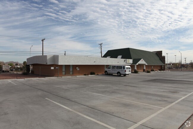
245 E Foster Ave, Henderson, NV 89011


Property Detail
245 E Foster Ave
178-01-310-057
SIERRA VISTA CITY PLAT BOOK 2 PAGE 5 LOT 15 BLOCK 11 & LOTS 16-24
Religious
Clark
RS6
Nevada
B and X Area of moderate flood hazard, usually the area between the limits of the 100-year and 500-year floods.
15
0
0.69 AC
2026
SE Las Vegas/Henderson
005439
Las Vegas
6,846 SF
Las Vegas-Henderson-North Las Vegas, NV
NEARBY LISTINGS FOR SALE OR LEASE
-
-
View all Henderson listings for sale on LoopNet.com
DEMOGRAPHICS near 245 E Foster Ave
1 mile
3 mile
5 mile
2025 Total Population
7,786
110,178
267,466
2030 Population
8,248
116,983
281,876
Pop Growth 2025-2030
+ 5.93%
+ 6.18%
+ 5.39%
Average Age
39
40
41
2025 Total Households
2,963
42,299
103,323
HH Growth 2025-2030
+ 6.04%
+ 6.25%
+ 5.44%
Median Household Inc
$71,195
$80,439
$82,173
Avg Household Size
2.60
2.50
2.50
2025 Avg HH Vehicles
2.00
2.00
2.00
Median Home Value
$326,585
$426,149
$434,676
Median Year Built
1987
2001
1996
Nearby Places
Map Layers
Map Styles
 Street
 Aerial
Transit
 Traffic
 Biking
Places
Listings with unknown addresses are not visible on the map
- Restaurants
- Banks
- Shops
- Fitness
- Groceries
PUBLIC TRANSPORTATION
AIRPORT
Harry Reid International
Drive
Walk
Distance
Harry Reid International
18 min
10.8 mi
Boulder City Municipal
Drive
Walk
Distance
Boulder City Municipal
23 min
13.2 mi
Nearby Properties
Address
Land Use
TOTAL SIZE
Lot Size
Zoning
Address
Land Use
TOTAL SIZE
Lot Size
Zoning
678,168 SF
69.69 AC
Address
Land Use
TOTAL SIZE
Lot Size
Zoning
726,941 SF
74.75 AC
CT
Address
Land Use
TOTAL SIZE
Lot Size
Zoning
62,258 SF
59.95 AC
Address
Land Use
TOTAL SIZE
Lot Size
Zoning
251,075 SF
24.28 AC
Address
Land Use
TOTAL SIZE
Lot Size
Zoning
14,840 SF
38.54 AC
CC
Address
Land Use
TOTAL SIZE
Lot Size
Zoning
Address
Land Use
TOTAL SIZE
Lot Size
Zoning
31,463 SF
191.46 AC
PS
Address
Land Use
TOTAL SIZE
Lot Size
Zoning
502,625 SF
45.92 AC
Address
Land Use
TOTAL SIZE
Lot Size
Zoning
9,493 SF
15.37 AC
Address
Land Use
TOTAL SIZE
Lot Size
Zoning
8,047 SF
17.42 AC
Address
Land Use
TOTAL SIZE
Lot Size
Zoning
358,212 SF
9.06 AC
CC
Address
Land Use
TOTAL SIZE
Lot Size
Zoning
8,168 SF
15.22 AC
Address
Land Use
TOTAL SIZE
Lot Size
Zoning
10.50 AC
Address
Land Use
TOTAL SIZE
Lot Size
Zoning
5,658 SF
16.18 AC
RH24
Address
Land Use
TOTAL SIZE
Lot Size
Zoning
404,030 SF
20.17 AC
RE
Address
Land Use
TOTAL SIZE
Lot Size
Zoning
387,990 SF
22.04 AC
Address
Land Use
TOTAL SIZE
Lot Size
Zoning
12.48 AC
Address
Land Use
TOTAL SIZE
Lot Size
Zoning
1,500 SF
25.08 AC
Address
Land Use
TOTAL SIZE
Lot Size
Zoning
9,000 SF
96.81 AC
RE
Address
Land Use
TOTAL SIZE
Lot Size
Zoning
3,289 SF
22.36 AC
R3
Address
Land Use
TOTAL SIZE
Lot Size
Zoning
383,889 SF
31.11 AC
Address
Land Use
TOTAL SIZE
Lot Size
Zoning
38.36 AC
Address
Land Use
TOTAL SIZE
Lot Size
Zoning
4,141 SF
9.15 AC
C2
Address
Land Use
TOTAL SIZE
Lot Size
Zoning
4,446 SF
15.81 AC
CC
Address
Land Use
TOTAL SIZE
Lot Size
Zoning
40,031 SF
21.25 AC
Address
Land Use
TOTAL SIZE
Lot Size
Zoning
78,760 SF
1.23 AC
Address
Land Use
TOTAL SIZE
Lot Size
Zoning
6,670 SF
14.18 AC
C2
Address
Land Use
TOTAL SIZE
Lot Size
Zoning
314,454 SF
22.94 AC
CC
Address
Land Use
TOTAL SIZE
Lot Size
Zoning
4,578 SF
13.23 AC
H:RH-24-MP
Address
Land Use
TOTAL SIZE
Lot Size
Zoning
4,496 SF
15.59 AC
H:RH-24-MP
The World's #1 Commercial Real Estate Marketplace
Connect with us
© 2026 CoStar Group
The information above has been obtained from sources believed reliable. While we do not doubt its accuracy we have not verified it and make no guarantee, warranty or representation about it. It is your responsibility to independently confirm its accuracy and completeness. Any projections, opinions, assumptions, or estimates used are for example only and do not represent the current or future performance of the property. The value of this transaction to you depends on tax and other factors which should be evaluated by your tax, financial, and legal advisors. You and your advisors should conduct a careful, independent investigation of the property to determine to your satisfaction the suitability of the property for your needs.