Property Record
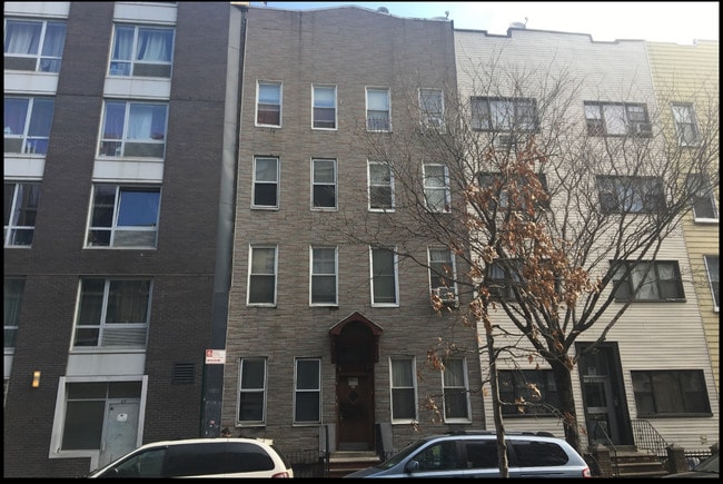
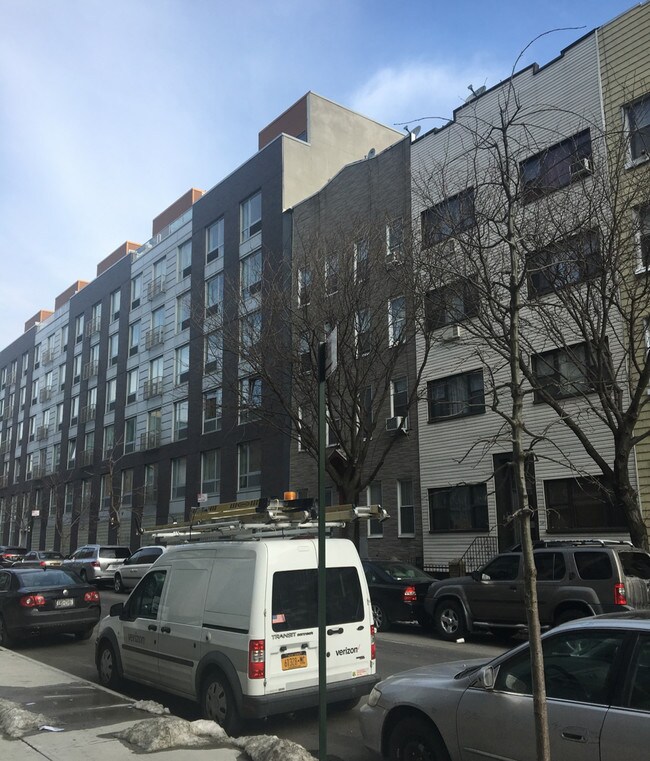
245 N 8Th St, Brooklyn, NY 11211


NEARBY LISTINGS FOR SALE OR LEASE
Property Detail
245 N 8Th St
02314-0032
Kings
Multifamilydwelling
New York
AE
32
3604970204F
0.06 AC
2024
Williamsburg
2025
Long Island (New York)
051900
New York-Jersey City-White Plains, NY-NJ
7,000 SF
DEMOGRAPHICS near 245 N 8Th St
1 mile
3 mile
5 mile
2024 Total Population
163,358
1,333,827
3,152,926
2029 Population
157,078
1,259,109
2,965,626
Pop Growth 2024-2029
(3.84%)
(5.60%)
(5.94%)
Average Age
35
38
39
2024 Total Households
69,499
594,609
1,368,551
HH Growth 2024-2029
(4.36%)
(5.99%)
(6.26%)
Median Household Inc
$95,070
$93,809
$90,712
Avg Household Size
2.30
2.10
2.20
2024 Avg HH Vehicles
.00
.00
.00
Median Home Value
$1,031,773
$962,683
$898,461
Median Year Built
1960
1951
1951
Nearby Places
Map Layers
Map Styles
 Street
 Aerial
Transit
 Traffic
 Biking
Places
Listings with unknown addresses are not visible on the map
- Restaurants
- Banks
- Shops
- Fitness
- Groceries
PUBLIC TRANSPORTATION
TRANSIT/SUBWAY
Bedford Avenue (L - New York MTA Subway (The Subway))
Drive
Walk
Distance
Bedford Avenue (L - New York MTA Subway (The Subway))
2 min
4 min
0.2 mi
Metropolitan Avenue (G - New York MTA Subway (The Subway))
Drive
Walk
Distance
Metropolitan Avenue (G - New York MTA Subway (The Subway))
2 min
7 min
0.3 mi
Lorimer Street (L Line) (L - New York MTA Subway (The Subway))
Drive
Walk
Distance
Lorimer Street (L Line) (L - New York MTA Subway (The Subway))
2 min
7 min
0.4 mi
Graham Avenue (L - New York MTA Subway (The Subway))
Drive
Walk
Distance
Graham Avenue (L - New York MTA Subway (The Subway))
3 min
12 min
0.6 mi
Nassau Avenue (G - New York MTA Subway (The Subway))
Drive
Walk
Distance
Nassau Avenue (G - New York MTA Subway (The Subway))
3 min
13 min
0.7 mi
COMMUTER RAIL
Hunterspoint Avenue Station (Hempstead Branch - Long Island Rail Road, Oyster Bay Branch - Long Island Rail Road)
Drive
Walk
Distance
Hunterspoint Avenue Station (Hempstead Branch - Long Island Rail Road, Oyster Bay Branch - Long Island Rail Road)
9 min
2.5 mi
Long Island City Station (Hempstead Branch - Long Island Rail Road)
Drive
Walk
Distance
Long Island City Station (Hempstead Branch - Long Island Rail Road)
10 min
2.8 mi
AIRPORT
LaGuardia
Drive
Walk
Distance
LaGuardia
16 min
7.0 mi
Newark Liberty International
Drive
Walk
Distance
Newark Liberty International
27 min
14.9 mi
John F Kennedy International
Drive
Walk
Distance
John F Kennedy International
25 min
15.2 mi
Freight Ports
NY - Red Hook Container Terminal
Drive
Walk
Distance
NY - Red Hook Container Terminal
10 min
4.9 mi
SALE & LEASE HISTORY
LISTING DATE
SALE/LEASE

May 09, 2017
For Sale
Feb 01, 2017
For Sale
Nearby Properties
Address
Land Use
TOTAL SIZE
Lot Size
Zoning
Address
Land Use
TOTAL SIZE
Lot Size
Zoning
8,462,176 SF
61.41 AC
R7-2
Address
Land Use
TOTAL SIZE
Lot Size
Zoning
1,678,135 SF
1.01 AC
C5-3
Address
Land Use
TOTAL SIZE
Lot Size
Zoning
2,812,739 SF
2.10 AC
C5-3
Address
Land Use
TOTAL SIZE
Lot Size
Zoning
1,586,876 SF
1.87 AC
C5-3
Address
Land Use
TOTAL SIZE
Lot Size
Zoning
2,344,406 SF
1.84 AC
C5-3
Address
Land Use
TOTAL SIZE
Lot Size
Zoning
2,400,000 SF
15.14 AC
C5-2
Address
Land Use
TOTAL SIZE
Lot Size
Zoning
8.22 AC
R8
Address
Land Use
TOTAL SIZE
Lot Size
Zoning
8.22 AC
R8
Address
Land Use
TOTAL SIZE
Lot Size
Zoning
2,124,441 SF
17.29 AC
R8
Address
Land Use
TOTAL SIZE
Lot Size
Zoning
1,233,394 SF
1.78 AC
C5-3
Address
Land Use
TOTAL SIZE
Lot Size
Zoning
1,134,017 SF
1.05 AC
C5-3
Address
Land Use
TOTAL SIZE
Lot Size
Zoning
1,104,505 SF
2.32 AC
C4-7
Address
Land Use
TOTAL SIZE
Lot Size
Zoning
1,560,607 SF
2.69 AC
C6-6
Address
Land Use
TOTAL SIZE
Lot Size
Zoning
916,553 SF
1.39 AC
C5-3
Address
Land Use
TOTAL SIZE
Lot Size
Zoning
940,000 SF
1.44 AC
C6-2
Address
Land Use
TOTAL SIZE
Lot Size
Zoning
988,829 SF
1.44 AC
R10
Address
Land Use
TOTAL SIZE
Lot Size
Zoning
988,829 SF
1.44 AC
R10
Address
Land Use
TOTAL SIZE
Lot Size
Zoning
988,829 SF
1.44 AC
R10
Address
Land Use
TOTAL SIZE
Lot Size
Zoning
988,829 SF
1.44 AC
R10
Address
Land Use
TOTAL SIZE
Lot Size
Zoning
988,829 SF
1.44 AC
R10
Address
Land Use
TOTAL SIZE
Lot Size
Zoning
988,829 SF
1.44 AC
R10
Address
Land Use
TOTAL SIZE
Lot Size
Zoning
988,829 SF
1.44 AC
R10
Address
Land Use
TOTAL SIZE
Lot Size
Zoning
988,829 SF
1.44 AC
R10
Address
Land Use
TOTAL SIZE
Lot Size
Zoning
988,829 SF
1.44 AC
R10
Address
Land Use
TOTAL SIZE
Lot Size
Zoning
988,829 SF
1.44 AC
R10
Address
Land Use
TOTAL SIZE
Lot Size
Zoning
988,829 SF
1.44 AC
R10
Address
Land Use
TOTAL SIZE
Lot Size
Zoning
988,829 SF
1.44 AC
R10
Address
Land Use
TOTAL SIZE
Lot Size
Zoning
988,829 SF
1.44 AC
R10
Address
Land Use
TOTAL SIZE
Lot Size
Zoning
988,829 SF
1.44 AC
R10
Address
Land Use
TOTAL SIZE
Lot Size
Zoning
988,829 SF
1.44 AC
R10
The World's #1 Commercial Real Estate Marketplace
Connect with us
© 2026 CoStar Group
The information above has been obtained from sources believed reliable. While we do not doubt its accuracy we have not verified it and make no guarantee, warranty or representation about it. It is your responsibility to independently confirm its accuracy and completeness. Any projections, opinions, assumptions, or estimates used are for example only and do not represent the current or future performance of the property. The value of this transaction to you depends on tax and other factors which should be evaluated by your tax, financial, and legal advisors. You and your advisors should conduct a careful, independent investigation of the property to determine to your satisfaction the suitability of the property for your needs.