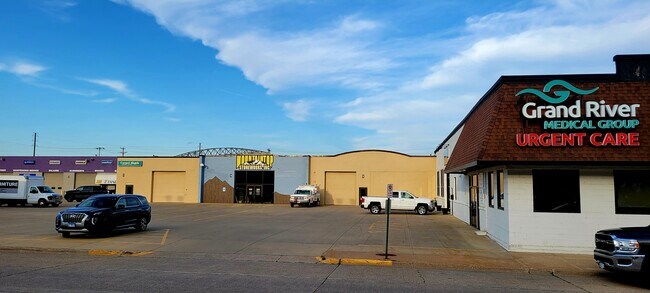
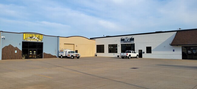
Property Record
245 Railroad Ave, Dubuque, IA 52003

NEARBY LISTINGS FOR SALE OR LEASE
Property Detail
245 Railroad Ave
10-25-480-001
Blk A Industrial Sub
Warehouse
BLK A INDUSTRIAL SUB
X
Dubuque
19097C0025E
Iowa
2025
2.73 AC
2025
Iowa Northeast Area
000801
Other Market Areas
74,066 SF
Dubuque, IA
DEMOGRAPHICS near 245 Railroad Ave
1 Mile
3 Mile
5 Mile
2024 Total Population
5,528
42,921
67,241
2029 Population
5,495
42,527
66,782
Pop Growth 2024-2029
(0.60%)
(0.92%)
(0.68%)
Average Age
41
39
41
2024 Total Households
2,432
17,892
28,108
HH Growth 2024-2029
(0.70%)
(0.97%)
(0.74%)
Median Household Inc
$67,789
$61,249
$67,079
Avg Household Size
2.10
2.20
2.20
2024 Avg HH Vehicles
2.00
2.00
2.00
Median Home Value
$185,118
$159,117
$171,922
Median Year Built
1949
1953
1964
Nearby Places
Map Layers
Map Styles
 Street
 Aerial
- Restaurants
- Banks
- Shops
- Fitness
- Groceries
SALE & LEASE HISTORY
LISTING DATE
SALE/LEASE

Oct 23, 2023
For Lease
Dec 22, 2017
For Lease
Apr 11, 2019
For Lease
Nearby Properties
Address
Land Use
TOTAL SIZE
Lot Size
Zoning
Address
Land Use
TOTAL SIZE
Lot Size
Zoning
182,880 SF
1.98 AC
Address
Land Use
TOTAL SIZE
Lot Size
Zoning
58,956 SF
18.52 AC
Address
Land Use
TOTAL SIZE
Lot Size
Zoning
21.73 AC
Address
Land Use
TOTAL SIZE
Lot Size
Zoning
6.48 AC
Address
Land Use
TOTAL SIZE
Lot Size
Zoning
84,966 SF
27.78 AC
CI
Address
Land Use
TOTAL SIZE
Lot Size
Zoning
148,824 SF
6.79 AC
Address
Land Use
TOTAL SIZE
Lot Size
Zoning
3,672 SF
18.81 AC
Address
Land Use
TOTAL SIZE
Lot Size
Zoning
43.61 AC
Address
Land Use
TOTAL SIZE
Lot Size
Zoning
42,400 SF
17.09 AC
Address
Land Use
TOTAL SIZE
Lot Size
Zoning
Address
Land Use
TOTAL SIZE
Lot Size
Zoning
132,465 SF
CI
Address
Land Use
TOTAL SIZE
Lot Size
Zoning
262,314 SF
0.67 AC
CI
Address
Land Use
TOTAL SIZE
Lot Size
Zoning
137,515 SF
2.02 AC
CI
Address
Land Use
TOTAL SIZE
Lot Size
Zoning
108,417 SF
2.60 AC
Address
Land Use
TOTAL SIZE
Lot Size
Zoning
117,636 SF
21.83 AC
Address
Land Use
TOTAL SIZE
Lot Size
Zoning
89,440 SF
2.95 AC
Address
Land Use
TOTAL SIZE
Lot Size
Zoning
94,400 SF
1.83 AC
Address
Land Use
TOTAL SIZE
Lot Size
Zoning
313,432 SF
2.31 AC
Address
Land Use
TOTAL SIZE
Lot Size
Zoning
8.17 AC
Address
Land Use
TOTAL SIZE
Lot Size
Zoning
3.46 AC
Address
Land Use
TOTAL SIZE
Lot Size
Zoning
151,927 SF
0.93 AC
CI
Address
Land Use
TOTAL SIZE
Lot Size
Zoning
395,408 SF
27.08 AC
CI
Address
Land Use
TOTAL SIZE
Lot Size
Zoning
28,498 SF
14.10 AC
Address
Land Use
TOTAL SIZE
Lot Size
Zoning
6,730 SF
2.56 AC
Address
Land Use
TOTAL SIZE
Lot Size
Zoning
85,281 SF
7.57 AC
CI
Address
Land Use
TOTAL SIZE
Lot Size
Zoning
27.31 AC
Address
Land Use
TOTAL SIZE
Lot Size
Zoning
6,684 SF
43.73 AC
CI
Address
Land Use
TOTAL SIZE
Lot Size
Zoning
148,784 SF
1.37 AC
CI
Address
Land Use
TOTAL SIZE
Lot Size
Zoning
124,484 SF
1.70 AC
Address
Land Use
TOTAL SIZE
Lot Size
Zoning
52,788 SF
1.29 AC
CI
The World's #1 Commercial Real Estate Marketplace
Connect with us
© 2026 CoStar Group
The information above has been obtained from sources believed reliable. While we do not doubt its accuracy we have not verified it and make no guarantee, warranty or representation about it. It is your responsibility to independently confirm its accuracy and completeness. Any projections, opinions, assumptions, or estimates used are for example only and do not represent the current or future performance of the property. The value of this transaction to you depends on tax and other factors which should be evaluated by your tax, financial, and legal advisors. You and your advisors should conduct a careful, independent investigation of the property to determine to your satisfaction the suitability of the property for your needs.