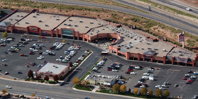
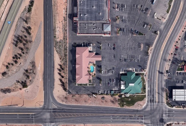
Property Record
245 Red Cliffs Dr, Saint George, UT 84790


Property Detail
245 Red Cliffs Dr
0481518
S: 29 T: 42S R: 15W BEG ELY R/W LN I-15 ENTRANCE RAMP BEING N 89*2428 E 866.83 FT ALG SEC/L & N 0*08 E 90.08 FT FM S1/4 COR SEC 20 T42S R15W BEING NW COR PARCEL #6; TH ALG R/W LN N 0*08 E 212 FT TO CURV 718.51 FT RAD CUR CNCV SE; TH NELY 393.67 FT AL
Commercialnec
Washington
C2
Utah
B and X Area of moderate flood hazard, usually the area between the limits of the 100-year and 500-year floods.
8.96 AC
2024
Cedar City & St George
2025
Other Market Areas
271200
St. George, UT
91,517 SF
NEARBY LISTINGS FOR SALE OR LEASE
DEMOGRAPHICS near 245 Red Cliffs Dr
1 mile
3 mile
5 mile
2025 Total Population
7,426
57,136
127,086
2030 Population
8,042
62,212
139,899
Pop Growth 2025-2030
+ 8.30%
+ 8.88%
+ 10.08%
Average Age
39
39
39
2025 Total Households
2,556
19,829
43,714
HH Growth 2025-2030
+ 8.49%
+ 9.23%
+ 10.45%
Median Household Inc
$58,430
$68,608
$77,628
Avg Household Size
2.50
2.70
2.80
2025 Avg HH Vehicles
2.00
2.00
2.00
Median Home Value
$445,168
$493,724
$534,651
Median Year Built
1997
1998
2002
Nearby Places
Map Layers
Map Styles
 Street
 Aerial
Layers
 Traffic
 Biking
Places
Listings with unknown addresses are not visible on the map
- Restaurants
- Banks
- Shops
- Fitness
- Groceries
PUBLIC TRANSPORTATION
AIRPORT
St George Regional
Drive
Walk
Distance
St George Regional
9 min
3.9 mi
Freight Ports
Port of Long Beach
Drive
Walk
Distance
Port of Long Beach
442 min
403.0 mi
SALE & LEASE HISTORY
LISTING DATE
SALE/LEASE

Sep 25, 2016
For Lease
Jul 19, 2019
For Sale
Jul 15, 2021
For Lease
Feb 01, 2017
For Lease
Apr 26, 2018
For Sale
Apr 11, 2017
For Lease
Nearby Properties
Address
Land Use
TOTAL SIZE
Lot Size
Zoning
Address
Land Use
TOTAL SIZE
Lot Size
Zoning
1,120,988 SF
52.22 AC
PDCOM
Address
Land Use
TOTAL SIZE
Lot Size
Zoning
319,351 SF
31.39 AC
PD
Address
Land Use
TOTAL SIZE
Lot Size
Zoning
319,351 SF
31.39 AC
Address
Land Use
TOTAL SIZE
Lot Size
Zoning
163,605 SF
13.51 AC
C3
Address
Land Use
TOTAL SIZE
Lot Size
Zoning
252,737 SF
3.95 AC
C-4
Address
Land Use
TOTAL SIZE
Lot Size
Zoning
175,817 SF
30.20 AC
Address
Land Use
TOTAL SIZE
Lot Size
Zoning
118,603 SF
16.56 AC
Address
Land Use
TOTAL SIZE
Lot Size
Zoning
141,151 SF
15 AC
PDCOM
Address
Land Use
TOTAL SIZE
Lot Size
Zoning
206,801 SF
12.60 AC
PD
Address
Land Use
TOTAL SIZE
Lot Size
Zoning
230,880 SF
25.58 AC
C-2
Address
Land Use
TOTAL SIZE
Lot Size
Zoning
9,037 SF
188.69 AC
C2
Address
Land Use
TOTAL SIZE
Lot Size
Zoning
66,506 SF
15.12 AC
Address
Land Use
TOTAL SIZE
Lot Size
Zoning
97,572 SF
10.51 AC
PD
Address
Land Use
TOTAL SIZE
Lot Size
Zoning
141,567 SF
1.31 AC
C-4
Address
Land Use
TOTAL SIZE
Lot Size
Zoning
280,428 SF
1.96 AC
C-4
Address
Land Use
TOTAL SIZE
Lot Size
Zoning
68,899 SF
7.36 AC
C3
Address
Land Use
TOTAL SIZE
Lot Size
Zoning
84,384 SF
6.34 AC
C2
Address
Land Use
TOTAL SIZE
Lot Size
Zoning
88,445 SF
3.28 AC
C2
Address
Land Use
TOTAL SIZE
Lot Size
Zoning
153,140 SF
17.17 AC
C-3
Address
Land Use
TOTAL SIZE
Lot Size
Zoning
120,219 SF
11.88 AC
Address
Land Use
TOTAL SIZE
Lot Size
Zoning
97,202 SF
2.92 AC
C3
Address
Land Use
TOTAL SIZE
Lot Size
Zoning
67,974 SF
7.04 AC
Address
Land Use
TOTAL SIZE
Lot Size
Zoning
76,907 SF
4 AC
PDCOM
Address
Land Use
TOTAL SIZE
Lot Size
Zoning
72,862 SF
3.20 AC
Address
Land Use
TOTAL SIZE
Lot Size
Zoning
94,810 SF
3.15 AC
C-3
Address
Land Use
TOTAL SIZE
Lot Size
Zoning
59,500 SF
4.93 AC
R110
Address
Land Use
TOTAL SIZE
Lot Size
Zoning
137,662 SF
7.81 AC
PD
Address
Land Use
TOTAL SIZE
Lot Size
Zoning
67,139 SF
1.25 AC
Address
Land Use
TOTAL SIZE
Lot Size
Zoning
158,638 SF
4.67 AC
C-3
The World's #1 Commercial Real Estate Marketplace
Connect with us
© 2026 CoStar Group
The information above has been obtained from sources believed reliable. While we do not doubt its accuracy we have not verified it and make no guarantee, warranty or representation about it. It is your responsibility to independently confirm its accuracy and completeness. Any projections, opinions, assumptions, or estimates used are for example only and do not represent the current or future performance of the property. The value of this transaction to you depends on tax and other factors which should be evaluated by your tax, financial, and legal advisors. You and your advisors should conduct a careful, independent investigation of the property to determine to your satisfaction the suitability of the property for your needs.