Property Record
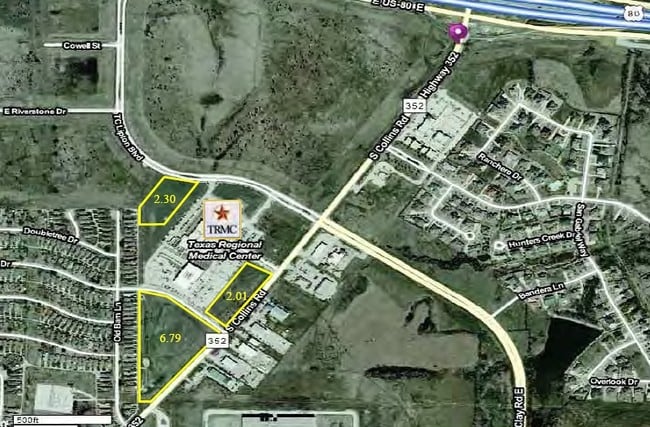
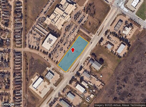
245 S Collins Rd, Sunnyvale, TX 75182
NEARBY LISTINGS FOR SALE OR LEASE
Property Detail
245 S Collins Rd
Dallas-Fort Worth-Arlington, TX
Texas Regional Medical Center
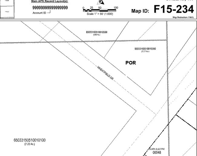
52150940000030000
TEXAS REGIONAL MEDICAL CENTER LT 3 ACS 1.9441 INT201500212960 DD08102015 CO-DC 1509400000300 3TS15094000
Commercialacreage
Dallas
X
Texas
48257C0025E
3
2024
1.94 AC
2025
Mesquite/Forney/Terrell
018158
Dallas/Ft Worth
DEMOGRAPHICS near 245 S Collins Rd
1 Mile
3 Mile
5 Mile
2024 Total Population
4,173
59,588
161,814
2029 Population
4,062
58,658
161,715
Pop Growth 2024-2029
(2.66%)
(1.56%)
(0.06%)
Average Age
36
37
36
2024 Total Households
1,341
19,025
52,485
HH Growth 2024-2029
(2.98%)
(1.89%)
(0.32%)
Median Household Inc
$68,221
$70,358
$65,121
Avg Household Size
3.00
3.10
3.00
2024 Avg HH Vehicles
2.00
2.00
2.00
Median Home Value
$184,809
$217,702
$210,014
Median Year Built
1986
1984
1985
Nearby Places
Map Layers
Map Styles
 Street
 Aerial
- Restaurants
- Banks
- Shops
- Fitness
- Groceries
PUBLIC TRANSPORTATION
AIRPORT
Dallas Love Field
DRIVE
WALK
Distance
Dallas Love Field
33 min
20.6 mi
Dallas-Fort Worth International
DRIVE
WALK
Distance
Dallas-Fort Worth International
48 min
38.7 mi
Nearby Properties
Address
Land Use
TOTAL SIZE
Lot Size
Zoning
Address
Land Use
TOTAL SIZE
Lot Size
Zoning
256,600 SF
80.73 AC
Z265
Address
Land Use
TOTAL SIZE
Lot Size
Zoning
877,230 SF
102.36 AC
Z05
Address
Land Use
TOTAL SIZE
Lot Size
Zoning
649,398 SF
42.19 AC
Address
Land Use
TOTAL SIZE
Lot Size
Zoning
592,958 SF
32.34 AC
Address
Land Use
TOTAL SIZE
Lot Size
Zoning
643,200 SF
30.02 AC
Z109
Address
Land Use
TOTAL SIZE
Lot Size
Zoning
144,858 SF
9.69 AC
Z206
Address
Land Use
TOTAL SIZE
Lot Size
Zoning
296,370 SF
17.15 AC
Z16
Address
Land Use
TOTAL SIZE
Lot Size
Zoning
100 SF
0.01 AC
Z268
Address
Land Use
TOTAL SIZE
Lot Size
Zoning
0.03 AC
Z63
Address
Land Use
TOTAL SIZE
Lot Size
Zoning
1,229,138 SF
115.08 AC
Z117
Address
Land Use
TOTAL SIZE
Lot Size
Zoning
622,615 SF
35 AC
Z104
Address
Land Use
TOTAL SIZE
Lot Size
Zoning
223,216 SF
17.17 AC
Z31
Address
Land Use
TOTAL SIZE
Lot Size
Zoning
214,853 SF
6.60 AC
Z372
Address
Land Use
TOTAL SIZE
Lot Size
Zoning
87,104 SF
18.31 AC
Z87
Address
Land Use
TOTAL SIZE
Lot Size
Zoning
407,195 SF
31.32 AC
Z109
Address
Land Use
TOTAL SIZE
Lot Size
Zoning
379,619 SF
24.68 AC
Z376
Address
Land Use
TOTAL SIZE
Lot Size
Zoning
320,390 SF
21.50 AC
Z267
Address
Land Use
TOTAL SIZE
Lot Size
Zoning
349,440 SF
20.07 AC
Z104
Address
Land Use
TOTAL SIZE
Lot Size
Zoning
333,000 SF
17.04 AC
Address
Land Use
TOTAL SIZE
Lot Size
Zoning
217,606 SF
10.01 AC
Z237
Address
Land Use
TOTAL SIZE
Lot Size
Zoning
295,916 SF
16.52 AC
Z104
Address
Land Use
TOTAL SIZE
Lot Size
Zoning
241,512 SF
12.61 AC
Address
Land Use
TOTAL SIZE
Lot Size
Zoning
310,900 SF
18.01 AC
Address
Land Use
TOTAL SIZE
Lot Size
Zoning
107,376 SF
38.55 AC
Z372
Address
Land Use
TOTAL SIZE
Lot Size
Zoning
174,200 SF
1 AC
Z372
Address
Land Use
TOTAL SIZE
Lot Size
Zoning
110,668 SF
8.05 AC
Z372
Address
Land Use
TOTAL SIZE
Lot Size
Zoning
56,325 SF
3.84 AC
Z28
Address
Land Use
TOTAL SIZE
Lot Size
Zoning
197,526 SF
12 AC
Z237
Address
Land Use
TOTAL SIZE
Lot Size
Zoning
342,000 SF
26.44 AC
Address
Land Use
TOTAL SIZE
Lot Size
Zoning
117,715 SF
13.18 AC
Z87
The World's #1 Commercial Real Estate Marketplace
Connect with us
© 2025 CoStar Group
The information above has been obtained from sources believed reliable. While we do not doubt its accuracy we have not verified it and make no guarantee, warranty or representation about it. It is your responsibility to independently confirm its accuracy and completeness. Any projections, opinions, assumptions, or estimates used are for example only and do not represent the current or future performance of the property. The value of this transaction to you depends on tax and other factors which should be evaluated by your tax, financial, and legal advisors. You and your advisors should conduct a careful, independent investigation of the property to determine to your satisfaction the suitability of the property for your needs.