Property Record
245 S Stuart Ave, Elkton, VA 22827
NEARBY LISTINGS FOR SALE OR LEASE
-
-
View all Elkton listings for sale on LoopNet.com
Property Detail
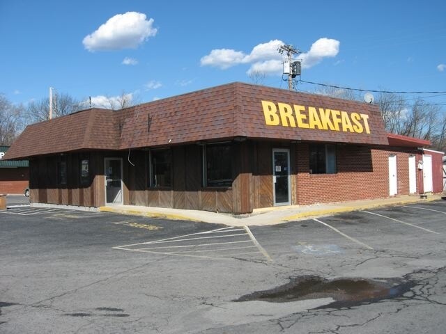
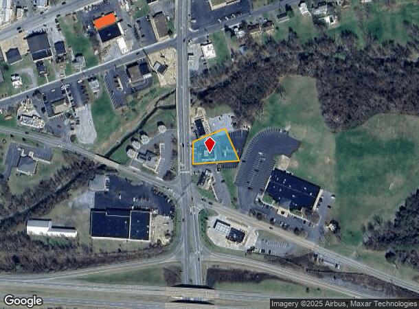
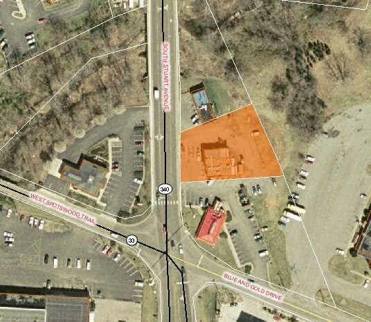
245 S Stuart Ave
Harrisonburg, VA
Division Of Charles D Brenda L Taylor
131B1-A-L64B
L 2
Restaurantbuilding
Rockingham
AE
Virginia
51079C0025C
2
2025
0.81 AC
2025
Staunton & Harrisonburg
010200
Other Market Areas
2,758 SF
DEMOGRAPHICS near 245 S Stuart Ave
1 Mile
3 Mile
5 Mile
2024 Total Population
2,609
5,979
10,096
2029 Population
2,692
6,173
10,393
Pop Growth 2024-2029
+ 3.18%
+ 3.24%
+ 2.94%
Average Age
42
43
43
2024 Total Households
1,151
2,513
4,153
HH Growth 2024-2029
+ 3.30%
+ 3.30%
+ 2.99%
Median Household Inc
$60,676
$61,994
$62,787
Avg Household Size
2.30
2.40
2.40
2024 Avg HH Vehicles
2.00
2.00
2.00
Median Home Value
$177,887
$203,546
$209,652
Median Year Built
1975
1978
1978
Nearby Places
Map Layers
Map Styles
 Street
 Aerial
- Restaurants
- Banks
- Shops
- Fitness
- Groceries
PUBLIC TRANSPORTATION
AIRPORT
Charlottesville-Albemarle
DRIVE
WALK
Distance
Charlottesville-Albemarle
44 min
30.1 mi
Nearby Properties
Address
Land Use
TOTAL SIZE
Lot Size
Zoning
Address
Land Use
TOTAL SIZE
Lot Size
Zoning
169.25 AC
I1
Address
Land Use
TOTAL SIZE
Lot Size
Zoning
91,860 SF
55 AC
A2
Address
Land Use
TOTAL SIZE
Lot Size
Zoning
86,249 SF
22.95 AC
A2
Address
Land Use
TOTAL SIZE
Lot Size
Zoning
68,292 SF
2.41 AC
R3
Address
Land Use
TOTAL SIZE
Lot Size
Zoning
94,782 SF
10.35 AC
B2
Address
Land Use
TOTAL SIZE
Lot Size
Zoning
1,824 SF
2.58 AC
A2
Address
Land Use
TOTAL SIZE
Lot Size
Zoning
52,065 SF
8.08 AC
M1
Address
Land Use
TOTAL SIZE
Lot Size
Zoning
12,470 SF
9.99 AC
A1
Address
Land Use
TOTAL SIZE
Lot Size
Zoning
13,110 SF
3 AC
B1
Address
Land Use
TOTAL SIZE
Lot Size
Zoning
13,294 SF
1.36 AC
A2
Address
Land Use
TOTAL SIZE
Lot Size
Zoning
10,080 SF
8.11 AC
R3
Address
Land Use
TOTAL SIZE
Lot Size
Zoning
129,968 SF
8.71 AC
B2
Address
Land Use
TOTAL SIZE
Lot Size
Zoning
20,397 SF
5 AC
R2
Address
Land Use
TOTAL SIZE
Lot Size
Zoning
15,000 SF
20.52 AC
I1
Address
Land Use
TOTAL SIZE
Lot Size
Zoning
3 AC
R3
Address
Land Use
TOTAL SIZE
Lot Size
Zoning
376.65 AC
A1
Address
Land Use
TOTAL SIZE
Lot Size
Zoning
30,156 SF
0.06 AC
R3
Address
Land Use
TOTAL SIZE
Lot Size
Zoning
13,440 SF
2.68 AC
R2
Address
Land Use
TOTAL SIZE
Lot Size
Zoning
24,233 SF
8 AC
B1
Address
Land Use
TOTAL SIZE
Lot Size
Zoning
16,380 SF
0.61 AC
B1
Address
Land Use
TOTAL SIZE
Lot Size
Zoning
26,996 SF
21.72 AC
M2
Address
Land Use
TOTAL SIZE
Lot Size
Zoning
23,844 SF
6.43 AC
A1
Address
Land Use
TOTAL SIZE
Lot Size
Zoning
22,527 SF
1.65 AC
A2
Address
Land Use
TOTAL SIZE
Lot Size
Zoning
20,472 SF
1.17 AC
B1
Address
Land Use
TOTAL SIZE
Lot Size
Zoning
3,955 SF
3.82 AC
B2
Address
Land Use
TOTAL SIZE
Lot Size
Zoning
10,035 SF
0.30 AC
B1
Address
Land Use
TOTAL SIZE
Lot Size
Zoning
26,517 SF
5.79 AC
R3
Address
Land Use
TOTAL SIZE
Lot Size
Zoning
3,862 SF
1.38 AC
B1
Address
Land Use
TOTAL SIZE
Lot Size
Zoning
18,426 SF
4.40 AC
B1
Address
Land Use
TOTAL SIZE
Lot Size
Zoning
6,679 SF
2.91 AC
R2
The World's #1 Commercial Real Estate Marketplace
Connect with us
© 2026 CoStar Group
The information above has been obtained from sources believed reliable. While we do not doubt its accuracy we have not verified it and make no guarantee, warranty or representation about it. It is your responsibility to independently confirm its accuracy and completeness. Any projections, opinions, assumptions, or estimates used are for example only and do not represent the current or future performance of the property. The value of this transaction to you depends on tax and other factors which should be evaluated by your tax, financial, and legal advisors. You and your advisors should conduct a careful, independent investigation of the property to determine to your satisfaction the suitability of the property for your needs.