Property Record
2450 69Th Ave, Moline, IL 61265


Save to a Folder
{{folder.Name}}
{{folder.ListingIds.length}} Properties
{{folder.ListingIds.length}} Property
Create a New Folder
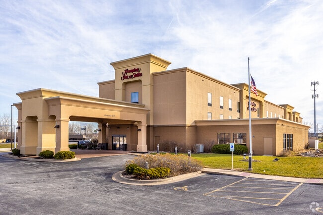
Property Detail
2450 69Th Ave
17-21-100-039
SUPVR ASST MAP LOT 111 SHEET 3 HAMPTON INN
Commercialnec
Rock Island
MOL
Illinois
B and X Area of moderate flood hazard, usually the area between the limits of the 100-year and 500-year floods.
111
2025
2.66 AC
2025
Davenport/Moline
024300
Davenport/Moline/Rock Island
63,972 SF
Davenport-Moline-Rock Island, IA-IL
NEARBY LISTINGS FOR SALE OR LEASE
-
-
View all Moline listings for sale on LoopNet.com
DEMOGRAPHICS near 2450 69Th Ave
1 mile
3 mile
5 mile
2025 Total Population
772
34,725
104,028
2030 Population
792
34,562
103,733
Pop Growth 2025-2030
+ 2.59%
(0.47%)
(0.28%)
Average Age
44
43
41
2025 Total Households
356
15,105
44,268
HH Growth 2025-2030
+ 2.53%
(0.47%)
(0.29%)
Median Household Inc
$42,343
$73,450
$64,892
Avg Household Size
2.10
2.20
2.20
2025 Avg HH Vehicles
2.00
2.00
2.00
Median Home Value
$90,839
$168,724
$154,680
Median Year Built
1958
1961
1957
Nearby Places
Map Layers
Map Styles
 Street
 Aerial
Layers
 Traffic
 Biking
Places
Listings with unknown addresses are not visible on the map
- Restaurants
- Banks
- Shops
- Fitness
- Groceries
PUBLIC TRANSPORTATION
AIRPORT
Quad Cities International
Drive
Walk
Distance
Quad Cities International
5 min
0.7 mi
Freight Ports
Port Milwaukee
Drive
Walk
Distance
Port Milwaukee
237 min
207.6 mi
SALE & LEASE HISTORY
LISTING DATE
SALE/LEASE

Sep 06, 2023
For Sale
Nearby Properties
Address
Land Use
TOTAL SIZE
Lot Size
Zoning
Address
Land Use
TOTAL SIZE
Lot Size
Zoning
2,595,576 SF
185.35 AC
MIL
Address
Land Use
TOTAL SIZE
Lot Size
Zoning
7.86 AC
Address
Land Use
TOTAL SIZE
Lot Size
Zoning
250,875 SF
11.92 AC
MOL
Address
Land Use
TOTAL SIZE
Lot Size
Zoning
132,647 SF
13.76 AC
MOL
Address
Land Use
TOTAL SIZE
Lot Size
Zoning
19.69 AC
MOL
Address
Land Use
TOTAL SIZE
Lot Size
Zoning
47,060 SF
3.23 AC
MOL
Address
Land Use
TOTAL SIZE
Lot Size
Zoning
194,267 SF
23.16 AC
MOL
Address
Land Use
TOTAL SIZE
Lot Size
Zoning
244,440 SF
13.25 AC
MOL
Address
Land Use
TOTAL SIZE
Lot Size
Zoning
10.75 AC
MOL
Address
Land Use
TOTAL SIZE
Lot Size
Zoning
142,836 SF
14.60 AC
MOL
Address
Land Use
TOTAL SIZE
Lot Size
Zoning
66.76 AC
MOL
Address
Land Use
TOTAL SIZE
Lot Size
Zoning
73,065 SF
12.67 AC
I2
Address
Land Use
TOTAL SIZE
Lot Size
Zoning
47,578 SF
23.65 AC
MOL
Address
Land Use
TOTAL SIZE
Lot Size
Zoning
9.42 AC
I2
Address
Land Use
TOTAL SIZE
Lot Size
Zoning
116,800 SF
9.30 AC
MOL
Address
Land Use
TOTAL SIZE
Lot Size
Zoning
96,352 SF
9.77 AC
MOL
Address
Land Use
TOTAL SIZE
Lot Size
Zoning
53,897 SF
3.13 AC
MOL
Address
Land Use
TOTAL SIZE
Lot Size
Zoning
33.09 AC
Address
Land Use
TOTAL SIZE
Lot Size
Zoning
9.18 AC
MOL
Address
Land Use
TOTAL SIZE
Lot Size
Zoning
162,924 SF
17.18 AC
MOL
Address
Land Use
TOTAL SIZE
Lot Size
Zoning
55.60 AC
CV
Address
Land Use
TOTAL SIZE
Lot Size
Zoning
24,985 SF
3.36 AC
RI
Address
Land Use
TOTAL SIZE
Lot Size
Zoning
3 AC
MOL
Address
Land Use
TOTAL SIZE
Lot Size
Zoning
4.40 AC
Address
Land Use
TOTAL SIZE
Lot Size
Zoning
46.02 AC
MOL
Address
Land Use
TOTAL SIZE
Lot Size
Zoning
10.76 AC
MOL
Address
Land Use
TOTAL SIZE
Lot Size
Zoning
7.02 AC
MIL
Address
Land Use
TOTAL SIZE
Lot Size
Zoning
170,666 SF
4.79 AC
MIL
Address
Land Use
TOTAL SIZE
Lot Size
Zoning
58,946 SF
2.65 AC
MOL
The World's #1 Commercial Real Estate Marketplace
Connect with us
© 2026 CoStar Group
The information above has been obtained from sources believed reliable. While we do not doubt its accuracy we have not verified it and make no guarantee, warranty or representation about it. It is your responsibility to independently confirm its accuracy and completeness. Any projections, opinions, assumptions, or estimates used are for example only and do not represent the current or future performance of the property. The value of this transaction to you depends on tax and other factors which should be evaluated by your tax, financial, and legal advisors. You and your advisors should conduct a careful, independent investigation of the property to determine to your satisfaction the suitability of the property for your needs.