Property Record
2450 Hilborn Rd, Fairfield, CA 94534
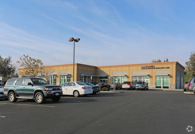


Property Detail
2450 Hilborn Rd
Vallejo, CA
BK-BG 48-07 LOT E
0156-490-050
SOLANO
Medicalbuilding
California
B and X Area of moderate flood hazard, usually the area between the limits of the 100-year and 500-year floods.
e
2024
1.30 AC
2025
Fairfield
252305
North Bay/Santa Rosa
12,018 SF
NEARBY LISTINGS FOR SALE OR LEASE
DEMOGRAPHICS near 2450 Hilborn Rd
1 mile
3 mile
5 mile
2025 Total Population
17,009
100,037
125,411
2030 Population
17,061
100,719
126,450
Pop Growth 2025-2030
+ 0.31%
+ 0.68%
+ 0.83%
Average Age
40
39
39
2025 Total Households
5,959
33,337
41,327
HH Growth 2025-2030
+ 0.23%
+ 0.67%
+ 0.80%
Median Household Inc
$96,811
$91,145
$97,745
Avg Household Size
2.80
2.90
3.00
2025 Avg HH Vehicles
2.00
2.00
2.00
Median Home Value
$668,736
$635,481
$655,739
Median Year Built
1978
1980
1982
Nearby Places
Map Layers
Map Styles
 Street
 Aerial
Layers
 Traffic
 Biking
Places
Listings with unknown addresses are not visible on the map
- Restaurants
- Banks
- Shops
- Fitness
- Groceries
PUBLIC TRANSPORTATION
COMMUTER RAIL
Drive
Walk
Distance
8 min
4.3 mi
Drive
Walk
Distance
10 min
5.8 mi
AIRPORT
Sacramento International
Drive
Walk
Distance
Sacramento International
57 min
45.2 mi
Freight Ports
Port of Richmond
Drive
Walk
Distance
Port of Richmond
48 min
36.5 mi
Nearby Properties
Address
Land Use
TOTAL SIZE
Lot Size
Zoning
Address
Land Use
TOTAL SIZE
Lot Size
Zoning
Address
Land Use
TOTAL SIZE
Lot Size
Zoning
317,493 SF
21.54 AC
Address
Land Use
TOTAL SIZE
Lot Size
Zoning
67.79 AC
Address
Land Use
TOTAL SIZE
Lot Size
Zoning
172,856 SF
10.11 AC
Address
Land Use
TOTAL SIZE
Lot Size
Zoning
184,572 SF
10.95 AC
Address
Land Use
TOTAL SIZE
Lot Size
Zoning
Address
Land Use
TOTAL SIZE
Lot Size
Zoning
527,279 SF
33.29 AC
Address
Land Use
TOTAL SIZE
Lot Size
Zoning
300,897 SF
14.63 AC
Address
Land Use
TOTAL SIZE
Lot Size
Zoning
22.49 AC
Address
Land Use
TOTAL SIZE
Lot Size
Zoning
8.80 AC
Address
Land Use
TOTAL SIZE
Lot Size
Zoning
260,356 SF
25.40 AC
Address
Land Use
TOTAL SIZE
Lot Size
Zoning
219,672 SF
10 AC
IND
Address
Land Use
TOTAL SIZE
Lot Size
Zoning
90,416 SF
6.03 AC
MULTIRE
Address
Land Use
TOTAL SIZE
Lot Size
Zoning
113,320 SF
6.63 AC
Address
Land Use
TOTAL SIZE
Lot Size
Zoning
151,537 SF
8.66 AC
Address
Land Use
TOTAL SIZE
Lot Size
Zoning
144,466 SF
8.07 AC
MULTI-RES
Address
Land Use
TOTAL SIZE
Lot Size
Zoning
76,195 SF
8.43 AC
Address
Land Use
TOTAL SIZE
Lot Size
Zoning
74,406 SF
3.21 AC
Address
Land Use
TOTAL SIZE
Lot Size
Zoning
72,718 SF
4.58 AC
Address
Land Use
TOTAL SIZE
Lot Size
Zoning
185,292 SF
10.18 AC
Address
Land Use
TOTAL SIZE
Lot Size
Zoning
102,528 SF
4.87 AC
Address
Land Use
TOTAL SIZE
Lot Size
Zoning
53,960 SF
8.22 AC
Address
Land Use
TOTAL SIZE
Lot Size
Zoning
59,427 SF
2.90 AC
Address
Land Use
TOTAL SIZE
Lot Size
Zoning
3.41 AC
Address
Land Use
TOTAL SIZE
Lot Size
Zoning
95,800 SF
8.95 AC
Address
Land Use
TOTAL SIZE
Lot Size
Zoning
111,717 SF
11.05 AC
COMML
Address
Land Use
TOTAL SIZE
Lot Size
Zoning
167,051 SF
11.97 AC
Address
Land Use
TOTAL SIZE
Lot Size
Zoning
64,863 SF
2.08 AC
COMML/MOT
Address
Land Use
TOTAL SIZE
Lot Size
Zoning
201,973 SF
11.83 AC
LT IND
Address
Land Use
TOTAL SIZE
Lot Size
Zoning
159,990 SF
11.93 AC
The World's #1 Commercial Real Estate Marketplace
Connect with us
© 2026 CoStar Group
The information above has been obtained from sources believed reliable. While we do not doubt its accuracy we have not verified it and make no guarantee, warranty or representation about it. It is your responsibility to independently confirm its accuracy and completeness. Any projections, opinions, assumptions, or estimates used are for example only and do not represent the current or future performance of the property. The value of this transaction to you depends on tax and other factors which should be evaluated by your tax, financial, and legal advisors. You and your advisors should conduct a careful, independent investigation of the property to determine to your satisfaction the suitability of the property for your needs.