Property Record
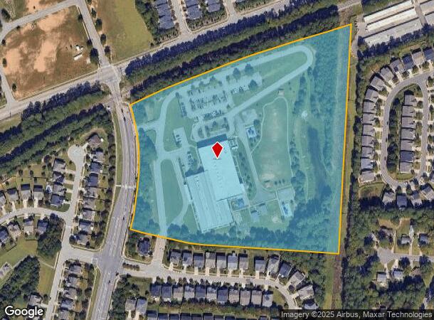
2450 Laura Duncan Rd, Apex, NC 27523


NEARBY LISTINGS FOR SALE OR LEASE
Property Detail
2450 Laura Duncan Rd
0753.17-11-5217-000
Laurel Park 01
Publicschool
LAUREL PARK ELEMENTARY TR1 BM2008-02072
X
Wake
3720075300K
North Carolina
0
17.66 AC
2025
Cary
053509
Raleigh/Durham
114,288 SF
Raleigh, NC
DEMOGRAPHICS near 2450 Laura Duncan Rd
1 Mile
3 Mile
5 Mile
2024 Total Population
10,188
80,335
206,959
2029 Population
11,017
86,746
224,441
Pop Growth 2024-2029
+ 8.14%
+ 7.98%
+ 8.45%
Average Age
41
41
39
2024 Total Households
3,991
31,179
79,478
HH Growth 2024-2029
+ 8.19%
+ 8.00%
+ 8.44%
Median Household Inc
$118,296
$118,213
$114,474
Avg Household Size
2.50
2.50
2.60
2024 Avg HH Vehicles
2.00
2.00
2.00
Median Home Value
$387,512
$406,378
$431,851
Median Year Built
1991
1993
1996
Nearby Places
Map Layers
Map Styles
 Street
 Aerial
- Restaurants
- Banks
- Shops
- Fitness
- Groceries
PUBLIC TRANSPORTATION
COMMUTER RAIL
Cary Station (Piedmont - North Carolina by Train (NC Train))
DRIVE
WALK
Distance
Cary Station (Piedmont - North Carolina by Train (NC Train))
8 min
3.9 mi
AIRPORT
Raleigh-Durham International
DRIVE
WALK
Distance
Raleigh-Durham International
22 min
11.2 mi
Freight Ports
Port of Wilmington
DRIVE
WALK
Distance
Port of Wilmington
167 min
143.8 mi
Nearby Properties
Address
Land Use
TOTAL SIZE
Lot Size
Zoning
Address
Land Use
TOTAL SIZE
Lot Size
Zoning
517,812 SF
18.51 AC
RMFP
Address
Land Use
TOTAL SIZE
Lot Size
Zoning
633,930 SF
23.01 AC
OI
Address
Land Use
TOTAL SIZE
Lot Size
Zoning
439,439 SF
30.59 AC
OICU
Address
Land Use
TOTAL SIZE
Lot Size
Zoning
534,604 SF
16.38 AC
RMFM
Address
Land Use
TOTAL SIZE
Lot Size
Zoning
433,914 SF
11.81 AC
MXD
Address
Land Use
TOTAL SIZE
Lot Size
Zoning
441,502 SF
15.42 AC
OIM
Address
Land Use
TOTAL SIZE
Lot Size
Zoning
450,107 SF
30.16 AC
HD MF
Address
Land Use
TOTAL SIZE
Lot Size
Zoning
453,970 SF
41.48 AC
RMF-C
Address
Land Use
TOTAL SIZE
Lot Size
Zoning
280,706 SF
15.38 AC
PUD-C
Address
Land Use
TOTAL SIZE
Lot Size
Zoning
313,623 SF
23.92 AC
HD MF
Address
Land Use
TOTAL SIZE
Lot Size
Zoning
364,972 SF
35.18 AC
RMF-C
Address
Land Use
TOTAL SIZE
Lot Size
Zoning
194,462 SF
21.62 AC
OICU
Address
Land Use
TOTAL SIZE
Lot Size
Zoning
294,088 SF
24.72 AC
RMF-C
Address
Land Use
TOTAL SIZE
Lot Size
Zoning
260,809 SF
18.80 AC
HD MF
Address
Land Use
TOTAL SIZE
Lot Size
Zoning
285,822 SF
24.57 AC
RMFP
Address
Land Use
TOTAL SIZE
Lot Size
Zoning
270,753 SF
20.56 AC
RMFP
Address
Land Use
TOTAL SIZE
Lot Size
Zoning
209,936 SF
55.26 AC
R8
Address
Land Use
TOTAL SIZE
Lot Size
Zoning
291,597 SF
20.58 AC
OIP
Address
Land Use
TOTAL SIZE
Lot Size
Zoning
145,001 SF
20.31 AC
PC-CZ
Address
Land Use
TOTAL SIZE
Lot Size
Zoning
225,296 SF
9.57 AC
PUD-C
Address
Land Use
TOTAL SIZE
Lot Size
Zoning
140,005 SF
16.89 AC
LD
Address
Land Use
TOTAL SIZE
Lot Size
Zoning
157,686 SF
35.03 AC
RA
Address
Land Use
TOTAL SIZE
Lot Size
Zoning
209,191 SF
48.77 AC
LD
Address
Land Use
TOTAL SIZE
Lot Size
Zoning
121,224 SF
11.47 AC
MD
Address
Land Use
TOTAL SIZE
Lot Size
Zoning
207,360 SF
12.80 AC
RMFP
Address
Land Use
TOTAL SIZE
Lot Size
Zoning
142,976 SF
12.82 AC
GCP
Address
Land Use
TOTAL SIZE
Lot Size
Zoning
161,210 SF
12.70 AC
RMFP
Address
Land Use
TOTAL SIZE
Lot Size
Zoning
206,382 SF
14.90 AC
GCP
Address
Land Use
TOTAL SIZE
Lot Size
Zoning
134,040 SF
3.36 AC
OIM
Address
Land Use
TOTAL SIZE
Lot Size
Zoning
133,002 SF
34.94 AC
ORD
The World's #1 Commercial Real Estate Marketplace
Connect with us
© 2025 CoStar Group
The information above has been obtained from sources believed reliable. While we do not doubt its accuracy we have not verified it and make no guarantee, warranty or representation about it. It is your responsibility to independently confirm its accuracy and completeness. Any projections, opinions, assumptions, or estimates used are for example only and do not represent the current or future performance of the property. The value of this transaction to you depends on tax and other factors which should be evaluated by your tax, financial, and legal advisors. You and your advisors should conduct a careful, independent investigation of the property to determine to your satisfaction the suitability of the property for your needs.