Property Record
2450 Mason Ave, Daytona Beach, FL 32114
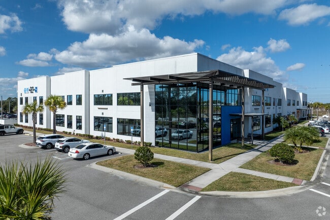


Property Detail
2450 Mason Ave
5215-00-00-0078
15-15-32 IRREG PARCEL MEAS 863.89 FT ALONG W ROW OF MASON AVE & 577.85 FT ALONG N ROW OF DUNN AVE EXC ROW AS DESC IN OR 7633 PG 1386 PER OR 7565 PG 4796
Officebuilding
VOLUSIA
B and X Area of moderate flood hazard, usually the area between the limits of the 100-year and 500-year floods.
Florida
2025
7.56 AC
2026
North Daytona Beach
082302
Deltona/Daytona Beach
77,771 SF
Deltona-Daytona Beach-Ormond Beach, FL
NEARBY LISTINGS FOR SALE OR LEASE
DEMOGRAPHICS near 2450 Mason Ave
1 mile
3 mile
5 mile
2025 Total Population
2,483
34,703
114,899
2030 Population
2,773
38,196
124,256
Pop Growth 2025-2030
+ 11.68%
+ 10.07%
+ 8.14%
Average Age
41
42
43
2025 Total Households
1,189
14,513
48,690
HH Growth 2025-2030
+ 11.94%
+ 10.36%
+ 8.24%
Median Household Inc
$53,750
$59,999
$54,065
Avg Household Size
2.00
2.20
2.10
2025 Avg HH Vehicles
2.00
2.00
2.00
Median Home Value
$321,154
$345,439
$261,934
Median Year Built
1996
1992
1983
Nearby Places
Map Layers
Map Styles
 Street
 Aerial
Layers
 Traffic
 Biking
Places
Listings with unknown addresses are not visible on the map
- Restaurants
- Banks
- Shops
- Fitness
- Groceries
PUBLIC TRANSPORTATION
AIRPORT
Daytona Beach International
Drive
Walk
Distance
Daytona Beach International
10 min
4.4 mi
Freight Ports
Port Canaveral
Drive
Walk
Distance
Port Canaveral
86 min
72.4 mi
Nearby Properties
Address
Land Use
TOTAL SIZE
Lot Size
Zoning
Address
Land Use
TOTAL SIZE
Lot Size
Zoning
863,820 SF
374 AC
AP
Address
Land Use
TOTAL SIZE
Lot Size
Zoning
2,673,647 SF
110.95 AC
I12
Address
Land Use
TOTAL SIZE
Lot Size
Zoning
1,365,998 SF
13 AC
Address
Land Use
TOTAL SIZE
Lot Size
Zoning
1,842,969 SF
25.56 AC
Address
Land Use
TOTAL SIZE
Lot Size
Zoning
1,058,116 SF
54.22 AC
Address
Land Use
TOTAL SIZE
Lot Size
Zoning
626,109 SF
72.96 AC
Address
Land Use
TOTAL SIZE
Lot Size
Zoning
437,897 SF
28.94 AC
Address
Land Use
TOTAL SIZE
Lot Size
Zoning
451,526 SF
17.96 AC
Address
Land Use
TOTAL SIZE
Lot Size
Zoning
353,548 SF
50.65 AC
Address
Land Use
TOTAL SIZE
Lot Size
Zoning
293,850 SF
29.38 AC
Address
Land Use
TOTAL SIZE
Lot Size
Zoning
400,964 SF
38.93 AC
Address
Land Use
TOTAL SIZE
Lot Size
Zoning
491,161 SF
31 AC
Address
Land Use
TOTAL SIZE
Lot Size
Zoning
356,386 SF
0.75 AC
Address
Land Use
TOTAL SIZE
Lot Size
Zoning
462,136 SF
31.84 AC
01A2
Address
Land Use
TOTAL SIZE
Lot Size
Zoning
275,814 SF
13 AC
Address
Land Use
TOTAL SIZE
Lot Size
Zoning
135,122 SF
78 AC
Address
Land Use
TOTAL SIZE
Lot Size
Zoning
286,461 SF
945.48 AC
B62
Address
Land Use
TOTAL SIZE
Lot Size
Zoning
291,590 SF
11.68 AC
Address
Land Use
TOTAL SIZE
Lot Size
Zoning
307,322 SF
65.41 AC
Address
Land Use
TOTAL SIZE
Lot Size
Zoning
434,487 SF
20.54 AC
Address
Land Use
TOTAL SIZE
Lot Size
Zoning
425,548 SF
10.16 AC
Address
Land Use
TOTAL SIZE
Lot Size
Zoning
375,572 SF
0.13 AC
R2
Address
Land Use
TOTAL SIZE
Lot Size
Zoning
422,146 SF
32.67 AC
Address
Land Use
TOTAL SIZE
Lot Size
Zoning
303,151 SF
13.58 AC
Address
Land Use
TOTAL SIZE
Lot Size
Zoning
535,856 SF
46.85 AC
Address
Land Use
TOTAL SIZE
Lot Size
Zoning
417,015 SF
27.55 AC
Address
Land Use
TOTAL SIZE
Lot Size
Zoning
259,175 SF
23.45 AC
Address
Land Use
TOTAL SIZE
Lot Size
Zoning
318,707 SF
12.16 AC
Address
Land Use
TOTAL SIZE
Lot Size
Zoning
346,734 SF
14 AC
Address
Land Use
TOTAL SIZE
Lot Size
Zoning
560,165 SF
37.79 AC
02BR2
The World's #1 Commercial Real Estate Marketplace
Connect with us
© 2026 CoStar Group
The information above has been obtained from sources believed reliable. While we do not doubt its accuracy we have not verified it and make no guarantee, warranty or representation about it. It is your responsibility to independently confirm its accuracy and completeness. Any projections, opinions, assumptions, or estimates used are for example only and do not represent the current or future performance of the property. The value of this transaction to you depends on tax and other factors which should be evaluated by your tax, financial, and legal advisors. You and your advisors should conduct a careful, independent investigation of the property to determine to your satisfaction the suitability of the property for your needs.