Property Record
2453 2Nd Ave E, Oneonta, AL 35121
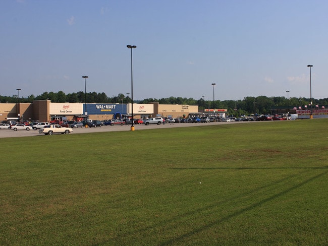

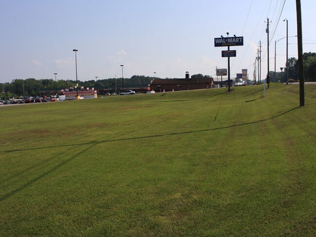
Property Detail
2453 2Nd Ave E
16-04-20-4-000-004.012
COM SE SEC COR TH N 325 TO POB TH SW 83 NW 899 NE 385 N 35 NW 149 TO SE R/W HWY 75 TH NE ALG R/W 420 TH SE 325 TH S TO POB--
Storebuilding
Blount
A Areas with a 1% annual chance of flooding and a 26% chance of flooding over the life of a 30-year mortgage.
Alabama
2025
11 AC
2025
Blount County
050105
Birmingham
147,374 SF
Birmingham, AL
NEARBY LISTINGS FOR SALE OR LEASE
DEMOGRAPHICS near 2453 2Nd Ave E
1 mile
3 mile
5 mile
2025 Total Population
969
7,430
11,278
2030 Population
983
7,562
11,505
Pop Growth 2025-2030
+ 1.44%
+ 1.78%
+ 2.01%
Average Age
44
42
41
2025 Total Households
343
2,793
4,249
HH Growth 2025-2030
+ 1.17%
+ 1.75%
+ 2.00%
Median Household Inc
$41,591
$53,746
$53,735
Avg Household Size
2.40
2.50
2.50
2025 Avg HH Vehicles
2.00
2.00
2.00
Median Home Value
$277,358
$216,162
$194,774
Median Year Built
1972
1971
1976
Nearby Places
Map Layers
Map Styles
 Street
 Aerial
Layers
 Traffic
 Biking
Places
Listings with unknown addresses are not visible on the map
- Restaurants
- Banks
- Shops
- Fitness
- Groceries
SALE & LEASE HISTORY
LISTING DATE
SALE/LEASE

Sep 25, 2016
For Lease
Nearby Properties
Address
Land Use
TOTAL SIZE
Lot Size
Zoning
Address
Land Use
TOTAL SIZE
Lot Size
Zoning
24,872 SF
24 AC
Address
Land Use
TOTAL SIZE
Lot Size
Zoning
6,510 SF
3.60 AC
Address
Land Use
TOTAL SIZE
Lot Size
Zoning
42,799 SF
6.10 AC
Address
Land Use
TOTAL SIZE
Lot Size
Zoning
27,944 SF
1.08 AC
Address
Land Use
TOTAL SIZE
Lot Size
Zoning
7,752 SF
7 AC
Address
Land Use
TOTAL SIZE
Lot Size
Zoning
32,392 SF
1.34 AC
Address
Land Use
TOTAL SIZE
Lot Size
Zoning
14,800 SF
2.98 AC
Address
Land Use
TOTAL SIZE
Lot Size
Zoning
11,040 SF
0.70 AC
Address
Land Use
TOTAL SIZE
Lot Size
Zoning
23,245 SF
0.99 AC
Address
Land Use
TOTAL SIZE
Lot Size
Zoning
15,626 SF
0.36 AC
Address
Land Use
TOTAL SIZE
Lot Size
Zoning
99,004 SF
18 AC
Address
Land Use
TOTAL SIZE
Lot Size
Zoning
6,418 SF
8.10 AC
Address
Land Use
TOTAL SIZE
Lot Size
Zoning
45,000 SF
7.20 AC
Address
Land Use
TOTAL SIZE
Lot Size
Zoning
17,536 SF
2.20 AC
Address
Land Use
TOTAL SIZE
Lot Size
Zoning
720 SF
3.20 AC
Address
Land Use
TOTAL SIZE
Lot Size
Zoning
12,152 SF
3 AC
Address
Land Use
TOTAL SIZE
Lot Size
Zoning
18,592 SF
0.50 AC
Address
Land Use
TOTAL SIZE
Lot Size
Zoning
5,920 SF
3.40 AC
Address
Land Use
TOTAL SIZE
Lot Size
Zoning
8,970 SF
0.65 AC
Address
Land Use
TOTAL SIZE
Lot Size
Zoning
49,700 SF
6.90 AC
Address
Land Use
TOTAL SIZE
Lot Size
Zoning
10,000 SF
1.02 AC
Address
Land Use
TOTAL SIZE
Lot Size
Zoning
9,238 SF
1.71 AC
Address
Land Use
TOTAL SIZE
Lot Size
Zoning
11,921 SF
6.70 AC
Address
Land Use
TOTAL SIZE
Lot Size
Zoning
15,928 SF
0.96 AC
Address
Land Use
TOTAL SIZE
Lot Size
Zoning
38,561 SF
3 AC
Address
Land Use
TOTAL SIZE
Lot Size
Zoning
20,930 SF
2.30 AC
Address
Land Use
TOTAL SIZE
Lot Size
Zoning
14,560 SF
4 AC
The World's #1 Commercial Real Estate Marketplace
Connect with us
© 2026 CoStar Group
The information above has been obtained from sources believed reliable. While we do not doubt its accuracy we have not verified it and make no guarantee, warranty or representation about it. It is your responsibility to independently confirm its accuracy and completeness. Any projections, opinions, assumptions, or estimates used are for example only and do not represent the current or future performance of the property. The value of this transaction to you depends on tax and other factors which should be evaluated by your tax, financial, and legal advisors. You and your advisors should conduct a careful, independent investigation of the property to determine to your satisfaction the suitability of the property for your needs.