Property Record
24549 S Highway 79, Hermosa, SD 57744
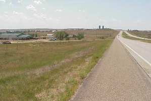

Property Detail
24549 S Highway 79
004135
PARK TRACT 1 IN NW4NW4NE4SE4, W2NE4NW4NE4SE4 & S2N2NE4SE4 LESS SD HWY 79 ROW SEC 30 T2 R8, 10.99 AC, HERMOSA TOWN 744-00-067-000-002-00
Commercialnec
CUSTER
AE The base floodplain where base flood elevations are provided. AE Zones are now used on new format FIRMs instead of A1-A30 Zones.
South Dakota
2025
10.99 AC
2025
South Dakota Area
965100
Other Market Areas
1,196 SF
Rapid City, SD
NEARBY LISTINGS FOR SALE OR LEASE
-
-
View all Hermosa listings for sale on LoopNet.com
DEMOGRAPHICS near 24549 S Highway 79
1 mile
3 mile
5 mile
2025 Total Population
398
711
1,441
2030 Population
429
766
1,547
Pop Growth 2025-2030
+ 7.79%
+ 7.74%
+ 7.36%
Average Age
48
48
47
2025 Total Households
173
308
606
HH Growth 2025-2030
+ 8.09%
+ 7.79%
+ 7.59%
Median Household Inc
$74,422
$79,412
$82,012
Avg Household Size
2.30
2.30
2.40
2025 Avg HH Vehicles
3.00
3.00
3.00
Median Home Value
$437,500
$442,045
$439,285
Median Year Built
2001
2001
2001
Nearby Places
Map Layers
Map Styles
 Street
 Aerial
Layers
 Traffic
 Biking
Places
Listings with unknown addresses are not visible on the map
- Restaurants
- Banks
- Shops
- Fitness
- Groceries
PUBLIC TRANSPORTATION
AIRPORT
Rapid City Regional
Drive
Walk
Distance
Rapid City Regional
32 min
23.4 mi
Freight Ports
Tulsa Port Of Catoosa
Drive
Walk
Distance
Tulsa Port Of Catoosa
966 min
875.7 mi
Nearby Properties
Address
Land Use
TOTAL SIZE
Lot Size
Zoning
Address
Land Use
TOTAL SIZE
Lot Size
Zoning
3,312 SF
34.88 AC
Address
Land Use
TOTAL SIZE
Lot Size
Zoning
11,917 SF
2.86 AC
Address
Land Use
TOTAL SIZE
Lot Size
Zoning
9,032 SF
12.10 AC
Address
Land Use
TOTAL SIZE
Lot Size
Zoning
6,400 SF
4.72 AC
Address
Land Use
TOTAL SIZE
Lot Size
Zoning
4,800 SF
1.22 AC
Address
Land Use
TOTAL SIZE
Lot Size
Zoning
2,400 SF
16.60 AC
Address
Land Use
TOTAL SIZE
Lot Size
Zoning
2,880 SF
3.51 AC
Address
Land Use
TOTAL SIZE
Lot Size
Zoning
8,400 SF
5.93 AC
Address
Land Use
TOTAL SIZE
Lot Size
Zoning
1,568 SF
2 AC
Address
Land Use
TOTAL SIZE
Lot Size
Zoning
6.88 AC
Address
Land Use
TOTAL SIZE
Lot Size
Zoning
3,388 SF
0.76 AC
Address
Land Use
TOTAL SIZE
Lot Size
Zoning
25,447 SF
150.96 AC
Address
Land Use
TOTAL SIZE
Lot Size
Zoning
5,204 SF
3.49 AC
Address
Land Use
TOTAL SIZE
Lot Size
Zoning
6,000 SF
0.80 AC
Address
Land Use
TOTAL SIZE
Lot Size
Zoning
Address
Land Use
TOTAL SIZE
Lot Size
Zoning
Address
Land Use
TOTAL SIZE
Lot Size
Zoning
8.57 AC
Address
Land Use
TOTAL SIZE
Lot Size
Zoning
1,440 SF
0.42 AC
Address
Land Use
TOTAL SIZE
Lot Size
Zoning
11.33 AC
Address
Land Use
TOTAL SIZE
Lot Size
Zoning
2,236 SF
1.06 AC
Address
Land Use
TOTAL SIZE
Lot Size
Zoning
Address
Land Use
TOTAL SIZE
Lot Size
Zoning
4,000 SF
0.41 AC
Address
Land Use
TOTAL SIZE
Lot Size
Zoning
9.10 AC
Address
Land Use
TOTAL SIZE
Lot Size
Zoning
6.11 AC
Address
Land Use
TOTAL SIZE
Lot Size
Zoning
1,003 SF
1.99 AC
Address
Land Use
TOTAL SIZE
Lot Size
Zoning
1,800 SF
0.11 AC
Address
Land Use
TOTAL SIZE
Lot Size
Zoning
4.78 AC
Address
Land Use
TOTAL SIZE
Lot Size
Zoning
3.43 AC
Address
Land Use
TOTAL SIZE
Lot Size
Zoning
The World's #1 Commercial Real Estate Marketplace
Connect with us
© 2026 CoStar Group
The information above has been obtained from sources believed reliable. While we do not doubt its accuracy we have not verified it and make no guarantee, warranty or representation about it. It is your responsibility to independently confirm its accuracy and completeness. Any projections, opinions, assumptions, or estimates used are for example only and do not represent the current or future performance of the property. The value of this transaction to you depends on tax and other factors which should be evaluated by your tax, financial, and legal advisors. You and your advisors should conduct a careful, independent investigation of the property to determine to your satisfaction the suitability of the property for your needs.