Property Record
246 Warner Rd, Tannersville, PA 18372
Current Lease Availabilities
NEARBY LISTINGS FOR SALE OR LEASE
-
-
View all Tannersville listings for lease on LoopNet.com
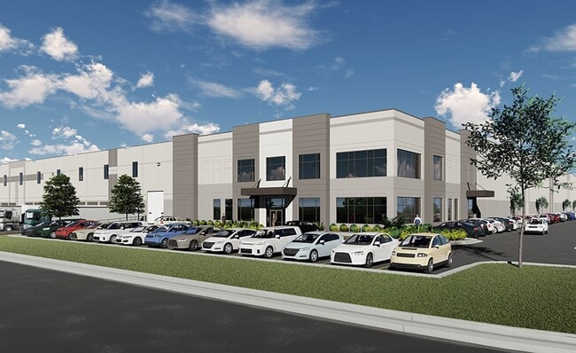
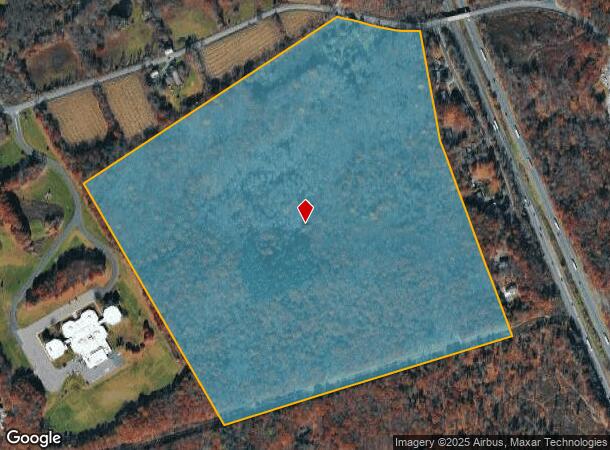
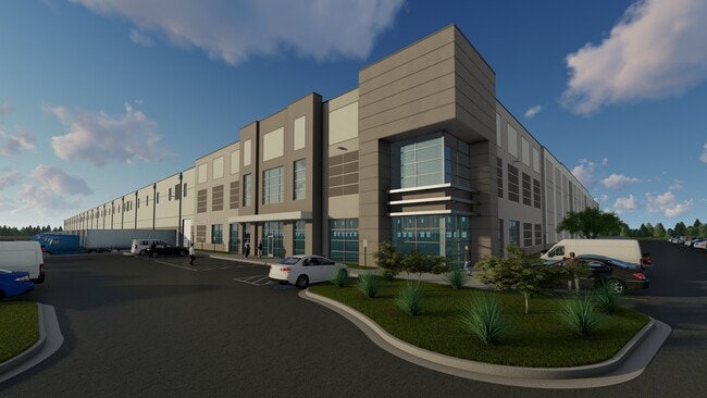
Property Detail
246 Warner Rd
East Stroudsburg, PA
Monroe
12.7.1.27
Pennsylvania
Sfr
82.95 AC
X
Monroe County
42089C0268E
Philadelphia
2,247 SF
DEMOGRAPHICS near 246 Warner Rd
1 Mile
3 Mile
5 Mile
2024 Total Population
797
8,901
26,033
2029 Population
763
8,666
25,449
Pop Growth 2024-2029
(4.27%)
(2.64%)
(2.24%)
Average Age
44
45
44
2024 Total Households
290
3,389
9,639
HH Growth 2024-2029
(4.14%)
(2.54%)
(2.26%)
Median Household Inc
$104,412
$95,428
$89,052
Avg Household Size
2.50
2.60
2.60
2024 Avg HH Vehicles
2.00
2.00
2.00
Median Home Value
$344,761
$303,729
$306,481
Median Year Built
1978
1982
1983
Nearby Places
- Restaurants
- Banks
- Shops
- Fitness
- Groceries
PUBLIC TRANSPORTATION
AIRPORT
Lehigh Valley International
DRIVE
WALK
Distance
Lehigh Valley International
52 min
33.1 mi
Freight Ports
Maher Terminal
DRIVE
WALK
Distance
Maher Terminal
102 min
78.4 mi
Nearby Properties
Address
Land Use
TOTAL SIZE
Lot Size
Zoning
Address
Land Use
TOTAL SIZE
Lot Size
Zoning
463,854 SF
95.86 AC
C
Address
Land Use
TOTAL SIZE
Lot Size
Zoning
64,000 SF
23.31 AC
C
Address
Land Use
TOTAL SIZE
Lot Size
Zoning
124,288 SF
10.58 AC
C
Address
Land Use
TOTAL SIZE
Lot Size
Zoning
40,418 SF
78.43 AC
C
Address
Land Use
TOTAL SIZE
Lot Size
Zoning
85,940 SF
16.19 AC
C-2
Address
Land Use
TOTAL SIZE
Lot Size
Zoning
174,532 SF
56.85 AC
R-2
Address
Land Use
TOTAL SIZE
Lot Size
Zoning
1,024 SF
147.49 AC
RD
Address
Land Use
TOTAL SIZE
Lot Size
Zoning
57,088 SF
58.47 AC
C
Address
Land Use
TOTAL SIZE
Lot Size
Zoning
72,386 SF
19.74 AC
C
Address
Land Use
TOTAL SIZE
Lot Size
Zoning
79,200 SF
67.68 AC
C
Address
Land Use
TOTAL SIZE
Lot Size
Zoning
103,185 SF
39.71 AC
C
Address
Land Use
TOTAL SIZE
Lot Size
Zoning
32,166 SF
3.16 AC
C-2
Address
Land Use
TOTAL SIZE
Lot Size
Zoning
36,626 SF
10.26 AC
R1
Address
Land Use
TOTAL SIZE
Lot Size
Zoning
38,158 SF
9.95 AC
C
Address
Land Use
TOTAL SIZE
Lot Size
Zoning
53,505 SF
Address
Land Use
TOTAL SIZE
Lot Size
Zoning
42,825 SF
1 AC
Address
Land Use
TOTAL SIZE
Lot Size
Zoning
48,622 SF
2.47 AC
C
Address
Land Use
TOTAL SIZE
Lot Size
Zoning
9,450 SF
159 AC
R-1
Address
Land Use
TOTAL SIZE
Lot Size
Zoning
8,400 SF
6.05 AC
C
Address
Land Use
TOTAL SIZE
Lot Size
Zoning
78,842 SF
7.24 AC
RD
Address
Land Use
TOTAL SIZE
Lot Size
Zoning
55,588 SF
12.16 AC
C-2
Address
Land Use
TOTAL SIZE
Lot Size
Zoning
7,767 SF
Address
Land Use
TOTAL SIZE
Lot Size
Zoning
51,060 SF
7 AC
C
Address
Land Use
TOTAL SIZE
Lot Size
Zoning
7,488 SF
5.74 AC
C
Address
Land Use
TOTAL SIZE
Lot Size
Zoning
62,147 SF
39.87 AC
C
Address
Land Use
TOTAL SIZE
Lot Size
Zoning
3,516 SF
24.60 AC
C-2
Address
Land Use
TOTAL SIZE
Lot Size
Zoning
4,106 SF
4.32 AC
C
Address
Land Use
TOTAL SIZE
Lot Size
Zoning
21,900 SF
6.11 AC
R-1
Address
Land Use
TOTAL SIZE
Lot Size
Zoning
2,000 SF
55.50 AC
I
Address
Land Use
TOTAL SIZE
Lot Size
Zoning
20,129 SF
5.20 AC
C
The World's #1 Commercial Real Estate Marketplace
Connect with us
© 2025 CoStar Group
The information above has been obtained from sources believed reliable. While we do not doubt its accuracy we have not verified it and make no guarantee, warranty or representation about it. It is your responsibility to independently confirm its accuracy and completeness. Any projections, opinions, assumptions, or estimates used are for example only and do not represent the current or future performance of the property. The value of this transaction to you depends on tax and other factors which should be evaluated by your tax, financial, and legal advisors. You and your advisors should conduct a careful, independent investigation of the property to determine to your satisfaction the suitability of the property for your needs.