Property Record
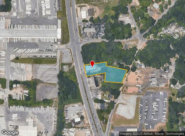
2460 Moreland Ave Se, Atlanta, GA 30315


Current Lease Availabilities
NEARBY LISTINGS FOR SALE OR LEASE
Property Detail
2460 Moreland Ave Se
15-080-08-013
109 X 240 X 42 X 228 X 150 X 188 X 78 X 203..1.47AC 4-29-88
Storebuilding
DeKalb
X
Georgia
13121C0386F
13
2025
1.47 AC
2025
Airport/North Clayton
023802
Atlanta
3,300 SF
Atlanta-Sandy Springs-Roswell, GA
DEMOGRAPHICS near 2460 Moreland Ave Se
1 Mile
3 Mile
5 Mile
2024 Total Population
4,057
56,640
209,300
2029 Population
4,266
58,773
215,017
Pop Growth 2024-2029
+ 5.15%
+ 3.77%
+ 2.73%
Average Age
36
37
37
2024 Total Households
1,135
20,935
86,620
HH Growth 2024-2029
+ 5.99%
+ 3.95%
+ 2.96%
Median Household Inc
$39,652
$53,588
$57,500
Avg Household Size
2.70
2.50
2.30
2024 Avg HH Vehicles
1.00
1.00
1.00
Median Home Value
$197,848
$263,906
$285,760
Median Year Built
1964
1976
1975
Nearby Places
Map Layers
Map Styles
 Street
 Aerial
- Restaurants
- Banks
- Shops
- Fitness
- Groceries
PUBLIC TRANSPORTATION
COMMUTER RAIL
Atlanta (Crescent - Amtrak)
DRIVE
WALK
Distance
Atlanta (Crescent - Amtrak)
17 min
9.5 mi
AIRPORT
Hartsfield - Jackson Atlanta International
DRIVE
WALK
Distance
Hartsfield - Jackson Atlanta International
15 min
8.1 mi
Freight Ports
Georgia Ports - Savannah
DRIVE
WALK
Distance
Georgia Ports - Savannah
270 min
241.4 mi
Nearby Properties
Address
Land Use
TOTAL SIZE
Lot Size
Zoning
Address
Land Use
TOTAL SIZE
Lot Size
Zoning
432,056 SF
17.87 AC
C1
Address
Land Use
TOTAL SIZE
Lot Size
Zoning
595,658 SF
4.09 AC
I1
Address
Land Use
TOTAL SIZE
Lot Size
Zoning
54 AC
I2
Address
Land Use
TOTAL SIZE
Lot Size
Zoning
436,143 SF
2.90 AC
I1
Address
Land Use
TOTAL SIZE
Lot Size
Zoning
828,718 SF
2.60 AC
I1
Address
Land Use
TOTAL SIZE
Lot Size
Zoning
318,300 SF
4.60 AC
I1
Address
Land Use
TOTAL SIZE
Lot Size
Zoning
381,983 SF
52.54 AC
M
Address
Land Use
TOTAL SIZE
Lot Size
Zoning
210,538 SF
101.40 AC
X
Address
Land Use
TOTAL SIZE
Lot Size
Zoning
313,734 SF
22.60 AC
R5
Address
Land Use
TOTAL SIZE
Lot Size
Zoning
295,632 SF
19.26 AC
RM75
Address
Land Use
TOTAL SIZE
Lot Size
Zoning
381,923 SF
19.72 AC
M
Address
Land Use
TOTAL SIZE
Lot Size
Zoning
7.65 AC
R5
Address
Land Use
TOTAL SIZE
Lot Size
Zoning
375,336 SF
22.76 AC
M
Address
Land Use
TOTAL SIZE
Lot Size
Zoning
59,807 SF
43.70 AC
X
Address
Land Use
TOTAL SIZE
Lot Size
Zoning
150,899 SF
21.89 AC
X
Address
Land Use
TOTAL SIZE
Lot Size
Zoning
12 AC
R4
Address
Land Use
TOTAL SIZE
Lot Size
Zoning
814,461 SF
29.12 AC
RG2
Address
Land Use
TOTAL SIZE
Lot Size
Zoning
402,544 SF
20.43 AC
I1
Address
Land Use
TOTAL SIZE
Lot Size
Zoning
118,310 SF
10.90 AC
RM85
Address
Land Use
TOTAL SIZE
Lot Size
Zoning
44,365 SF
17.77 AC
M
Address
Land Use
TOTAL SIZE
Lot Size
Zoning
87,382 SF
83.24 AC
I1C
Address
Land Use
TOTAL SIZE
Lot Size
Zoning
86,071 SF
18 AC
M
Address
Land Use
TOTAL SIZE
Lot Size
Zoning
403,328 SF
31.30 AC
I1
Address
Land Use
TOTAL SIZE
Lot Size
Zoning
91,446 SF
14.80 AC
RM85
Address
Land Use
TOTAL SIZE
Lot Size
Zoning
1,150,236 SF
16.70 AC
RG2
Address
Land Use
TOTAL SIZE
Lot Size
Zoning
13,108 SF
28.02 AC
M
Address
Land Use
TOTAL SIZE
Lot Size
Zoning
129,064 SF
13.29 AC
RM75
Address
Land Use
TOTAL SIZE
Lot Size
Zoning
69,384 SF
29.86 AC
OD
Address
Land Use
TOTAL SIZE
Lot Size
Zoning
178,495 SF
14.47 AC
RM100
Address
Land Use
TOTAL SIZE
Lot Size
Zoning
The World's #1 Commercial Real Estate Marketplace
Connect with us
© 2025 CoStar Group
The information above has been obtained from sources believed reliable. While we do not doubt its accuracy we have not verified it and make no guarantee, warranty or representation about it. It is your responsibility to independently confirm its accuracy and completeness. Any projections, opinions, assumptions, or estimates used are for example only and do not represent the current or future performance of the property. The value of this transaction to you depends on tax and other factors which should be evaluated by your tax, financial, and legal advisors. You and your advisors should conduct a careful, independent investigation of the property to determine to your satisfaction the suitability of the property for your needs.