Property Record
2460 W Whitestone Blvd, Cedar Park, TX 78613
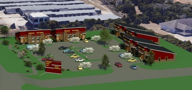


This Property Is For Sale
Property Detail
2460 W Whitestone Blvd
Austin-Round Rock-San Marcos, TX
LOT 1 *(1.94 ACR) VISTA RIDGE OAKS
186281
TRAVIS
Vacantlandnec
Texas
B and X Area of moderate flood hazard, usually the area between the limits of the 100-year and 500-year floods.
1
2025
1.94 AC
2025
Far Northwest
035600
Austin
NEARBY LISTINGS FOR SALE OR LEASE
DEMOGRAPHICS near 2460 W Whitestone Blvd
1 mile
3 mile
5 mile
2025 Total Population
6,264
66,575
163,225
2030 Population
7,011
74,160
183,493
Pop Growth 2025-2030
+ 11.93%
+ 11.39%
+ 12.42%
Average Age
39
38
38
2025 Total Households
2,158
23,518
59,314
HH Growth 2025-2030
+ 12.51%
+ 12.10%
+ 13.03%
Median Household Inc
$140,213
$132,005
$124,709
Avg Household Size
2.90
2.80
2.70
2025 Avg HH Vehicles
2.00
2.00
2.00
Median Home Value
$458,864
$499,999
$495,124
Median Year Built
2000
2003
2006
Nearby Places
Map Layers
Map Styles
 Street
 Aerial
Transit
 Traffic
 Biking
Places
Listings with unknown addresses are not visible on the map
- Restaurants
- Banks
- Shops
- Fitness
- Groceries
PUBLIC TRANSPORTATION
COMMUTER RAIL
Leander Station (Capital MetroRail - Capital Metropolitan Transportation Authority Rail (MetroRail))
Drive
Walk
Distance
Leander Station (Capital MetroRail - Capital Metropolitan Transportation Authority Rail (MetroRail))
12 min
7.1 mi
Lakeline Station (Capital MetroRail - Capital Metropolitan Transportation Authority Rail (MetroRail))
Drive
Walk
Distance
Lakeline Station (Capital MetroRail - Capital Metropolitan Transportation Authority Rail (MetroRail))
13 min
7.7 mi
AIRPORT
Austin-Bergstrom International
Drive
Walk
Distance
Austin-Bergstrom International
42 min
34.9 mi
Nearby Properties
Address
Land Use
TOTAL SIZE
Lot Size
Zoning
Address
Land Use
TOTAL SIZE
Lot Size
Zoning
320,454 SF
19.56 AC
Address
Land Use
TOTAL SIZE
Lot Size
Zoning
324,508 SF
24.08 AC
Address
Land Use
TOTAL SIZE
Lot Size
Zoning
223,681 SF
7.78 AC
Address
Land Use
TOTAL SIZE
Lot Size
Zoning
250,556 SF
17.51 AC
Address
Land Use
TOTAL SIZE
Lot Size
Zoning
180,799 SF
22.90 AC
Address
Land Use
TOTAL SIZE
Lot Size
Zoning
276,029 SF
7.63 AC
Address
Land Use
TOTAL SIZE
Lot Size
Zoning
151,181 SF
6 AC
Address
Land Use
TOTAL SIZE
Lot Size
Zoning
240,800 SF
17.16 AC
Address
Land Use
TOTAL SIZE
Lot Size
Zoning
264,140 SF
21.37 AC
Address
Land Use
TOTAL SIZE
Lot Size
Zoning
111,518 SF
15.55 AC
Address
Land Use
TOTAL SIZE
Lot Size
Zoning
173,199 SF
7.66 AC
Address
Land Use
TOTAL SIZE
Lot Size
Zoning
47,009 SF
1.59 AC
Address
Land Use
TOTAL SIZE
Lot Size
Zoning
201,900 SF
33.81 AC
Address
Land Use
TOTAL SIZE
Lot Size
Zoning
136,829 SF
6.72 AC
Address
Land Use
TOTAL SIZE
Lot Size
Zoning
123,858 SF
6.06 AC
Address
Land Use
TOTAL SIZE
Lot Size
Zoning
60 AC
1-SFU
Address
Land Use
TOTAL SIZE
Lot Size
Zoning
207,697 SF
26.25 AC
4-GR
Address
Land Use
TOTAL SIZE
Lot Size
Zoning
99,223 SF
8.90 AC
Address
Land Use
TOTAL SIZE
Lot Size
Zoning
34,824 SF
4.53 AC
4-GR
Address
Land Use
TOTAL SIZE
Lot Size
Zoning
197,911 SF
9.74 AC
Address
Land Use
TOTAL SIZE
Lot Size
Zoning
151,029 SF
16.70 AC
Address
Land Use
TOTAL SIZE
Lot Size
Zoning
77,818 SF
9.80 AC
Address
Land Use
TOTAL SIZE
Lot Size
Zoning
33.13 AC
Address
Land Use
TOTAL SIZE
Lot Size
Zoning
121,524 SF
9.34 AC
Address
Land Use
TOTAL SIZE
Lot Size
Zoning
58,651 SF
5.33 AC
Address
Land Use
TOTAL SIZE
Lot Size
Zoning
158,700 SF
7.82 AC
Address
Land Use
TOTAL SIZE
Lot Size
Zoning
82,798 SF
9.28 AC
Address
Land Use
TOTAL SIZE
Lot Size
Zoning
Address
Land Use
TOTAL SIZE
Lot Size
Zoning
102,717 SF
6.93 AC
Address
Land Use
TOTAL SIZE
Lot Size
Zoning
157,330 SF
5.65 AC
The World's #1 Commercial Real Estate Marketplace
Connect with us
© 2026 CoStar Group
The information above has been obtained from sources believed reliable. While we do not doubt its accuracy we have not verified it and make no guarantee, warranty or representation about it. It is your responsibility to independently confirm its accuracy and completeness. Any projections, opinions, assumptions, or estimates used are for example only and do not represent the current or future performance of the property. The value of this transaction to you depends on tax and other factors which should be evaluated by your tax, financial, and legal advisors. You and your advisors should conduct a careful, independent investigation of the property to determine to your satisfaction the suitability of the property for your needs.