Property Record
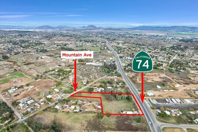
24603 Highway 74, Perris, CA 92570


NEARBY LISTINGS FOR SALE OR LEASE
Property Detail
24603 Highway 74
Inland Empire (California)
Good Hope Ac Add 1
Riverside-San Bernardino-Ontario, CA
Riverside
342-140-002
California
Residentialnec
1.38 AC
D
Moreno Valley/Perris
06065C1420G
DEMOGRAPHICS near 24603 Highway 74
1 Mile
3 Mile
5 Mile
2024 Total Population
3,526
32,783
96,046
2029 Population
3,703
34,711
101,776
Pop Growth 2024-2029
+ 5.02%
+ 5.88%
+ 5.97%
Average Age
33
33
35
2024 Total Households
815
8,038
25,491
HH Growth 2024-2029
+ 4.66%
+ 5.62%
+ 5.65%
Median Household Inc
$50,488
$64,446
$68,708
Avg Household Size
4.10
3.90
3.60
2024 Avg HH Vehicles
3.00
3.00
2.00
Median Home Value
$299,397
$352,262
$359,223
Median Year Built
1980
1986
1989
Nearby Places
Map Layers
Map Styles
 Street
 Aerial
- Restaurants
- Banks
- Shops
- Fitness
- Groceries
PUBLIC TRANSPORTATION
COMMUTER RAIL
Perris Downtown (Metrolink 91-Perris Valley Line - Metrolink Trains)
DRIVE
WALK
Distance
Perris Downtown (Metrolink 91-Perris Valley Line - Metrolink Trains)
4 min
2.7 mi
South Perris (Metrolink 91-Perris Valley Line - Metrolink Trains)
DRIVE
WALK
Distance
South Perris (Metrolink 91-Perris Valley Line - Metrolink Trains)
7 min
4.7 mi
AIRPORT
Ontario International
DRIVE
WALK
Distance
Ontario International
46 min
36.8 mi
Freight Ports
Port of Long Beach
DRIVE
WALK
Distance
Port of Long Beach
88 min
69.3 mi
SALE & LEASE HISTORY
LISTING DATE
SALE/LEASE

Sep 17, 2024
For Sale
Jan 12, 2024
For Sale
Nearby Properties
Address
Land Use
TOTAL SIZE
Lot Size
Zoning
Address
Land Use
TOTAL SIZE
Lot Size
Zoning
57,600 SF
51.69 AC
Address
Land Use
TOTAL SIZE
Lot Size
Zoning
1,080 SF
9.53 AC
A02
Address
Land Use
TOTAL SIZE
Lot Size
Zoning
1,018,178 SF
57.91 AC
Address
Land Use
TOTAL SIZE
Lot Size
Zoning
3,750 SF
37.79 AC
GI
Address
Land Use
TOTAL SIZE
Lot Size
Zoning
13,489 SF
6.18 AC
R3
Address
Land Use
TOTAL SIZE
Lot Size
Zoning
198.39 AC
RR
Address
Land Use
TOTAL SIZE
Lot Size
Zoning
17,976 SF
6.03 AC
Address
Land Use
TOTAL SIZE
Lot Size
Zoning
17,776 SF
14.92 AC
Address
Land Use
TOTAL SIZE
Lot Size
Zoning
5,460 SF
5.60 AC
M2
Address
Land Use
TOTAL SIZE
Lot Size
Zoning
27,448 SF
0.95 AC
M1
Address
Land Use
TOTAL SIZE
Lot Size
Zoning
80,158 SF
2.47 AC
DTSP
Address
Land Use
TOTAL SIZE
Lot Size
Zoning
71,741 SF
32.78 AC
Address
Land Use
TOTAL SIZE
Lot Size
Zoning
25,645 SF
1.79 AC
C2
Address
Land Use
TOTAL SIZE
Lot Size
Zoning
103,450 SF
8.93 AC
Address
Land Use
TOTAL SIZE
Lot Size
Zoning
8,900 SF
1.68 AC
C1
Address
Land Use
TOTAL SIZE
Lot Size
Zoning
45,250 SF
5.19 AC
M4
Address
Land Use
TOTAL SIZE
Lot Size
Zoning
103,450 SF
9.57 AC
Address
Land Use
TOTAL SIZE
Lot Size
Zoning
59,711 SF
2.60 AC
Address
Land Use
TOTAL SIZE
Lot Size
Zoning
77,850 SF
12.14 AC
LI
Address
Land Use
TOTAL SIZE
Lot Size
Zoning
50,460 SF
2.53 AC
Address
Land Use
TOTAL SIZE
Lot Size
Zoning
50,120 SF
2.51 AC
The World's #1 Commercial Real Estate Marketplace
Connect with us
© 2025 CoStar Group
The information above has been obtained from sources believed reliable. While we do not doubt its accuracy we have not verified it and make no guarantee, warranty or representation about it. It is your responsibility to independently confirm its accuracy and completeness. Any projections, opinions, assumptions, or estimates used are for example only and do not represent the current or future performance of the property. The value of this transaction to you depends on tax and other factors which should be evaluated by your tax, financial, and legal advisors. You and your advisors should conduct a careful, independent investigation of the property to determine to your satisfaction the suitability of the property for your needs.