Property Record
24640 Southpoint Dr, Chantilly, VA 20152


NEARBY LISTINGS FOR SALE OR LEASE
Property Detail
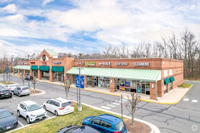
24640 Southpoint Dr
Washington-Arlington-Alexandria, DC-VA-MD-WV
Gum Spring Village
204-20-2346
GUM SPRING VILLAGE CENTER LOT 2 200605030039383 200712050084381P
Regionalshoppingcenterormallwithanchorstore
Loudoun
X
Virginia
51107C0370E
2
2025
5.76 AC
2025
Leesburg/West Loudoun
611807
Washington, DC
40,146 SF
DEMOGRAPHICS near 24640 Southpoint Dr
1 Mile
3 Mile
5 Mile
2024 Total Population
12,022
79,499
132,249
2029 Population
13,003
86,053
142,938
Pop Growth 2024-2029
+ 8.16%
+ 8.24%
+ 8.08%
Average Age
34
34
34
2024 Total Households
4,004
23,874
39,760
HH Growth 2024-2029
+ 8.44%
+ 8.39%
+ 8.18%
Median Household Inc
$160,684
$181,958
$187,885
Avg Household Size
3.00
3.30
3.30
2024 Avg HH Vehicles
2.00
2.00
2.00
Median Home Value
$639,254
$724,470
$735,295
Median Year Built
2010
2010
2010
Nearby Places
Map Layers
Map Styles
 Street
 Aerial
- Restaurants
- Banks
- Shops
- Fitness
- Groceries
PUBLIC TRANSPORTATION
AIRPORT
Washington Dulles International
DRIVE
WALK
Distance
Washington Dulles International
23 min
10.8 mi
Ronald Reagan Washington Ntl
DRIVE
WALK
Distance
Ronald Reagan Washington Ntl
50 min
33.0 mi
SALE & LEASE HISTORY
LISTING DATE
SALE/LEASE

Sep 25, 2016
For Lease
Nov 22, 2017
For Lease
Jul 12, 2017
For Lease
Jan 11, 2018
For Lease
Dec 05, 2017
For Lease
Nearby Properties
Address
Land Use
TOTAL SIZE
Lot Size
Zoning
Address
Land Use
TOTAL SIZE
Lot Size
Zoning
525,482 SF
39.73 AC
PDGI
Address
Land Use
TOTAL SIZE
Lot Size
Zoning
669,358 SF
39.88 AC
IP
Address
Land Use
TOTAL SIZE
Lot Size
Zoning
538,565 SF
135.31 AC
PDIP
Address
Land Use
TOTAL SIZE
Lot Size
Zoning
778,426 SF
48.02 AC
CLI
Address
Land Use
TOTAL SIZE
Lot Size
Zoning
695,321 SF
63.54 AC
PDGI
Address
Land Use
TOTAL SIZE
Lot Size
Zoning
204,014 SF
23.47 AC
PDIP
Address
Land Use
TOTAL SIZE
Lot Size
Zoning
252,600 SF
33.26 AC
PDIP
Address
Land Use
TOTAL SIZE
Lot Size
Zoning
759,405 SF
64.76 AC
IP
Address
Land Use
TOTAL SIZE
Lot Size
Zoning
49.36 AC
IP
Address
Land Use
TOTAL SIZE
Lot Size
Zoning
536,602 SF
117.49 AC
TR3UBF
Address
Land Use
TOTAL SIZE
Lot Size
Zoning
415,477 SF
97.76 AC
TR1UBF
Address
Land Use
TOTAL SIZE
Lot Size
Zoning
222,313 SF
36.21 AC
PDOP
Address
Land Use
TOTAL SIZE
Lot Size
Zoning
422,597 SF
85.43 AC
TR3UBF
Address
Land Use
TOTAL SIZE
Lot Size
Zoning
327,400 SF
37.53 AC
PDGI
Address
Land Use
TOTAL SIZE
Lot Size
Zoning
48.30 AC
PDIP
Address
Land Use
TOTAL SIZE
Lot Size
Zoning
59.20 AC
IP
Address
Land Use
TOTAL SIZE
Lot Size
Zoning
181,718 SF
10.23 AC
R16
Address
Land Use
TOTAL SIZE
Lot Size
Zoning
303,168 SF
41.95 AC
PDCCRC
Address
Land Use
TOTAL SIZE
Lot Size
Zoning
264,902 SF
60.25 AC
PDH4
Address
Land Use
TOTAL SIZE
Lot Size
Zoning
54 AC
PDTC
Address
Land Use
TOTAL SIZE
Lot Size
Zoning
192,413 SF
30.38 AC
TR3UBF
Address
Land Use
TOTAL SIZE
Lot Size
Zoning
234,264 SF
66.14 AC
PDGI
Address
Land Use
TOTAL SIZE
Lot Size
Zoning
39.89 AC
PDGI
Address
Land Use
TOTAL SIZE
Lot Size
Zoning
177,740 SF
36.92 AC
TR3LF
Address
Land Use
TOTAL SIZE
Lot Size
Zoning
1,848 SF
21.23 AC
PDIP
Address
Land Use
TOTAL SIZE
Lot Size
Zoning
107,378 SF
16.86 AC
PDH4
Address
Land Use
TOTAL SIZE
Lot Size
Zoning
169,872 SF
33.51 AC
PDH4
Address
Land Use
TOTAL SIZE
Lot Size
Zoning
72.66 AC
PDAAAR
The World's #1 Commercial Real Estate Marketplace
Connect with us
© 2025 CoStar Group
The information above has been obtained from sources believed reliable. While we do not doubt its accuracy we have not verified it and make no guarantee, warranty or representation about it. It is your responsibility to independently confirm its accuracy and completeness. Any projections, opinions, assumptions, or estimates used are for example only and do not represent the current or future performance of the property. The value of this transaction to you depends on tax and other factors which should be evaluated by your tax, financial, and legal advisors. You and your advisors should conduct a careful, independent investigation of the property to determine to your satisfaction the suitability of the property for your needs.