Property Record
2467 Highway 306, Des Allemands, LA 70030

NEARBY LISTINGS FOR SALE OR LEASE
-
-
View all Des Allemands listings for sale on LoopNet.com
Property Detail
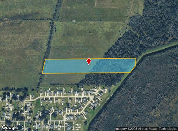
2467 Highway 306
New Orleans/Metairie/Kenner
Sunset Drainage Dist #1
New Orleans-Metairie, LA
1.LOTS 886, 887, 888, AND PORT. OF LOTS 927, 928, 929, 930, 931, 932, 933, 934, 935, 936, 943, 944, 945, 946, 947, 948, 949,
40348870887A
St Charles
Agriculturalland
Louisiana
2024
886,887
2024
244.49 AC
063200
St Charles Parish
DEMOGRAPHICS near 2467 Highway 306
1 Mile
3 Mile
5 Mile
2024 Total Population
1,621
3,106
5,581
2029 Population
1,595
3,048
5,445
Pop Growth 2024-2029
(1.60%)
(1.87%)
(2.44%)
Average Age
40
40
41
2024 Total Households
586
1,130
2,048
HH Growth 2024-2029
(1.54%)
(1.86%)
(2.44%)
Median Household Inc
$100,087
$93,508
$83,572
Avg Household Size
2.80
2.70
2.60
2024 Avg HH Vehicles
2.00
2.00
2.00
Median Home Value
$312,014
$294,090
$223,472
Median Year Built
1998
1995
1988
Nearby Places
Map Layers
Map Styles
 Street
 Aerial
- Restaurants
- Banks
- Shops
- Fitness
- Groceries
PUBLIC TRANSPORTATION
AIRPORT
Louis Armstrong New Orleans International
DRIVE
WALK
Distance
Louis Armstrong New Orleans International
34 min
22.6 mi
Freight Ports
Port of New Orleans
DRIVE
WALK
Distance
Port of New Orleans
55 min
37.2 mi
SALE & LEASE HISTORY
LISTING DATE
SALE/LEASE

Jun 10, 2021
For Sale
Dec 15, 2023
For Sale
Nearby Properties
Address
Land Use
TOTAL SIZE
Lot Size
Zoning
Address
Land Use
TOTAL SIZE
Lot Size
Zoning
10.67 AC
Address
Land Use
TOTAL SIZE
Lot Size
Zoning
Address
Land Use
TOTAL SIZE
Lot Size
Zoning
Address
Land Use
TOTAL SIZE
Lot Size
Zoning
Address
Land Use
TOTAL SIZE
Lot Size
Zoning
0.79 AC
Address
Land Use
TOTAL SIZE
Lot Size
Zoning
0.79 AC
Address
Land Use
TOTAL SIZE
Lot Size
Zoning
0.71 AC
Address
Land Use
TOTAL SIZE
Lot Size
Zoning
1.50 AC
Address
Land Use
TOTAL SIZE
Lot Size
Zoning
Address
Land Use
TOTAL SIZE
Lot Size
Zoning
14.02 AC
Address
Land Use
TOTAL SIZE
Lot Size
Zoning
Address
Land Use
TOTAL SIZE
Lot Size
Zoning
Address
Land Use
TOTAL SIZE
Lot Size
Zoning
Address
Land Use
TOTAL SIZE
Lot Size
Zoning
Address
Land Use
TOTAL SIZE
Lot Size
Zoning
Address
Land Use
TOTAL SIZE
Lot Size
Zoning
7,085 SF
0.43 AC
Address
Land Use
TOTAL SIZE
Lot Size
Zoning
6,400 SF
0.46 AC
Address
Land Use
TOTAL SIZE
Lot Size
Zoning
Address
Land Use
TOTAL SIZE
Lot Size
Zoning
31.95 AC
Address
Land Use
TOTAL SIZE
Lot Size
Zoning
31.95 AC
Address
Land Use
TOTAL SIZE
Lot Size
Zoning
22.50 AC
Address
Land Use
TOTAL SIZE
Lot Size
Zoning
2.79 AC
Address
Land Use
TOTAL SIZE
Lot Size
Zoning
Address
Land Use
TOTAL SIZE
Lot Size
Zoning
Address
Land Use
TOTAL SIZE
Lot Size
Zoning
2,400 SF
0.24 AC
Address
Land Use
TOTAL SIZE
Lot Size
Zoning
Address
Land Use
TOTAL SIZE
Lot Size
Zoning
Address
Land Use
TOTAL SIZE
Lot Size
Zoning
1,219 SF
10 AC
Address
Land Use
TOTAL SIZE
Lot Size
Zoning
Address
Land Use
TOTAL SIZE
Lot Size
Zoning
4.76 AC
The World's #1 Commercial Real Estate Marketplace
Connect with us
© 2025 CoStar Group
The information above has been obtained from sources believed reliable. While we do not doubt its accuracy we have not verified it and make no guarantee, warranty or representation about it. It is your responsibility to independently confirm its accuracy and completeness. Any projections, opinions, assumptions, or estimates used are for example only and do not represent the current or future performance of the property. The value of this transaction to you depends on tax and other factors which should be evaluated by your tax, financial, and legal advisors. You and your advisors should conduct a careful, independent investigation of the property to determine to your satisfaction the suitability of the property for your needs.