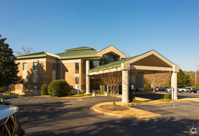
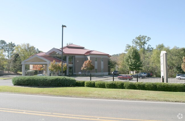
Property Record
2470 Rocky Ridge Rd, Vestavia, AL 35243

NEARBY LISTINGS FOR SALE OR LEASE
Property Detail
2470 Rocky Ridge Rd
Birmingham-Hoover, AL
Healthsouth Sur 28-32-3
28-00-32-3-002-046.000
LOT 1 HEALTHSOUTH SURVEY PB 177 PG 18
Medicalbuilding
Jefferson
X
Alabama
01117C0067F
1
2023
1.37 AC
2024
Hwy 280/Jefferson County
012917
Birmingham
15,180 SF
DEMOGRAPHICS near 2470 Rocky Ridge Rd
1 Mile
3 Mile
5 Mile
2024 Total Population
5,631
56,262
152,025
2029 Population
5,405
55,208
151,357
Pop Growth 2024-2029
(4.01%)
(1.87%)
(0.44%)
Average Age
42
40
39
2024 Total Households
2,119
23,699
63,839
HH Growth 2024-2029
(4.06%)
(2.01%)
(0.52%)
Median Household Inc
$112,160
$83,317
$86,315
Avg Household Size
2.60
2.30
2.30
2024 Avg HH Vehicles
2.00
2.00
2.00
Median Home Value
$463,968
$373,835
$373,086
Median Year Built
1978
1980
1982
Nearby Places
Map Layers
Map Styles
 Street
 Aerial
- Restaurants
- Banks
- Shops
- Fitness
- Groceries
PUBLIC TRANSPORTATION
COMMUTER RAIL
Birmingham (Crescent - Amtrak)
DRIVE
WALK
Distance
Birmingham (Crescent - Amtrak)
14 min
8.9 mi
AIRPORT
Birmingham-Shuttlesworth International
DRIVE
WALK
Distance
Birmingham-Shuttlesworth International
20 min
12.6 mi
Freight Ports
Port of Mobile
DRIVE
WALK
Distance
Port of Mobile
273 min
249.1 mi
Nearby Properties
Address
Land Use
TOTAL SIZE
Lot Size
Zoning
Address
Land Use
TOTAL SIZE
Lot Size
Zoning
212,615 SF
19.66 AC
B-2
Address
Land Use
TOTAL SIZE
Lot Size
Zoning
140,853 SF
27 AC
B-2
Address
Land Use
TOTAL SIZE
Lot Size
Zoning
7,280 SF
35 AC
Address
Land Use
TOTAL SIZE
Lot Size
Zoning
200,927 SF
19 AC
PMUD
Address
Land Use
TOTAL SIZE
Lot Size
Zoning
169,501 SF
18 AC
E-2
Address
Land Use
TOTAL SIZE
Lot Size
Zoning
235,082 SF
26.10 AC
C1
Address
Land Use
TOTAL SIZE
Lot Size
Zoning
102,373 SF
12.33 AC
R1-E
Address
Land Use
TOTAL SIZE
Lot Size
Zoning
344,434 SF
15.52 AC
R4
Address
Land Use
TOTAL SIZE
Lot Size
Zoning
321,157 SF
33 AC
C
Address
Land Use
TOTAL SIZE
Lot Size
Zoning
365,402 SF
25 AC
R4
Address
Land Use
TOTAL SIZE
Lot Size
Zoning
125,165 SF
8.07 AC
CP
Address
Land Use
TOTAL SIZE
Lot Size
Zoning
265,418 SF
26.55 AC
R2
Address
Land Use
TOTAL SIZE
Lot Size
Zoning
62,516 SF
1.37 AC
I3
Address
Land Use
TOTAL SIZE
Lot Size
Zoning
294,855 SF
30 AC
R4
Address
Land Use
TOTAL SIZE
Lot Size
Zoning
121,872 SF
8.70 AC
PB
Address
Land Use
TOTAL SIZE
Lot Size
Zoning
170,850 SF
9.31 AC
INST
Address
Land Use
TOTAL SIZE
Lot Size
Zoning
252,432 SF
17.99 AC
R5
Address
Land Use
TOTAL SIZE
Lot Size
Zoning
285,719 SF
18 AC
R-4
Address
Land Use
TOTAL SIZE
Lot Size
Zoning
219,277 SF
22.50 AC
R5
Address
Land Use
TOTAL SIZE
Lot Size
Zoning
94,126 SF
10 AC
C-1
Address
Land Use
TOTAL SIZE
Lot Size
Zoning
218,354 SF
15.23 AC
R4
Address
Land Use
TOTAL SIZE
Lot Size
Zoning
195,150 SF
11 AC
R-5
Address
Land Use
TOTAL SIZE
Lot Size
Zoning
32,088 SF
15.63 AC
C1
Address
Land Use
TOTAL SIZE
Lot Size
Zoning
165,328 SF
12 AC
R6C
Address
Land Use
TOTAL SIZE
Lot Size
Zoning
76,816 SF
4.90 AC
PO
Address
Land Use
TOTAL SIZE
Lot Size
Zoning
51,597 SF
6 AC
MU
Address
Land Use
TOTAL SIZE
Lot Size
Zoning
52,239 SF
9 AC
PMUD
Address
Land Use
TOTAL SIZE
Lot Size
Zoning
221,936 SF
14.18 AC
R4
Address
Land Use
TOTAL SIZE
Lot Size
Zoning
306,182 SF
15.37 AC
R4
Address
Land Use
TOTAL SIZE
Lot Size
Zoning
2.60 AC
C1
The World's #1 Commercial Real Estate Marketplace
Connect with us
© 2025 CoStar Group
The information above has been obtained from sources believed reliable. While we do not doubt its accuracy we have not verified it and make no guarantee, warranty or representation about it. It is your responsibility to independently confirm its accuracy and completeness. Any projections, opinions, assumptions, or estimates used are for example only and do not represent the current or future performance of the property. The value of this transaction to you depends on tax and other factors which should be evaluated by your tax, financial, and legal advisors. You and your advisors should conduct a careful, independent investigation of the property to determine to your satisfaction the suitability of the property for your needs.