Property Record
2471 Elk Grove Blvd, Elk Grove, CA 95758


NEARBY LISTINGS FOR SALE OR LEASE
Property Detail
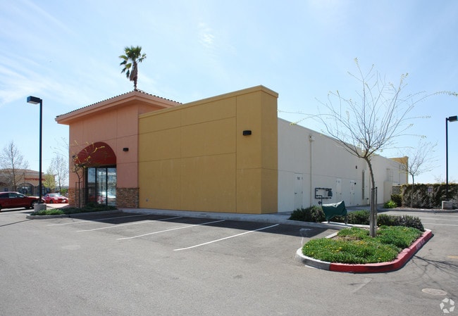
2471 Elk Grove Blvd
Sacramento-Roseville-Folsom, CA
Parcel Map- Harbour Palms Commercial Cen
119-1920-051
PORTION LOT6
Storebuilding
Sacramento
X
California
06067C0315J
1
2024
1.16 AC
2025
Elk Grove
009622
Sacramento
8,125 SF
DEMOGRAPHICS near 2471 Elk Grove Blvd
1 Mile
3 Mile
5 Mile
2024 Total Population
14,211
63,869
170,684
2029 Population
14,245
63,985
171,842
Pop Growth 2024-2029
+ 0.24%
+ 0.18%
+ 0.68%
Average Age
40
39
38
2024 Total Households
4,691
20,199
51,961
HH Growth 2024-2029
+ 0.26%
+ 0.14%
+ 0.65%
Median Household Inc
$129,596
$113,966
$97,310
Avg Household Size
3.00
3.10
3.20
2024 Avg HH Vehicles
2.00
2.00
2.00
Median Home Value
$657,171
$570,655
$485,161
Median Year Built
2001
1999
1997
Nearby Places
Map Layers
Map Styles
 Street
 Aerial
- Restaurants
- Banks
- Shops
- Fitness
- Groceries
PUBLIC TRANSPORTATION
AIRPORT
Sacramento International
DRIVE
WALK
Distance
Sacramento International
32 min
24.0 mi
Freight Ports
Port of Stockton
DRIVE
WALK
Distance
Port of Stockton
41 min
34.2 mi
SALE & LEASE HISTORY
LISTING DATE
SALE/LEASE

Mar 21, 2017
For Lease
Feb 06, 2019
For Lease
Nearby Properties
Address
Land Use
TOTAL SIZE
Lot Size
Zoning
Address
Land Use
TOTAL SIZE
Lot Size
Zoning
306,028 SF
9.74 AC
LI
Address
Land Use
TOTAL SIZE
Lot Size
Zoning
468,870 SF
26.55 AC
RD-20
Address
Land Use
TOTAL SIZE
Lot Size
Zoning
265,222 SF
14.42 AC
RD-20
Address
Land Use
TOTAL SIZE
Lot Size
Zoning
156,330 SF
8.44 AC
LI
Address
Land Use
TOTAL SIZE
Lot Size
Zoning
359,648 SF
17.23 AC
RD-25
Address
Land Use
TOTAL SIZE
Lot Size
Zoning
192,518 SF
8.97 AC
RD-20
Address
Land Use
TOTAL SIZE
Lot Size
Zoning
94,585 SF
5.73 AC
RD-30
Address
Land Use
TOTAL SIZE
Lot Size
Zoning
207,000 SF
11.53 AC
LI
Address
Land Use
TOTAL SIZE
Lot Size
Zoning
150,328 SF
9.23 AC
LI
Address
Land Use
TOTAL SIZE
Lot Size
Zoning
153,541 SF
8.36 AC
LI
Address
Land Use
TOTAL SIZE
Lot Size
Zoning
186,980 SF
20.88 AC
GC
Address
Land Use
TOTAL SIZE
Lot Size
Zoning
166,850 SF
7.93 AC
LI
Address
Land Use
TOTAL SIZE
Lot Size
Zoning
23,545 SF
9.83 AC
PS
Address
Land Use
TOTAL SIZE
Lot Size
Zoning
66,205 SF
5.95 AC
GC
Address
Land Use
TOTAL SIZE
Lot Size
Zoning
75,080 SF
7.76 AC
MP
Address
Land Use
TOTAL SIZE
Lot Size
Zoning
132,455 SF
6.45 AC
LI
Address
Land Use
TOTAL SIZE
Lot Size
Zoning
108,246 SF
8.82 AC
RD-20
Address
Land Use
TOTAL SIZE
Lot Size
Zoning
47,900 SF
4.89 AC
GC
Address
Land Use
TOTAL SIZE
Lot Size
Zoning
81,841 SF
3.52 AC
MP
Address
Land Use
TOTAL SIZE
Lot Size
Zoning
45 AC
M2
Address
Land Use
TOTAL SIZE
Lot Size
Zoning
109,300 SF
8.97 AC
MP
Address
Land Use
TOTAL SIZE
Lot Size
Zoning
25.22 AC
SPASEPA
Address
Land Use
TOTAL SIZE
Lot Size
Zoning
39,588 SF
1.23 AC
GC
Address
Land Use
TOTAL SIZE
Lot Size
Zoning
86,034 SF
5.03 AC
MP
Address
Land Use
TOTAL SIZE
Lot Size
Zoning
118,600 SF
14.22 AC
LI
Address
Land Use
TOTAL SIZE
Lot Size
Zoning
Address
Land Use
TOTAL SIZE
Lot Size
Zoning
68,244 SF
2.57 AC
GC
Address
Land Use
TOTAL SIZE
Lot Size
Zoning
10,570 SF
1.15 AC
GC
Address
Land Use
TOTAL SIZE
Lot Size
Zoning
45,540 SF
4.20 AC
GC
Address
Land Use
TOTAL SIZE
Lot Size
Zoning
27,199 SF
4.26 AC
RD-20
The World's #1 Commercial Real Estate Marketplace
Connect with us
© 2026 CoStar Group
The information above has been obtained from sources believed reliable. While we do not doubt its accuracy we have not verified it and make no guarantee, warranty or representation about it. It is your responsibility to independently confirm its accuracy and completeness. Any projections, opinions, assumptions, or estimates used are for example only and do not represent the current or future performance of the property. The value of this transaction to you depends on tax and other factors which should be evaluated by your tax, financial, and legal advisors. You and your advisors should conduct a careful, independent investigation of the property to determine to your satisfaction the suitability of the property for your needs.