Property Record
2471 W Horizon Ridge Pky, Henderson, NV 89052


NEARBY LISTINGS FOR SALE OR LEASE
Property Detail
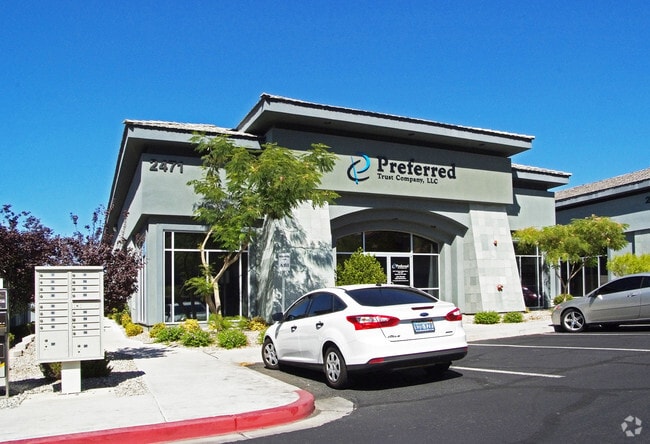
2471 W Horizon Ridge Pky
Las Vegas-Henderson-North Las Vegas, NV
Horizon Ridge Commons Prof Office Park
178-30-317-017
HORIZON RIDGE COMMONS PROF OFFICE PARK PLAT BOOK 106 PAGE 63 PT LOT 1
Commercialnec
Clark
X
Nevada
32003C2590F
1
2025
0.31 AC
2025
South Las Vegas
005351
Las Vegas
4,750 SF
DEMOGRAPHICS near 2471 W Horizon Ridge Pky
1 Mile
3 Mile
5 Mile
2024 Total Population
17,820
136,248
310,784
2029 Population
19,142
145,920
334,361
Pop Growth 2024-2029
+ 7.42%
+ 7.10%
+ 7.59%
Average Age
43
42
42
2024 Total Households
7,508
54,758
126,953
HH Growth 2024-2029
+ 7.53%
+ 7.07%
+ 7.53%
Median Household Inc
$84,461
$82,699
$79,173
Avg Household Size
2.40
2.50
2.40
2024 Avg HH Vehicles
2.00
2.00
2.00
Median Home Value
$473,757
$434,006
$417,847
Median Year Built
2000
1998
1999
Nearby Places
Map Layers
Map Styles
 Street
 Aerial
- Restaurants
- Banks
- Shops
- Fitness
- Groceries
PUBLIC TRANSPORTATION
AIRPORT
Harry Reid International
DRIVE
WALK
Distance
Harry Reid International
14 min
8.3 mi
Boulder City Municipal
DRIVE
WALK
Distance
Boulder City Municipal
28 min
18.0 mi
SALE & LEASE HISTORY
LISTING DATE
SALE/LEASE

Sep 28, 2016
For Lease
Oct 31, 2017
For Sale
Oct 31, 2017
For Lease
Nov 15, 2019
For Lease
Mar 19, 2025
For Lease
Jun 19, 2018
For Lease
Feb 02, 2022
For Lease
Apr 15, 2019
For Lease
Apr 05, 2017
For Sale
Nearby Properties
Address
Land Use
TOTAL SIZE
Lot Size
Zoning
Address
Land Use
TOTAL SIZE
Lot Size
Zoning
630,906 SF
39.87 AC
CT
Address
Land Use
TOTAL SIZE
Lot Size
Zoning
9,314 SF
23.10 AC
PS
Address
Land Use
TOTAL SIZE
Lot Size
Zoning
1,365 SF
22.68 AC
Address
Land Use
TOTAL SIZE
Lot Size
Zoning
7,177 SF
15.88 AC
Address
Land Use
TOTAL SIZE
Lot Size
Zoning
4,312 SF
19.42 AC
C:R-4
Address
Land Use
TOTAL SIZE
Lot Size
Zoning
438,778 SF
19.30 AC
C:R-4
Address
Land Use
TOTAL SIZE
Lot Size
Zoning
3,528 SF
18.15 AC
RH36
Address
Land Use
TOTAL SIZE
Lot Size
Zoning
161,090 SF
355.75 AC
Address
Land Use
TOTAL SIZE
Lot Size
Zoning
36.85 AC
PS
Address
Land Use
TOTAL SIZE
Lot Size
Zoning
3,990 SF
24.88 AC
RM16
Address
Land Use
TOTAL SIZE
Lot Size
Zoning
18.08 AC
RE
Address
Land Use
TOTAL SIZE
Lot Size
Zoning
402,610 SF
15.51 AC
R3
Address
Land Use
TOTAL SIZE
Lot Size
Zoning
220,694 SF
44.74 AC
Address
Land Use
TOTAL SIZE
Lot Size
Zoning
22,009 SF
11.53 AC
Address
Land Use
TOTAL SIZE
Lot Size
Zoning
371,958 SF
22.85 AC
RM16
Address
Land Use
TOTAL SIZE
Lot Size
Zoning
Address
Land Use
TOTAL SIZE
Lot Size
Zoning
213,957 SF
19.68 AC
Address
Land Use
TOTAL SIZE
Lot Size
Zoning
3,850 SF
6.09 AC
R3
Address
Land Use
TOTAL SIZE
Lot Size
Zoning
4,444 SF
15.48 AC
H:RH-24
Address
Land Use
TOTAL SIZE
Lot Size
Zoning
61,157 SF
2.54 AC
Address
Land Use
TOTAL SIZE
Lot Size
Zoning
59,421 SF
14 AC
Address
Land Use
TOTAL SIZE
Lot Size
Zoning
9,196 SF
17.77 AC
R3
Address
Land Use
TOTAL SIZE
Lot Size
Zoning
341,744 SF
21.82 AC
RM16
Address
Land Use
TOTAL SIZE
Lot Size
Zoning
4,330 SF
21.45 AC
RM16
Address
Land Use
TOTAL SIZE
Lot Size
Zoning
18.75 AC
PF
Address
Land Use
TOTAL SIZE
Lot Size
Zoning
20 AC
RE
Address
Land Use
TOTAL SIZE
Lot Size
Zoning
6,295 SF
13.58 AC
R3
Address
Land Use
TOTAL SIZE
Lot Size
Zoning
5,179 SF
24.21 AC
RM16
Address
Land Use
TOTAL SIZE
Lot Size
Zoning
17.31 AC
PS
Address
Land Use
TOTAL SIZE
Lot Size
Zoning
17.18 AC
PS
The World's #1 Commercial Real Estate Marketplace
Connect with us
© 2026 CoStar Group
The information above has been obtained from sources believed reliable. While we do not doubt its accuracy we have not verified it and make no guarantee, warranty or representation about it. It is your responsibility to independently confirm its accuracy and completeness. Any projections, opinions, assumptions, or estimates used are for example only and do not represent the current or future performance of the property. The value of this transaction to you depends on tax and other factors which should be evaluated by your tax, financial, and legal advisors. You and your advisors should conduct a careful, independent investigation of the property to determine to your satisfaction the suitability of the property for your needs.