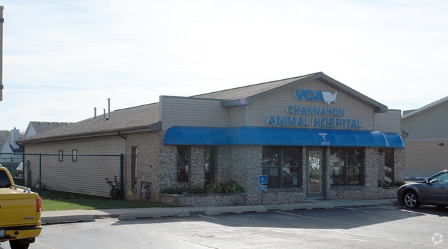
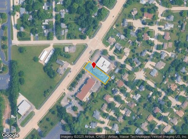
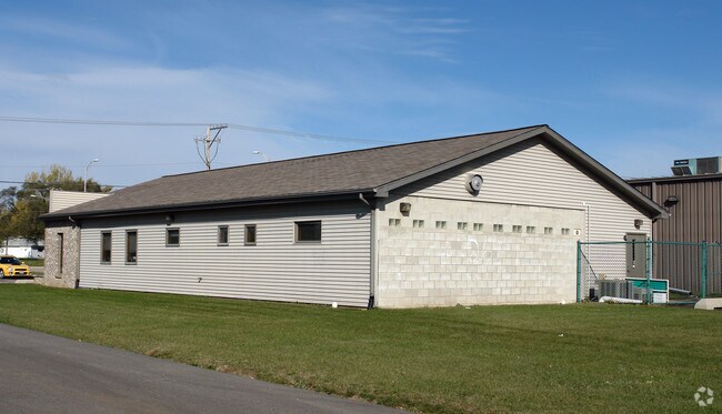
Property Record
24725 W Eames St, Channahon, IL 60410
NEARBY LISTINGS FOR SALE OR LEASE
Property Detail
24725 W Eames St
Chicago-Naperville-Elgin, IL-IN
Springbrook Commercial
04-10-09-306-003
LOT 1B IN SPRINGBROOK COMMERCIAL SUB UNIT #1 LOT 1B, A SUB IN THE W1/2 SW1/4 OF SEC 9, T34N-R9E. (EX THAT PRT TAKEN FOR ROAD
Commercialnec
Will
X
Illinois
17197C0255G
1b,1b
2024
0.44 AC
2024
Joliet/Central Will
883305
Chicago
DEMOGRAPHICS near 24725 W Eames St
1 Mile
3 Mile
5 Mile
2024 Total Population
2,919
16,849
36,424
2029 Population
2,926
16,929
36,883
Pop Growth 2024-2029
+ 0.24%
+ 0.47%
+ 1.26%
Average Age
42
39
38
2024 Total Households
1,067
5,751
12,318
HH Growth 2024-2029
+ 0.28%
+ 0.42%
+ 1.16%
Median Household Inc
$113,319
$102,515
$105,279
Avg Household Size
2.70
2.90
2.90
2024 Avg HH Vehicles
2.00
2.00
2.00
Median Home Value
$248,100
$261,023
$270,136
Median Year Built
1979
1993
2000
Nearby Places
Map Layers
Map Styles
 Street
 Aerial
- Restaurants
- Banks
- Shops
- Fitness
- Groceries
PUBLIC TRANSPORTATION
COMMUTER RAIL
Joliet Station (Heritage Corridor Line - Northeast Illinois Regional Commuter Railroad (Metra), Rock Island District Line - Northeast Illinois Regional Commuter Railroad (Metra))
DRIVE
WALK
Distance
Joliet Station (Heritage Corridor Line - Northeast Illinois Regional Commuter Railroad (Metra), Rock Island District Line - Northeast Illinois Regional Commuter Railroad (Metra))
17 min
9.6 mi
Freight Ports
Port Milwaukee
DRIVE
WALK
Distance
Port Milwaukee
149 min
122.3 mi
Nearby Properties
Address
Land Use
TOTAL SIZE
Lot Size
Zoning
Address
Land Use
TOTAL SIZE
Lot Size
Zoning
563.86 AC
Address
Land Use
TOTAL SIZE
Lot Size
Zoning
79.79 AC
Address
Land Use
TOTAL SIZE
Lot Size
Zoning
273.07 AC
Address
Land Use
TOTAL SIZE
Lot Size
Zoning
146.25 AC
Address
Land Use
TOTAL SIZE
Lot Size
Zoning
57.52 AC
Address
Land Use
TOTAL SIZE
Lot Size
Zoning
93.31 AC
Address
Land Use
TOTAL SIZE
Lot Size
Zoning
418.75 AC
Address
Land Use
TOTAL SIZE
Lot Size
Zoning
175.60 AC
Address
Land Use
TOTAL SIZE
Lot Size
Zoning
94.02 AC
Address
Land Use
TOTAL SIZE
Lot Size
Zoning
23.22 AC
Address
Land Use
TOTAL SIZE
Lot Size
Zoning
48,172 SF
21.06 AC
Address
Land Use
TOTAL SIZE
Lot Size
Zoning
92.57 AC
Address
Land Use
TOTAL SIZE
Lot Size
Zoning
16.48 AC
Address
Land Use
TOTAL SIZE
Lot Size
Zoning
17.85 AC
Address
Land Use
TOTAL SIZE
Lot Size
Zoning
70.99 AC
Address
Land Use
TOTAL SIZE
Lot Size
Zoning
550.96 AC
Address
Land Use
TOTAL SIZE
Lot Size
Zoning
145.74 AC
Address
Land Use
TOTAL SIZE
Lot Size
Zoning
9.62 AC
Address
Land Use
TOTAL SIZE
Lot Size
Zoning
98,099 SF
7.99 AC
Address
Land Use
TOTAL SIZE
Lot Size
Zoning
Address
Land Use
TOTAL SIZE
Lot Size
Zoning
2,100 SF
49.63 AC
Address
Land Use
TOTAL SIZE
Lot Size
Zoning
92.41 AC
Address
Land Use
TOTAL SIZE
Lot Size
Zoning
29.33 AC
Address
Land Use
TOTAL SIZE
Lot Size
Zoning
25.54 AC
Address
Land Use
TOTAL SIZE
Lot Size
Zoning
85.21 AC
Address
Land Use
TOTAL SIZE
Lot Size
Zoning
16.41 AC
Address
Land Use
TOTAL SIZE
Lot Size
Zoning
550.96 AC
Address
Land Use
TOTAL SIZE
Lot Size
Zoning
45.45 AC
Address
Land Use
TOTAL SIZE
Lot Size
Zoning
5.45 AC
Address
Land Use
TOTAL SIZE
Lot Size
Zoning
4.96 AC
The World's #1 Commercial Real Estate Marketplace
Connect with us
© 2026 CoStar Group
The information above has been obtained from sources believed reliable. While we do not doubt its accuracy we have not verified it and make no guarantee, warranty or representation about it. It is your responsibility to independently confirm its accuracy and completeness. Any projections, opinions, assumptions, or estimates used are for example only and do not represent the current or future performance of the property. The value of this transaction to you depends on tax and other factors which should be evaluated by your tax, financial, and legal advisors. You and your advisors should conduct a careful, independent investigation of the property to determine to your satisfaction the suitability of the property for your needs.