Property Record
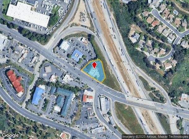
24737 Pico Canyon Rd, Stevenson Ranch, CA 91381


NEARBY LISTINGS FOR SALE OR LEASE
Property Detail
24737 Pico Canyon Rd
2826-010-014
*TR=PARCEL MAP AS PER BK 109 P 90-92 OF PM LOT 1
Restaurantbuilding
Los Angeles
X
California
06037C0815G
1
2024
0.80 AC
2025
Santa Clarita Valley
920326
Los Angeles
4,086 SF
Los Angeles-Long Beach-Glendale, CA
DEMOGRAPHICS near 24737 Pico Canyon Rd
1 Mile
3 Mile
5 Mile
2024 Total Population
14,146
67,980
105,490
2029 Population
13,731
65,703
101,957
Pop Growth 2024-2029
(2.93%)
(3.35%)
(3.35%)
Average Age
40
40
40
2024 Total Households
5,064
23,778
36,504
HH Growth 2024-2029
(3.16%)
(3.63%)
(3.65%)
Median Household Inc
$119,376
$112,661
$112,518
Avg Household Size
2.70
2.80
2.80
2024 Avg HH Vehicles
2.00
2.00
2.00
Median Home Value
$723,252
$775,208
$750,756
Median Year Built
1987
1986
1988
Nearby Places
Map Layers
Map Styles
 Street
 Aerial
- Restaurants
- Banks
- Shops
- Fitness
- Groceries
PUBLIC TRANSPORTATION
COMMUTER RAIL
Newhall (Antelope Valley Line - Southern California Regional Rail Authority (Metrolink))
DRIVE
WALK
Distance
Newhall (Antelope Valley Line - Southern California Regional Rail Authority (Metrolink))
7 min
2.8 mi
Santa Clarita (Antelope Valley Line - Southern California Regional Rail Authority (Metrolink))
DRIVE
WALK
Distance
Santa Clarita (Antelope Valley Line - Southern California Regional Rail Authority (Metrolink))
11 min
6.3 mi
AIRPORT
Bob Hope
DRIVE
WALK
Distance
Bob Hope
24 min
18.5 mi
Los Angeles International
DRIVE
WALK
Distance
Los Angeles International
45 min
35.6 mi
Nearby Properties
Address
Land Use
TOTAL SIZE
Lot Size
Zoning
Address
Land Use
TOTAL SIZE
Lot Size
Zoning
491,654 SF
17.56 AC
SCPI
Address
Land Use
TOTAL SIZE
Lot Size
Zoning
479,178 SF
14.17 AC
SCCR
Address
Land Use
TOTAL SIZE
Lot Size
Zoning
173,298 SF
12.42 AC
LCA25*
Address
Land Use
TOTAL SIZE
Lot Size
Zoning
200,717 SF
7.62 AC
SCCR
Address
Land Use
TOTAL SIZE
Lot Size
Zoning
197,558 SF
3.08 AC
SCBP
Address
Land Use
TOTAL SIZE
Lot Size
Zoning
495,604 SF
38.40 AC
SCI
Address
Land Use
TOTAL SIZE
Lot Size
Zoning
291,344 SF
15.32 AC
LCA2
Address
Land Use
TOTAL SIZE
Lot Size
Zoning
1,014,267 SF
59.95 AC
SCPI
Address
Land Use
TOTAL SIZE
Lot Size
Zoning
225,723 SF
11.37 AC
Address
Land Use
TOTAL SIZE
Lot Size
Zoning
245,053 SF
19.81 AC
LCA25*
Address
Land Use
TOTAL SIZE
Lot Size
Zoning
258,260 SF
12.67 AC
SCSP
Address
Land Use
TOTAL SIZE
Lot Size
Zoning
139,196 SF
8.79 AC
SCUR5
Address
Land Use
TOTAL SIZE
Lot Size
Zoning
325,406 SF
4.11 AC
SCBP
Address
Land Use
TOTAL SIZE
Lot Size
Zoning
161,103 SF
4.68 AC
SCUR4
Address
Land Use
TOTAL SIZE
Lot Size
Zoning
180,450 SF
5.08 AC
SCCR
Address
Land Use
TOTAL SIZE
Lot Size
Zoning
402,480 SF
13.58 AC
SCCN
Address
Land Use
TOTAL SIZE
Lot Size
Zoning
118,380 SF
4.52 AC
LCA2
Address
Land Use
TOTAL SIZE
Lot Size
Zoning
83,698 SF
8.94 AC
SCPI
Address
Land Use
TOTAL SIZE
Lot Size
Zoning
174,562 SF
4.01 AC
SCCR
Address
Land Use
TOTAL SIZE
Lot Size
Zoning
212,783 SF
11.44 AC
SCBP
Address
Land Use
TOTAL SIZE
Lot Size
Zoning
132,668 SF
0.90 AC
SCCR
Address
Land Use
TOTAL SIZE
Lot Size
Zoning
271,399 SF
7.49 AC
LCA25*
Address
Land Use
TOTAL SIZE
Lot Size
Zoning
131,425 SF
0.82 AC
SCCR
Address
Land Use
TOTAL SIZE
Lot Size
Zoning
93,450 SF
4.83 AC
LCA2
Address
Land Use
TOTAL SIZE
Lot Size
Zoning
86,201 SF
3.68 AC
SCUR4
Address
Land Use
TOTAL SIZE
Lot Size
Zoning
320,405 SF
8.03 AC
SCCR
Address
Land Use
TOTAL SIZE
Lot Size
Zoning
125,275 SF
2.39 AC
SCCC
Address
Land Use
TOTAL SIZE
Lot Size
Zoning
138,025 SF
14.51 AC
LCA2
Address
Land Use
TOTAL SIZE
Lot Size
Zoning
245,606 SF
11.67 AC
SCUR4
Address
Land Use
TOTAL SIZE
Lot Size
Zoning
78,596 SF
4.62 AC
SCCR
The World's #1 Commercial Real Estate Marketplace
Connect with us
© 2025 CoStar Group
The information above has been obtained from sources believed reliable. While we do not doubt its accuracy we have not verified it and make no guarantee, warranty or representation about it. It is your responsibility to independently confirm its accuracy and completeness. Any projections, opinions, assumptions, or estimates used are for example only and do not represent the current or future performance of the property. The value of this transaction to you depends on tax and other factors which should be evaluated by your tax, financial, and legal advisors. You and your advisors should conduct a careful, independent investigation of the property to determine to your satisfaction the suitability of the property for your needs.