Property Record
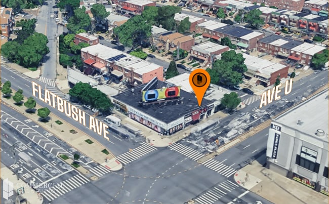
2475 Flatbush Ave, Brooklyn, NY 11234


Property Detail
2475 Flatbush Ave
08543-0003
Kings
Storebuilding
New York
C8-1
6
B and X Area of moderate flood hazard, usually the area between the limits of the 100-year and 500-year floods.
0.19 AC
2024
South Brooklyn
2025
Long Island (New York)
072800
New York-Jersey City-White Plains, NY-NJ
8,000 SF
NEARBY LISTINGS FOR SALE OR LEASE
DEMOGRAPHICS near 2475 Flatbush Ave
1 mile
3 mile
5 mile
2025 Total Population
48,921
608,286
1,698,249
2030 Population
46,490
593,098
1,667,825
Pop Growth 2025-2030
(4.97%)
(2.50%)
(1.79%)
Average Age
43
42
40
2025 Total Households
16,418
210,311
596,231
HH Growth 2025-2030
(5.60%)
(2.83%)
(2.02%)
Median Household Inc
$103,553
$75,664
$69,346
Avg Household Size
2.90
2.80
2.70
2025 Avg HH Vehicles
1.00
1.00
1.00
Median Home Value
$768,134
$779,160
$837,934
Median Year Built
1949
1948
1948
Nearby Places
Map Layers
Map Styles
 Street
 Aerial
Layers
 Traffic
 Biking
Places
Listings with unknown addresses are not visible on the map
- Restaurants
- Banks
- Shops
- Fitness
- Groceries
PUBLIC TRANSPORTATION
TRANSIT/SUBWAY
Avenue U (Q Line) (Q - New York MTA Subway (The Subway))
Drive
Walk
Distance
Avenue U (Q Line) (Q - New York MTA Subway (The Subway))
9 min
1 min
0.0 mi
COMMUTER RAIL
East New York Station (Far Rockaway Branch - Long Island Rail Road, Long Beach Branch - Long Island Rail Road, West Hempstead Branch - Long Island Rail Road)
Drive
Walk
Distance
East New York Station (Far Rockaway Branch - Long Island Rail Road, Long Beach Branch - Long Island Rail Road, West Hempstead Branch - Long Island Rail Road)
19 min
5.7 mi
Nostrand Avenue Station (Far Rockaway Branch - Long Island Rail Road, Hempstead Branch - Long Island Rail Road, Long Beach Branch - Long Island Rail Road, West Hempstead Branch - Long Island Rail Road)
Drive
Walk
Distance
Nostrand Avenue Station (Far Rockaway Branch - Long Island Rail Road, Hempstead Branch - Long Island Rail Road, Long Beach Branch - Long Island Rail Road, West Hempstead Branch - Long Island Rail Road)
23 min
5.9 mi
AIRPORT
John F Kennedy International
Drive
Walk
Distance
John F Kennedy International
19 min
12.8 mi
LaGuardia
Drive
Walk
Distance
LaGuardia
28 min
19.9 mi
Newark Liberty International
Drive
Walk
Distance
Newark Liberty International
39 min
29.5 mi
Freight Ports
NY - Red Hook Container Terminal
Drive
Walk
Distance
NY - Red Hook Container Terminal
1 min
6.8 mi
SALE & LEASE HISTORY
LISTING DATE
SALE/LEASE

Nov 16, 2020
For Lease
May 19, 2020
For Lease
Mar 07, 2025
For Lease
Feb 06, 2018
For Lease
Nearby Properties
Address
Land Use
TOTAL SIZE
Lot Size
Zoning
Address
Land Use
TOTAL SIZE
Lot Size
Zoning
100 SF
1,207.35 AC
M1-1
Address
Land Use
TOTAL SIZE
Lot Size
Zoning
1,281,577 SF
20.78 AC
M3-1
Address
Land Use
TOTAL SIZE
Lot Size
Zoning
1,078,317 SF
10.45 AC
R4
Address
Land Use
TOTAL SIZE
Lot Size
Zoning
10,250 SF
773.50 AC
PARK
Address
Land Use
TOTAL SIZE
Lot Size
Zoning
1,073,920 SF
16.53 AC
R6
Address
Land Use
TOTAL SIZE
Lot Size
Zoning
61.60 AC
PARK
Address
Land Use
TOTAL SIZE
Lot Size
Zoning
785,450 SF
14.22 AC
R6
Address
Land Use
TOTAL SIZE
Lot Size
Zoning
353,600 SF
55.79 AC
R3-1
Address
Land Use
TOTAL SIZE
Lot Size
Zoning
1,526,800 SF
32.39 AC
R5
Address
Land Use
TOTAL SIZE
Lot Size
Zoning
6,000 SF
110.42 AC
PARK
Address
Land Use
TOTAL SIZE
Lot Size
Zoning
229,456 SF
4.15 AC
M1-1
Address
Land Use
TOTAL SIZE
Lot Size
Zoning
241,735 SF
1.99 AC
C8-4
Address
Land Use
TOTAL SIZE
Lot Size
Zoning
75,340 SF
3.02 AC
PARK
Address
Land Use
TOTAL SIZE
Lot Size
Zoning
22.96 AC
PARK
Address
Land Use
TOTAL SIZE
Lot Size
Zoning
7,948 SF
65.50 AC
R4
Address
Land Use
TOTAL SIZE
Lot Size
Zoning
275,163 SF
9.69 AC
R3-1
Address
Land Use
TOTAL SIZE
Lot Size
Zoning
137,500 SF
2.13 AC
M1-1
Address
Land Use
TOTAL SIZE
Lot Size
Zoning
351,762 SF
1.65 AC
R7A
Address
Land Use
TOTAL SIZE
Lot Size
Zoning
387,706 SF
8 AC
C4-2
Address
Land Use
TOTAL SIZE
Lot Size
Zoning
987,444 SF
21.01 AC
R3-2
Address
Land Use
TOTAL SIZE
Lot Size
Zoning
302,208 SF
6.34 AC
R4
Address
Land Use
TOTAL SIZE
Lot Size
Zoning
267,852 SF
1.65 AC
R4
Address
Land Use
TOTAL SIZE
Lot Size
Zoning
221,704 SF
0.83 AC
R5B
Address
Land Use
TOTAL SIZE
Lot Size
Zoning
822,192 SF
14.15 AC
R6
Address
Land Use
TOTAL SIZE
Lot Size
Zoning
521,976 SF
13.59 AC
R5
Address
Land Use
TOTAL SIZE
Lot Size
Zoning
2,000 SF
73.29 AC
PARK
Address
Land Use
TOTAL SIZE
Lot Size
Zoning
60,288 SF
0.76 AC
R5
Address
Land Use
TOTAL SIZE
Lot Size
Zoning
211,552 SF
7.39 AC
R3-2
Address
Land Use
TOTAL SIZE
Lot Size
Zoning
107,680 SF
2.40 AC
M1-1
Address
Land Use
TOTAL SIZE
Lot Size
Zoning
411,500 SF
3.48 AC
R5B
The World's #1 Commercial Real Estate Marketplace
Connect with us
© 2026 CoStar Group
The information above has been obtained from sources believed reliable. While we do not doubt its accuracy we have not verified it and make no guarantee, warranty or representation about it. It is your responsibility to independently confirm its accuracy and completeness. Any projections, opinions, assumptions, or estimates used are for example only and do not represent the current or future performance of the property. The value of this transaction to you depends on tax and other factors which should be evaluated by your tax, financial, and legal advisors. You and your advisors should conduct a careful, independent investigation of the property to determine to your satisfaction the suitability of the property for your needs.