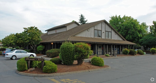
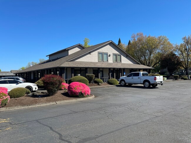
Property Record
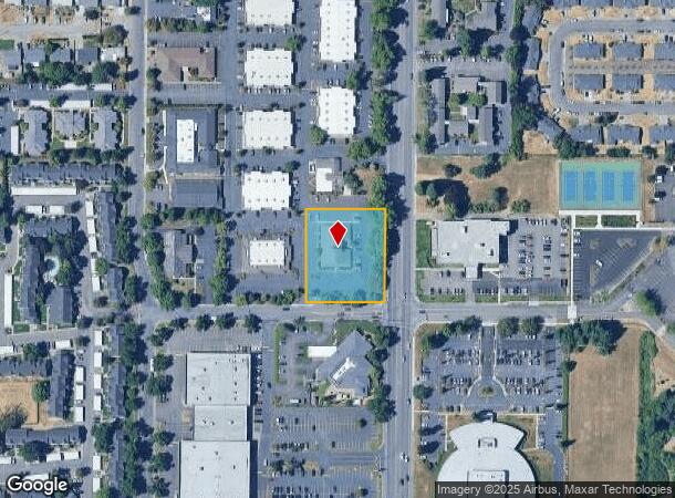
2475 Lancaster Dr Ne, Salem, OR 97305
Current Lease Availabilities
Property Detail
2475 Lancaster Dr Ne
Salem, OR
Village East Park-Phase I
595462
VILLAGE EAST PARK-PHASE I BLOCK 1 LOT 5 ACRES 1.07
Officebuilding
Marion
X
Oregon
41047C0375G
5
2024
1.07 AC
2025
Marion County
001607
Portland
7,520 SF
NEARBY LISTINGS FOR SALE OR LEASE
DEMOGRAPHICS near 2475 Lancaster Dr Ne
1 mile
3 mile
5 mile
2024 Total Population
21,727
117,655
202,909
2029 Population
21,915
119,235
207,543
Pop Growth 2024-2029
+ 0.87%
+ 1.34%
+ 2.28%
Average Age
36
37
38
2024 Total Households
7,227
40,187
73,215
HH Growth 2024-2029
+ 0.82%
+ 1.38%
+ 2.44%
Median Household Inc
$47,600
$54,214
$60,416
Avg Household Size
2.90
2.70
2.60
2024 Avg HH Vehicles
2.00
2.00
2.00
Median Home Value
$238,418
$281,824
$325,641
Median Year Built
1982
1975
1976
Nearby Places
Map Layers
Map Styles
 Street
 Aerial
Transit
 Traffic
 Biking
Places
Listings with unknown addresses are not visible on the map
- Restaurants
- Banks
- Shops
- Fitness
- Groceries
PUBLIC TRANSPORTATION
COMMUTER RAIL
Salem (Amtrak Cascades - Amtrak, Coast Starlight - Amtrak)
Drive
Walk
Distance
Salem (Amtrak Cascades - Amtrak, Coast Starlight - Amtrak)
11 min
5.8 mi
Freight Ports
Port of Portland
Drive
Walk
Distance
Port of Portland
64 min
48.7 mi
Nearby Properties
Address
Land Use
TOTAL SIZE
Lot Size
Zoning
Address
Land Use
TOTAL SIZE
Lot Size
Zoning
978,999 SF
25.74 AC
PE
Address
Land Use
TOTAL SIZE
Lot Size
Zoning
236,837 SF
20.76 AC
PE
Address
Land Use
TOTAL SIZE
Lot Size
Zoning
118,829 SF
3.49 AC
CB
Address
Land Use
TOTAL SIZE
Lot Size
Zoning
532,684 SF
158.53 AC
PA
Address
Land Use
TOTAL SIZE
Lot Size
Zoning
184.48 AC
PE
Address
Land Use
TOTAL SIZE
Lot Size
Zoning
145,520 SF
1.70 AC
PM
Address
Land Use
TOTAL SIZE
Lot Size
Zoning
94,577 SF
10.65 AC
PA
Address
Land Use
TOTAL SIZE
Lot Size
Zoning
305,230 SF
9.76 AC
PS
Address
Land Use
TOTAL SIZE
Lot Size
Zoning
166,344 SF
1.70 AC
PM
Address
Land Use
TOTAL SIZE
Lot Size
Zoning
183,400 SF
7.17 AC
PE; CB
Address
Land Use
TOTAL SIZE
Lot Size
Zoning
264,504 SF
28.17 AC
PS
Address
Land Use
TOTAL SIZE
Lot Size
Zoning
236,632 SF
24.45 AC
CO
Address
Land Use
TOTAL SIZE
Lot Size
Zoning
318,068 SF
14.57 AC
RM2
Address
Land Use
TOTAL SIZE
Lot Size
Zoning
393,453 SF
24.18 AC
CR
Address
Land Use
TOTAL SIZE
Lot Size
Zoning
1,490 SF
17.41 AC
PA
Address
Land Use
TOTAL SIZE
Lot Size
Zoning
Address
Land Use
TOTAL SIZE
Lot Size
Zoning
137,002 SF
6.27 AC
PE
Address
Land Use
TOTAL SIZE
Lot Size
Zoning
33,560 SF
4.95 AC
CR
Address
Land Use
TOTAL SIZE
Lot Size
Zoning
164,539 SF
8.98 AC
CR; RM2
Address
Land Use
TOTAL SIZE
Lot Size
Zoning
36.16 AC
P; RM
Address
Land Use
TOTAL SIZE
Lot Size
Zoning
77,198 SF
1.71 AC
PM
Address
Land Use
TOTAL SIZE
Lot Size
Zoning
170,756 SF
2.65 AC
PS
Address
Land Use
TOTAL SIZE
Lot Size
Zoning
253,189 SF
12.83 AC
RM2
Address
Land Use
TOTAL SIZE
Lot Size
Zoning
105,152 SF
2.39 AC
CR
Address
Land Use
TOTAL SIZE
Lot Size
Zoning
171,702 SF
16.02 AC
CR
Address
Land Use
TOTAL SIZE
Lot Size
Zoning
115,561 SF
26.70 AC
PE; RA
Address
Land Use
TOTAL SIZE
Lot Size
Zoning
3,792 SF
34.64 AC
PE
Address
Land Use
TOTAL SIZE
Lot Size
Zoning
29.36 AC
IG; CR
Address
Land Use
TOTAL SIZE
Lot Size
Zoning
5,184 SF
14.57 AC
RA
The World's #1 Commercial Real Estate Marketplace
Connect with us
© 2026 CoStar Group
The information above has been obtained from sources believed reliable. While we do not doubt its accuracy we have not verified it and make no guarantee, warranty or representation about it. It is your responsibility to independently confirm its accuracy and completeness. Any projections, opinions, assumptions, or estimates used are for example only and do not represent the current or future performance of the property. The value of this transaction to you depends on tax and other factors which should be evaluated by your tax, financial, and legal advisors. You and your advisors should conduct a careful, independent investigation of the property to determine to your satisfaction the suitability of the property for your needs.