Property Record
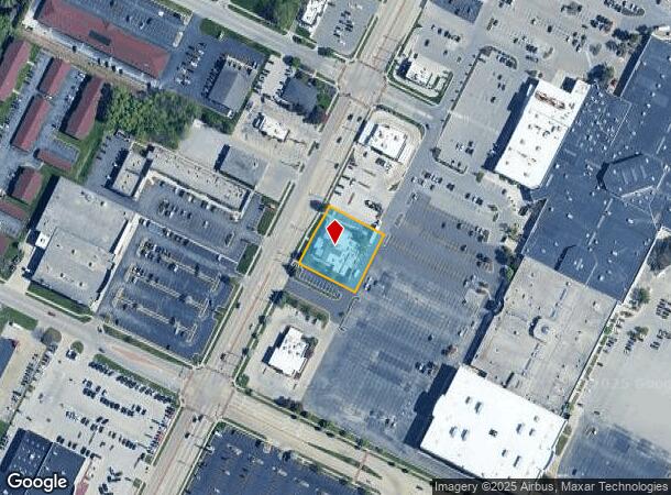
2475 S Oneida St, Green Bay, WI 54304


NEARBY LISTINGS FOR SALE OR LEASE
Property Detail
2475 S Oneida St
Green Bay, WI
Cert Surv Map 6688
VA-142-2-1
26,345 SQ FT LOT 1 OF 44 CSM 345 MAP 6688 IN 1948432 BNG PRT OF PC 21 WSFR EX RD IN 2559344
Commercialnec
Brown
X
Wisconsin
55009C0252F
1
2024
0.61 AC
2024
Green Bay
021303
Green Bay
DEMOGRAPHICS near 2475 S Oneida St
1 Mile
3 Mile
5 Mile
2024 Total Population
5,073
63,843
154,053
2029 Population
5,257
65,062
157,098
Pop Growth 2024-2029
+ 3.63%
+ 1.91%
+ 1.98%
Average Age
42
41
39
2024 Total Households
2,554
27,305
64,861
HH Growth 2024-2029
+ 3.88%
+ 2.04%
+ 2.06%
Median Household Inc
$40,448
$61,973
$59,801
Avg Household Size
1.90
2.20
2.30
2024 Avg HH Vehicles
1.00
2.00
2.00
Median Home Value
$180,201
$189,969
$190,735
Median Year Built
1976
1970
1973
Nearby Places
Map Layers
Map Styles
 Street
 Aerial
- Restaurants
- Banks
- Shops
- Fitness
- Groceries
PUBLIC TRANSPORTATION
AIRPORT
Green Bay/Austin Straubel International
DRIVE
WALK
Distance
Green Bay/Austin Straubel International
10 min
4.7 mi
Appleton International
DRIVE
WALK
Distance
Appleton International
43 min
33.3 mi
Freight Ports
Port Milwaukee
DRIVE
WALK
Distance
Port Milwaukee
137 min
117.7 mi
SALE & LEASE HISTORY
LISTING DATE
SALE/LEASE

Nov 19, 2018
For Sale
May 05, 2020
For Sale
Mar 11, 2019
For Sale
Feb 02, 2018
For Sale
Nearby Properties
Address
Land Use
TOTAL SIZE
Lot Size
Zoning
Address
Land Use
TOTAL SIZE
Lot Size
Zoning
11.89 AC
Address
Land Use
TOTAL SIZE
Lot Size
Zoning
197.25 AC
Address
Land Use
TOTAL SIZE
Lot Size
Zoning
22.35 AC
Address
Land Use
TOTAL SIZE
Lot Size
Zoning
Address
Land Use
TOTAL SIZE
Lot Size
Zoning
27.86 AC
Address
Land Use
TOTAL SIZE
Lot Size
Zoning
Address
Land Use
TOTAL SIZE
Lot Size
Zoning
25.31 AC
Address
Land Use
TOTAL SIZE
Lot Size
Zoning
Address
Land Use
TOTAL SIZE
Lot Size
Zoning
71.85 AC
Address
Land Use
TOTAL SIZE
Lot Size
Zoning
45.50 AC
Address
Land Use
TOTAL SIZE
Lot Size
Zoning
18.61 AC
Address
Land Use
TOTAL SIZE
Lot Size
Zoning
3.90 AC
Address
Land Use
TOTAL SIZE
Lot Size
Zoning
Address
Land Use
TOTAL SIZE
Lot Size
Zoning
17,227 SF
3.13 AC
GI
Address
Land Use
TOTAL SIZE
Lot Size
Zoning
1.99 AC
Address
Land Use
TOTAL SIZE
Lot Size
Zoning
20.83 AC
Address
Land Use
TOTAL SIZE
Lot Size
Zoning
26.42 AC
Address
Land Use
TOTAL SIZE
Lot Size
Zoning
184,367 SF
10.34 AC
GI
Address
Land Use
TOTAL SIZE
Lot Size
Zoning
9.14 AC
Address
Land Use
TOTAL SIZE
Lot Size
Zoning
Address
Land Use
TOTAL SIZE
Lot Size
Zoning
Address
Land Use
TOTAL SIZE
Lot Size
Zoning
2.98 AC
Address
Land Use
TOTAL SIZE
Lot Size
Zoning
5.94 AC
Address
Land Use
TOTAL SIZE
Lot Size
Zoning
17.66 AC
Address
Land Use
TOTAL SIZE
Lot Size
Zoning
19.73 AC
Address
Land Use
TOTAL SIZE
Lot Size
Zoning
16.74 AC
Address
Land Use
TOTAL SIZE
Lot Size
Zoning
13.58 AC
Address
Land Use
TOTAL SIZE
Lot Size
Zoning
15.41 AC
Address
Land Use
TOTAL SIZE
Lot Size
Zoning
6.34 AC
Address
Land Use
TOTAL SIZE
Lot Size
Zoning
1.65 AC
The World's #1 Commercial Real Estate Marketplace
Connect with us
© 2025 CoStar Group
The information above has been obtained from sources believed reliable. While we do not doubt its accuracy we have not verified it and make no guarantee, warranty or representation about it. It is your responsibility to independently confirm its accuracy and completeness. Any projections, opinions, assumptions, or estimates used are for example only and do not represent the current or future performance of the property. The value of this transaction to you depends on tax and other factors which should be evaluated by your tax, financial, and legal advisors. You and your advisors should conduct a careful, independent investigation of the property to determine to your satisfaction the suitability of the property for your needs.